Pickens in Pickens County, South Carolina — The American South (South Atlantic)
Beliefs Set in Stone
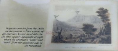
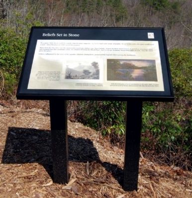
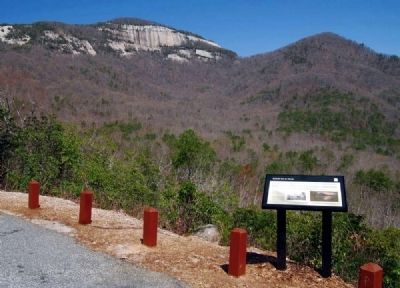
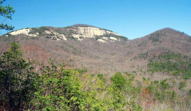
To a giant, Table Rock could be exactly what its name suggests -- a 3,124'-high table made of granite. To eat at this table, the giant would need a seat -- Stool Mountain at 2,600' served this purpose.
This is how the Cherokee saw the memorable landscape before you. Their beliefs, shaped by their environment, featured an enormous spirit who loomed over this mountain range, his shadow forming the bluish haze. Sha-ka-na-ga, meaning "Great Blue Hills of God," was the name given this place.
Settlers, influenced by the story of the gigantic chieftain dining here, preserved the legend when naming the landmarks.
Erected by South Carolina Department of Parks, Recreation and Tourism.
Topics. This historical marker is listed in these topic lists: Native Americans • Natural Features • Notable Places.
Location. 35° 2.092′ N, 82° 41.567′ W. Marker is in Pickens, South Carolina, in Pickens County. Marker is on Table Rock State Park Road, on the left when traveling east. Marker is located on the grounds of Table Rock State Park, in a location known as the Overlook. Touch for map. Marker is in this post office area: Pickens SC 29671, United States of America. Touch for directions.
Other nearby markers. At least 10 other markers are within 4 miles of this marker, measured as the crow flies . The Civilian Conservation Corps (approx. half a mile away); a different marker also named Civilian Conservation Corps (approx. half a mile away); A CCC Classic (approx. half a mile away); Parkitecture (approx. half a mile away); Table Rock State Park (approx. one mile away); Granite and Gravity (approx. one mile away); Pumpkintown (approx. 3.2 miles away); Cornelius Keith - 1715-1808 (approx. 3˝ miles away); Cornelius Keith (approx. 4 miles away); Oolenoy Baptist Church (approx. 4 miles away). Touch for a list and map of all markers in Pickens.
Also see . . .
1. Table Rock State Park. Table Rock State Park is a 3,083-acre (12.48 km2) park at the edge of the Blue Ridge Mountains in northern Pickens County, South Carolina. (Submitted on April 29, 2010, by Brian Scott of Anderson, South Carolina.)
2. Table Rock State Park Historic District. Table Rock State Park Historic District is significant for its cultural and social relationship to the history and prehistory of the area within the state park boundaries and is also architecturally significant as an example of the construction of a state park by the Civilian Conservation Corps (CCC). (Submitted on April 29, 2010, by Brian Scott of Anderson, South Carolina.)
Credits. This page was last revised on November 23, 2020. It was originally submitted on April 29, 2010, by Brian Scott of Anderson, South Carolina. This page has been viewed 1,465 times since then and 50 times this year. Photos: 1, 2, 3, 4, 5, 6. submitted on April 29, 2010, by Brian Scott of Anderson, South Carolina.


