
Ceylon in Erie County, Ohio — The American Midwest (Great Lakes)
The Value of Wetlands
| — | Old Woman Creek National Estuarine Research Reserve | — |
Photographed by Craig Doda, June 6, 2026
1. The Value of Wetlands Marker
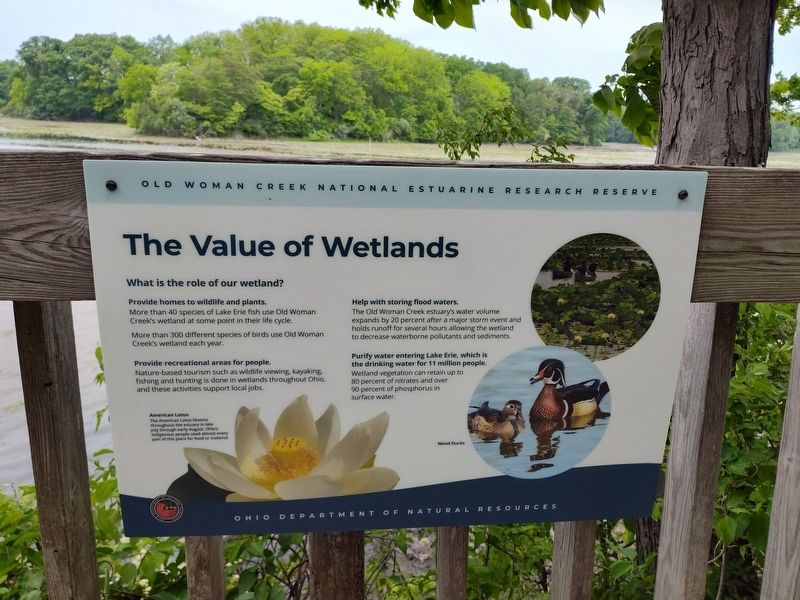
Provide homes to wildlife and plants.
More than 40 species of Lake Erie fish use Old Woman Creek's wetland at some point in their life cycle.
More than 300 different species of birds use Old Woman Creek's wetland each year.
Provide recreational areas for people.
Nature-based tourism such as wildlife viewing, kayaking, fishing and hunting is done in wetlands throughout Ohio, and these activities support local jobs.
Help with storing flood waters.
The Old Woman Creek estuary's water volume expands by 20 percent after a major storm event and holds runoff for several hours allowing the wetland to decrease waterborne pollutants and sediments.
Purify water entering Lake Erie, which is the drinking water for 11 million people.
Wetland vegetation can retain up to 80 percent of nitrates and over 90 percent of phosphorus in surface water.
American Lotus
The American Lotus blooms throughout the estuary in late July through early August. Ohio's indigenous people used almost every part of this plant for food or material.
Erected by Ohio Department of Natural Resources.
Topics. This
this page online
Location. 41° 22.637′ N, 82° 30.605′ W. Marker is in Ceylon, Ohio, in Erie County. It is at the intersection of Cleveland Road East (U.S. 6) and Mirheath Drive, on the right when traveling east on Cleveland Road East. Touch for map. Marker is at or near this postal address: 2514 Cleveland Rd E, Huron OH 44839, United States of America. Touch for directions.

Regionally, this marker is on Ohio’s Lake Erie Shore and in the Western Reserve. It is also in the American Midwest and in the Corn Belt. Globally, it is in North America, on the Great Lakes, in the Western Hemisphere, in the Western World, and in the Anglosphere. Historically, it finds itself in what was once the Haudenosaunee (Iroquois) Confederacy, the territory of the Mississippian Culture, and the Northwest Territory.
Other nearby markers. At least 8 other markers are within 3 miles of this marker, measured as the crow flies: Invasives (here, next to this marker);
Photographed by Craig Doda, June 6, 2026
2. The Value of Wetlands Marker
Credits. This page was last revised on June 10, 2026. It was originally submitted on June 9, 2026, by Craig Doda of Napoleon, Ohio. This page has been viewed 13 times since then. Photos: 1, 2. submitted on June 9, 2026, by Craig Doda of Napoleon, Ohio. • Devry Becker Jones was the editor who published this page.
