
Salt Lake City in Salt Lake County, Utah — The American Mountains (Southwest)
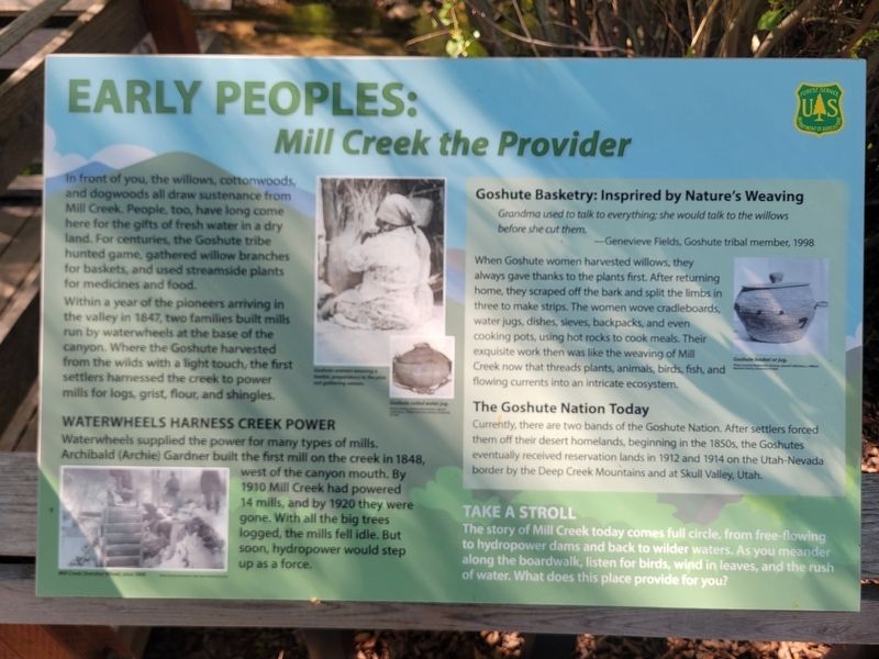
Early Peoples: Mill Creek the Provider
⎯⎯⎯
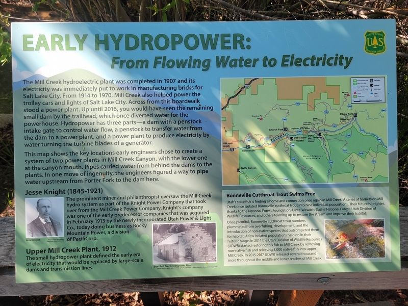
Early Hydropower: From Flowing Water to Electricity
Photographed by Jeremy Snow, June 4, 2026
1. Early Peoples: Mill Creek the Provider side of marker
In front of you, the willows, cottonwoods, and dogwoods all draw sustenance from Mill Creek. People, too, have long come here for the gifts of fresh water in a dry land. For centuries, the Goshute tribe hunted game, gathered willow branches for baskets, and used streamside plants for medicines and food.
Within a year of the pioneers arriving in the valley in 1847, two families built mills run by waterwheels at the base of the canyon. Where the Goshute harvested from the wilds with a light touch, the first settlers harnessed the creek to power mills for logs, grist, flour, and shingles.
Waterwheels Harness Creek Power
Waterwheels supplied the power for many types of mills. Archibald (Archie) Gardner built the first mill on the creek in 1848, west of the canyon mouth. By 1910 Mill Creek had powered 14 mills, and by 1920 they were gone. With all the big trees logged, the mills fell idle. But soon, hydropower would step up as a force.
Goshute Basketry: Insprired by Nature's Weaving
Grandma used to talk to everything: she would talk to the willows before she cut them.
this page online
When Goshute women harvested willows, they always gave thanks to the plants first. After returning home, they scraped off the bark and split the limbs in three to make strips. The women wove cradleboards, water jugs, dishes, sieves, backpacks, and even cooking pots, using hot rocks to cook meals. Their exquisite work then was like the weaving of Mill Creek now that threads plants, animals, birds, fish, and flowing currents into an intricate ecosystem.
The Goshute Nation Today
Currently, there are two bands of the Goshute Nation. After settlers forced them off their desert homelands, beginning in the 1850s, the Goshutes eventually received reservation lands in 1912 and 1914 on the Utah-Nevada border by the Deep Creek Mountains and at Skull Valley, Utah.
Take a Stroll
The story of Mill Creek today comes full circle, from free-flowing to hydropower dams and back to wilder waters. As you meander along the boardwalk, listen for birds, wind in leaves, and the rush of water. What does this place provide for you?
Early Hydropower: From Flowing Water to Electricity
The
Photographed by Jeremy Snow, June 4, 2026
2. Early Hydropower: From Flowing Water to Electricity side of marker
This map shows the key locations early engineers chose to create a system of two power plants in Mill Creek Canyon, with the lower one at the canyon mouth. Pipes carried water from behind the dams to the plants. In one move of ingenuity, the engineers figured a way to pipe water upstream from Porter Fork to the dam here.
Jesse Knight (1845-1921)
The prominent miner and philanthropist oversaw the Mill Creek hydro system as part of the Knight Power Company that took over from
Photographed by Jeremy Snow, June 4, 2026
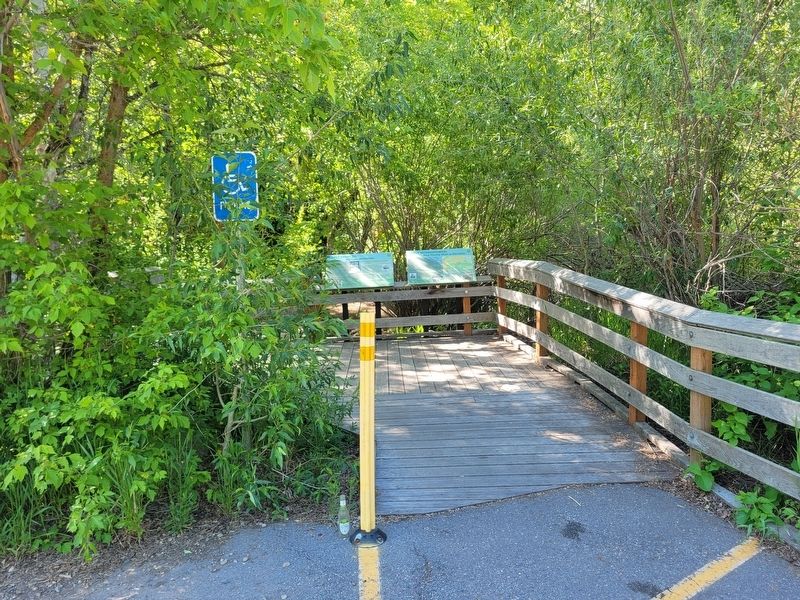
3. Early Peoples: Mill Creek the Provider / Early Hydropower: From Flowing Water to Electricity Marker
Upper Mill Creek Plant, 1912
The small hydropower plant defined the early era of electricity that would be replaced by large-scale dams and transmission lines.
Bonneville Cutthroat Trout Swims Free
Utah's state fish is finding a home and connection once again in Mill Creek. A series of barriers on Mill Creek once isolated Bonneville cutthroat trout into nine individual populations. Their future is brighter thanks to the National Forest Foundation, Uinta Wasatch Cache National Forest, Utah Division of Wildlife Resources, and others teaming up to restore the stream and improve their habitat
Once plentiful, Bonneville cutthroat trout numbers plummeted from overfishing, development, and the introduction of non-native species that outcompeted them for habitat. A few isolated populations held on in their historic range. In 2014 the Utah Division of Wildlife Resources (UDWR) started restoring this fish to Mill Creek by removing non-native fish and releasing 3,000 native fish into upper Mill Creek In 2015-2017 UDWR released several thousand more throughout the middle and lower reaches of Mill Creek.
Topics. This historical marker is listed in these topic lists: Animals • Indigenous Peoples and Communities • Industry & Commerce • Waterways & Vessels.
Location. 40° 41.96′ N, 111° 43.135′ W. Marker is in Salt Lake City, Utah, in Salt Lake County. It is on Mill Creek Canyon Road, on the right when traveling east. Located at the beginning of the boardwalk, on the west side of the parking lot. Touch for map. Marker is at or near this postal address: 6752 Mill Creek Canyon Road, Salt Lake City UT 84109, United States of America. Touch for directions.

Regionally, this marker is in the Wasatch Front and in Greater Salt Lake. It is also in the American Mountain West and on the Colorado Plateau. Globally, it is in North America, the Rocky Mountains, the Western Hemisphere, the Western World, and the Anglosphere. Historically, it finds itself in what was once New Spain and also Mexico’s Alta California.
Other nearby markers. At least 8 other markers are within 5 miles of this marker, measured as the crow flies: The Railroad (approx. 4.4 miles away); The Golden Pass Road and Tollhouse (approx. 4½ miles away); Blind Miner of the Wasatch (approx. 4½ miles away); Big Cottonwood Mining District (approx. 4½ miles away); Dudler's Inn (approx. 4.6 miles away); Dudler's Wine Cellar (approx. 4.6 miles away); Sandstone Wall & Aquaduct (approx. 4.7 miles away); Early East Millcreek Schools (approx. 5 miles away). Touch for a list and map of all markers in Salt Lake City.
Credits. This page was last revised on June 11, 2026. It was originally submitted on June 11, 2026, by Jeremy Snow of Cedar City, Utah. This page has been viewed 23 times since then. Photos: 1, 2, 3. submitted on June 11, 2026, by Jeremy Snow of Cedar City, Utah. • Andrew Ruppenstein was the editor who published this page.
