People of the Plains
American Indians of Central Kansas
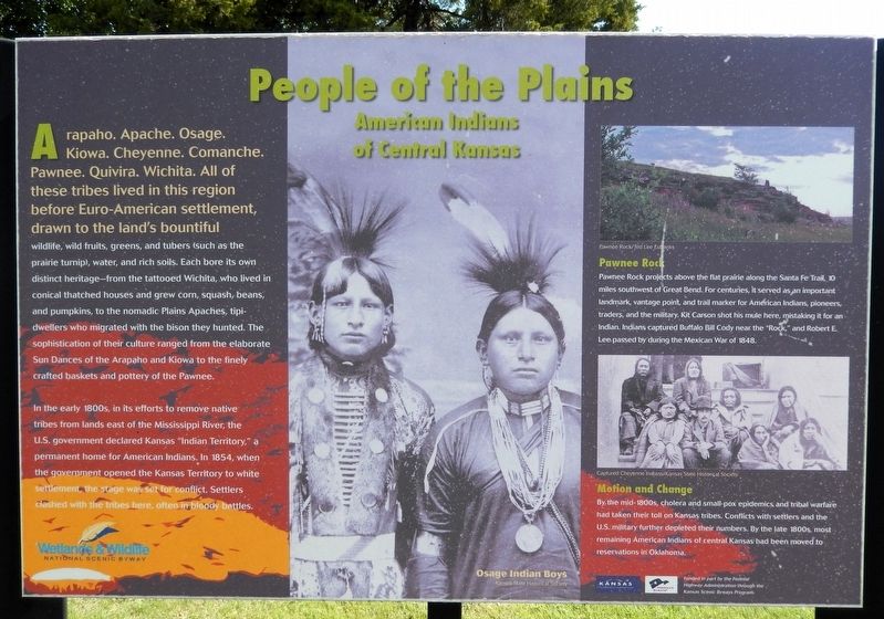
Arapaho. Apache. Osage. Kiowa. Cheyenne. Comanche. Pawnee. Quivira. Wichita. All of these tribes lived in this region before Euro-American settlement, drawn to the land's bountiful wildlife, wild fruits, greens, and tubers (such as the prairie turnip), water, and rich soils. Each bore its own distinct heritage — from the tattooed Wichita, who lived in conical thatched houses and grew corn, squash, beans, and pumpkins, to the nomadic Plains Apaches, tipi-dwellers who migrated with the bison they hunted. The sophistication of their culture ranged from the elaborate Sun Dances of the Arapaho and Kiowa to the finely crafted baskets and pottery of the Pawnee.
In the early 1800s, in its efforts to remove native tribes from lands east of the Mississippi River, the U.S. government declared Kansas “Indian Territory,” a permanent home for American Indians. In 1854, when the government opened the Kansas Territory to white settlement, the stage was set for conflict. Settlers clashed with the tribes here, often in bloody battles.
Pawnee Rock
Pawnee Rock projects above the flat prairie along the Santa Fe Trail, 10 miles southwest of Great
this page online
Motion and Change
By the mid-1800s, cholera and smallpox epidemics and tribal warfare had taken their toll on Kansas tribes. Conflicts with settlers and the U.S. military further depleted their numbers. By the late 1800s, most remaining American Indians of central Kansas had been moved to reservations in Oklahoma.
[captions]
• Osage Indian Boys/Kansas State Historical Society
• Pawnee Rock/Ted Lee Eubanks
• Captured Cheyenne Indians/Kansas State Historical Society
Erected by Wetlands & Wildlife National Scenic Byway, Kansas Dept of Transportation, and Federal Highway Administration.
Topics. This historical marker is listed in these topic lists: Indigenous Peoples and Communities • Settlements & Settlers • Wars, US Indian. A significant historical year for this entry is 1854.
Location. 38° 20.9′ N, 98° 45.932′ W.


Regionally, this marker is in Central Kansas. It is also in the American Midwest, in the Corn Belt, on the prairies, on the Southern Plains, and on the Santa Fe Trail Corridor. Globally, it is in North America, the Western Hemisphere, the Western World, and the Anglosphere. Historically, it finds itself in what was once the Louisiana Purchase.
Other nearby markers. At least 8 other markers are within 2 miles of this marker, measured as the crow flies: The Arkansas River's Great Bend (here, next to this marker); Post Rock & Black Gold (approx. 0.9 miles away); Prey and Play (approx. 0.9 miles away); Lt. Zebulon Pike, 1806 (approx. one mile away); Santa Fe Trail (approx. one mile away); a different marker also named Santa Fe Trail (approx. one mile away); Wild West Superhighway (approx. 1.1 miles away); Veterans of Foreign Wars Memorial (approx. 1.2 miles away). Touch for a list and map of all markers in Great Bend.
Also see . . . American Indians in Kansas (Kansas Historical Society).
Excerpt: The land we now call Kansas had been home to many American Indian peoples. The Arapaho, Cheyenne, Comanche, Kansa, Kiowa, Osage, Pawnee, and Wichita are tribes that are considered native to present day Kansas. The area has also been inhabited by many emigrant tribes. Emigrant Indians are those people who have been moved to a new geographic region after being displaced from their original homelands.(Submitted on June 13, 2026, by Cosmos Mariner of Cape Canaveral, Florida.)As early as 1803, President Thomas Jefferson proposed a plan that offered eastern tribes land west of the Mississippi River. This offer was extended to volunteers but did not prove successful. In 1825 and 1830, however, Congress passed specific acts that forced removal of the Native American peoples. These acts were based on the belief that Indians could be moved west to make room for European American settlement. Many of the lands in the West, including present-day Kansas, were determined to be unsuitable for white settlement.
In 1829, the Delawares were the first Indians to sign a treaty giving them land in what was to become Kansas. After 1830, nearly 30 tribes were given land in the areas. Among these tribes were the Cherokee, Chippewa, Delaware, Iowa, Iroquois, Kaskaskia, Kickapoo, Munsee, Ottawa, Peoria, Piankashaw, Potawatomi, Quapaw, Sac and Fox, Shawnee, Stockbridge, Wea, and Wyandot. Although these emigrant tribes were assured by the federal government that they would not be moved again, Kansas Territory opened for settlement in 1854 and once again forced the removal of native peoples. Many settlers moved into Kansas Territory after the Civil War, accelerating the movement of Indians off the land. Today, Kansas is home to four Indian reservations — the Iowa, Kickapoo, Potawatomi, and Sac and Fox. American Indians of various tribal affiliations also reside in the cities and towns of the state.
Credits. This page was last revised on June 13, 2026. It was originally submitted on June 12, 2026, by Cosmos Mariner of Cape Canaveral, Florida. This page has been viewed 18 times since then. Photos: 1, 2. submitted on June 13, 2026, by Cosmos Mariner of Cape Canaveral, Florida.
