Spaarndam in Haarlemmermeer, North Holland, Netherlands — Northwestern Europe
Verenigde Binnenpolders
⎯⎯⎯
“United Inner Polders”
Photographed by Andrew Ruppenstein, May 31, 2026
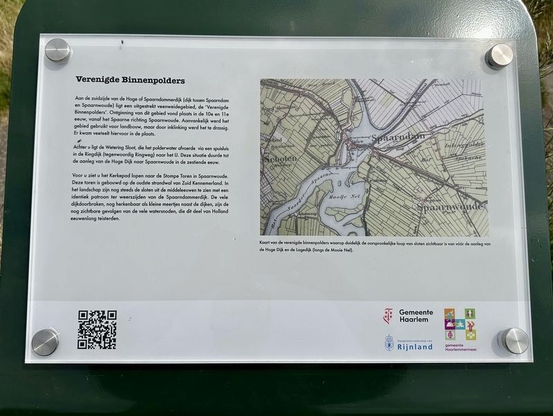
1. Verenigde Binnenpolders / “United Inner Polders“ Marker

Aan de zuidzijde van de Hoge of Spaarndammerdijk (dijk tussen Spaarndam en Spaarnwoude) ligt een uitgestrekt veenweidegebied, de 'Verenigde Binnenpolders'. Ontginning van dit gebied vond plaats in de 10e en 11e eeuw, vanaf het Spaarne richting Spaarnwoude. Aanvankelijk werd het gebied gebruikt voor landbouw, maar door inklinking werd het te drassig. Er kwam veeteelt hiervoor in de plaats.
Achter u ligt de Wetering Sloot, die het polderwater afvoerde via een spuisluis in de Ringdijk (tegenwoordig Ringweg) naar het IJ. Deze situatie duurde tot de aanleg van de Hoge Dijk naar Spaarnwoude in de zestiende eeuw.
Voor u ziet u het Kerkepad lopen naar de Stompe Toren in Spaarnwoude. Deze toren is gebouwd op de oudste strandwal van Zuid Kennemerland. In het landschap zijn nog steeds de sloten uit de middeleeuwen te zien met een identiek patroon ter weerszijden van de Spaarndammerdijk. De vele dijkdoorbraken, nog herkenbaar als kleine meertjes naast de dijken, zijn de nog zichtbare gevolgen van de vele watersnoden, die dit deel van Holland eeuwenlang teisterden.
Verenigde Binnenpolders (“United Inner Polders”)
South
this page online
Behind you lies the Wetering Sloot, which drained polder water into the IJ via a sluice in the Ringdijk (now the Ringweg). This arrangement remained in place until the construction of the Hoge Dijk to Spaarnwoude in the sixteenth century.
Ahead of you, the Kerkepad runs towards the Stompe Toren (“Stumpy Tower”) in Spaarnwoude. This tower stands on the oldest beach ridge in South Kennemerland. Medieval ditches—featuring an identical pattern on either side of the Spaarndammerdijk—can still be seen in the landscape. The numerous dike breaches, still recognizable as small ponds beside the dikes, are visible reminders of the many floods that plagued this part of Holland for centuries.
Erected 2026 by
Photographed by Andrew Ruppenstein, May 31, 2026
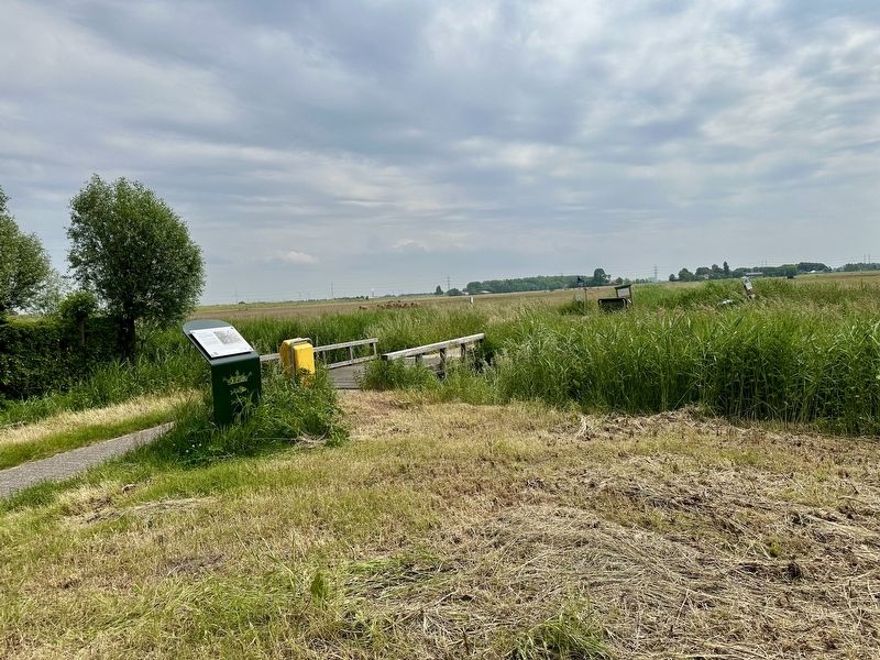
2. Verenigde Binnenpolders / “United Inner Polders” Marker - wide view
Topics. This historical marker is listed in these topic lists: Agriculture • Man-Made Features.
Location. 52° 24.593′ N, 4° 40.979′ E. Marker is in Spaarndam, Noord-Holland (North Holland), in Haarlemmermeer. It is at the intersection of Lageweg and Langedijk, on the right when traveling north on Lageweg. Touch for map. Marker is at or near this postal address: Lageweg 15, Spaarndam, Noord-Holland 2064 KT, Netherlands. Touch for directions.

Regionally, it is in Europe, the European Union, Atlantic Europe, the Benelux Low Countries, the Schengen Area, Western Europe, and the Western World. Historically, it finds itself in what was once the Holy Roman Empire.
Other nearby markers. At least 8 other markers are within walking distance of this marker: Het Rijnlandshuis / The Rijnlandshuis (approx. 0.3 kilometers away); Het Rijnlandshuis / The Rijnland House (approx. 0.3 kilometers away); De Grote Haarlemmersluis / The Grote Haarlemmersluis (approx. 0.4 kilometers away); Het haarlemse huis / The Haarlem House (approx. half a kilometer away); Woerdersluis / Woerder Sluice (approx. half a kilometer away); a different marker also named Woerdersluis / Woerder Sluice (approx. half a kilometer away); Palingrokerij Balm en palinghandel / Balm Eel Smokehouse and Eel Trading (approx. half a kilometer away); Spaarndam (approx. half a kilometer away). Touch for a list and map of all markers in Spaarndam.
Also see . . . Verenigde Binnenpolders (kolksluis.nl, in Dutch). The QR code on the marker provides sources for their information but nothing further. (Submitted on June 16, 2026.)
Credits. This page was last revised on June 16, 2026. It was originally submitted on June 16, 2026, by Andrew Ruppenstein of Lamorinda, California. This page has been viewed 19 times since then. Photos: 1, 2. submitted on June 16, 2026, by Andrew Ruppenstein of Lamorinda, California.
