South Dartmouth in Bristol County, Massachusetts — The American Northeast (New England)
The Russell Garrison
Photographed by G.W.Bartlett, June 19, 2026
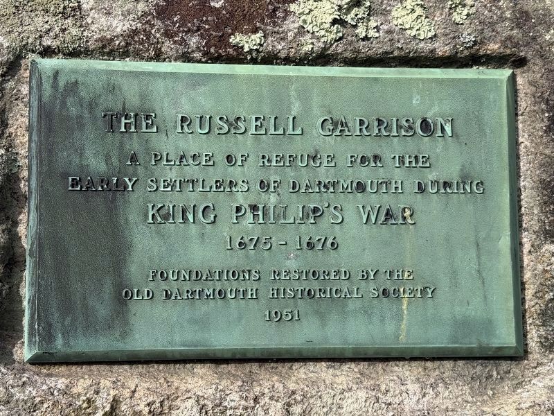
1. The Russell Garrison Marker
A place of refuge for the
Early settlers of Dartmouth during
King Philip’s War
1675-1676
Foundations restored by the
Old Dartmouth Historical Society
1951
Erected 1951 by Old Dartmouth Historical Society.
Topics and series. This historical marker is listed in these topic lists: Colonial Era • Forts and Castles • Settlements & Settlers • Wars, US Indian. In addition, it is included in the King Philip's War 1675-1676 series list. A significant historical year for this entry is 1675.
Location. 41° 35.862′ N, 70° 57.419′ W. Marker is in South Dartmouth, Massachusetts, in Bristol County. It can be reached from Fort Street north of Lucy Street, on the left when traveling north. Touch for map. Marker is in this post office area: South Dartmouth MA 02748, United States of America. Touch for directions.

Regionally, this marker is in the American Northeast, in New England, and on the Eastern Seaboard. Globally, it is in the North Atlantic Region, North America, the Western Hemisphere, the Western World, and the Anglosphere. Historically, it finds itself in what was once one of
this page online
Other nearby markers. At least 8 other markers are within 3 miles of this marker, measured as the crow flies: Russell Garrison Site c. 1664 (a few steps from this marker); Pvt. David Lewis Gifford Memorial (approx. 2 miles away); Col. Lewis L. Millett Memorial (approx. 2 miles away); Dedicated as a Tribute (approx. 2.4 miles away); Nathan and Mary (Polly) Johnson House (approx. 2.9 miles away); Defending a Rich Target (approx. 2.9 miles away); Captain Paul Cuffe's Atlantic World (approx. 3 miles away); The Rescue of Six Fenians (approx. 3 miles away).
Also see . . .
1. Russell Garrison (Wikipedia).
The Russell Garrison was a fortified area of Dartmouth, Massachusetts in the 17th century. Now a small town-owned public park located on Fort Street in its Apponagansett neighborhood, the garrison site includes the reconstructed foundational remnants of the homestead of early settler John Russell, progenitor of the locally prominent Russell family.(Submitted on June 20, 2026, by G.W.Bartlett of Hingham, Massachusetts.)
2. Old Dartmouth Historical Sketches - John Russell.
Beside(Submitted on June 20, 2026, by G.W.Bartlett of Hingham, Massachusetts.)this stream he built his house, about 20 feet square with large stone chimney, and so-called "salt-box" ell at the north. This house was undoubtedly similar to the Thomas Taber House at Fairhaven a fragment of which still remains and belongs to this Society, and we also have an interesting painting of Taber's, giving an excellent idea of a very early Dartmouth House. The entire sides of the Russell house were probably constructed of stones. Nearby where he planted his apple orchards well fenced. Here he dwelt with his household in comparative peace and plenty. Such was the pattern of his Dartmouth scene when the Indian War with King Philip broke out in the summer of 167S.Photographed by G.W.Bartlett, June 19, 20262. The Russell Garrison Marker
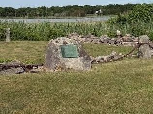
3. The Russell Garrison - Holly Herbster, Senior Archaeologist.
This presentation explores the context and the importance of this historical location and archaeological site.(Submitted on June 20, 2026, by G.W.Bartlett of Hingham, Massachusetts.)
Photographed by G.W.Bartlett, June 19, 2026
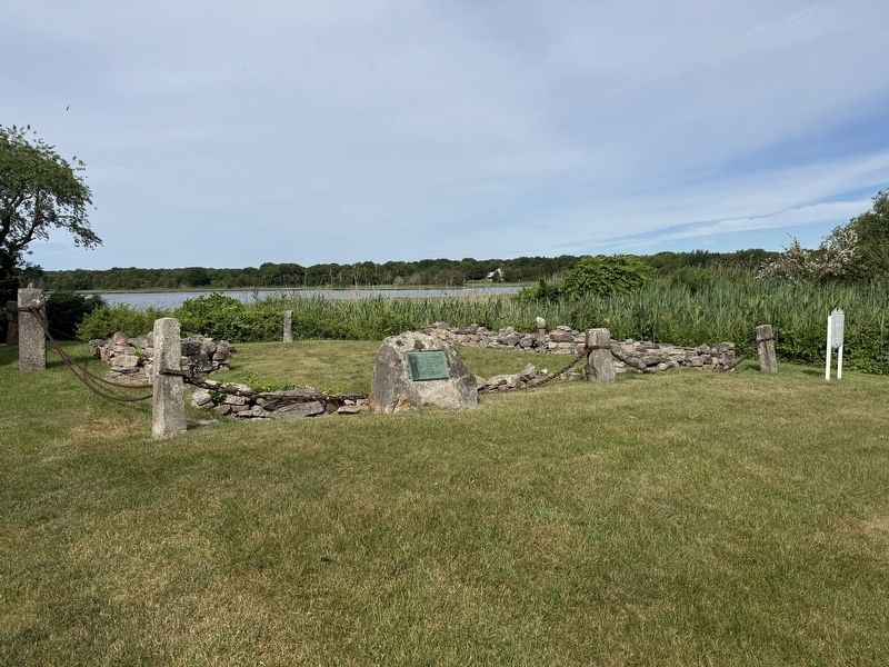
3. The Russell Garrison Foundation
Photographed by G.W.Bartlett, June 19, 2026
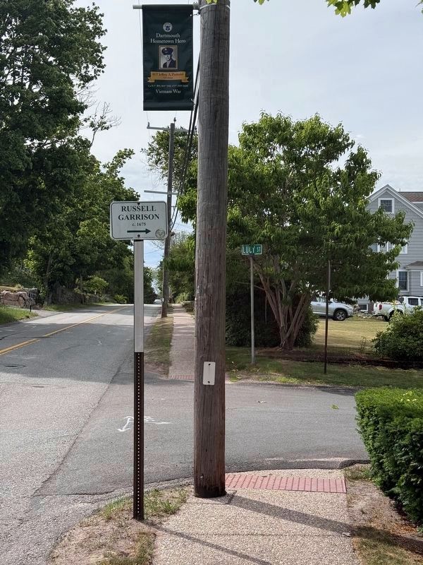
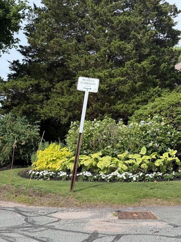
4. The Russell Garrison Roadside Sign
Posted on Elm Street and Lucy Street.
Photographed by G.W.Bartlett, June 19, 2026
5. The Russell Garrison Roadside Sign
Directs the historical journeyman to turn onto Fort Street to the Russel Garrison.
Credits. This page was last revised on June 28, 2026. It was originally submitted on June 19, 2026, by G.W.Bartlett of Hingham, Massachusetts. This page has been viewed 33 times since then. Photos: 1. submitted on June 19, 2026, by G.W.Bartlett of Hingham, Massachusetts. 2. submitted on June 28, 2026, by G.W.Bartlett of Hingham, Massachusetts. 3, 4, 5. submitted on June 19, 2026, by G.W.Bartlett of Hingham, Massachusetts. • Michael Herrick was the editor who published this page.
