Near Walla Walla in Walla Walla County, Washington — The American West (Northwest)
Battle of Walla Walla
Tellier Cabin Site
Photographed by Barry Swackhamer, August 14, 2020
1. Battle of Walla Walla - Wikipedia Marker
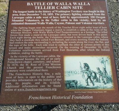
Caption: Sketch by Oregon Volunteer George Hunter, 1887
The longest battle in the history of Washington Territory was fought in this area, from December 7-10,1855. The primary fighting extended from the Larocque cabin a mile west of here, held by approximately 350 Oregon Mounted Volunteers, to the Tellier cabin in this vicinity, held by an estimated thousand Walla Walla, Cayuse, Palouse, and Yakama warriors.
The fighting began near the mouth of the of the Touchet River eight miles west of here when the Oregon Volunteers began a march to establish a camp at the ruins of the Whitman Mission, with Walla Walla Chief Peopeomoxmox as a hostage. The tribal forces first made a stand at the Larocque cabin, but were driven back to this point. Each night during the battle, the Volunteers returned to the Larocque cabin, where they built a stockade they called Fort Bennett, and every morning found the Indians had retaken the area surrounding it, including the woods along the river, the flat, and the tops of the hills. Each side tried to outflank the other at various points in this terrain and many skirmishes occurred. On the evening of December 10, 1855, Volunteers reinforcements
this page online
In the vicinity of the Larocque cabin, the battleground became the site of an early Frenchtown chapel, cemetery, and school. In 1876, the St. Rose of Lima Mission Church and the present Frenchtown cemetery were established there.
The Frenchtown Historic Site, a mile west of here, is open to the public and provided information on the history of the area, its people, and its wildlife. Additional information can be found online at www.frenchtownpartners.org.
Erected by Frenchtown Historical Foundation.
Topics. This historical marker is listed in these topic lists: Indigenous Peoples and Communities • Wars, US Indian. A significant historical date for this entry is December 7, 1855.
Location. 46° 2.759′ N, 118° 29.25′ W. Marker is near Walla Walla, Washington, in Walla Walla County. It is on Old Highway 12 near Frenchtown Road, on the right when traveling east. Touch for map. Marker is at or near this postal address: 7246 Old Highway 12, Walla Walla WA 99362, United States of America. Touch for directions.

Regionally, this marker is in Washington’s
Photographed by Barry Swackhamer, August 14, 2020
2. Battle of Walla Walla - Wikipedia Marker
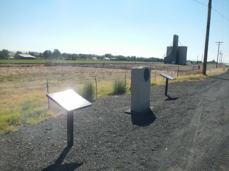
Other nearby markers. At least 8 other markers are within 2 miles of this marker, measured as the crow flies: Oregon Trail Memorial (here, next to this marker); The Baker Railroad (a few steps from this marker); Wai-i-lat-pu (approx. 1.1 miles away); Local Tribes (approx. 1.1 miles away); Frenchtown (approx. 1.1 miles away); a different marker also named The Battle of Walla Walla (approx. 1.1 miles away); Saint Rose Mission (approx. 1.1 miles away); St. Rose Mission (approx. 1.1 miles away). Touch for a list and map of all markers in Walla Walla.
Credits. This page was last revised on June 23, 2026. It was originally submitted on October 29, 2020, by Barry Swackhamer of Brentwood, California. This page has been viewed 383 times since then and 26 times this year. Last updated on June 20, 2026, by Clayton Pickett of Richland, Washington. Photos: 1, 2. submitted on October 29, 2020, by Barry Swackhamer of Brentwood, California. • Devry Becker Jones was the editor who published this page.
