Badlands National Park near Wall in Pennington County, South Dakota — The American Midwest (Upper Plains)
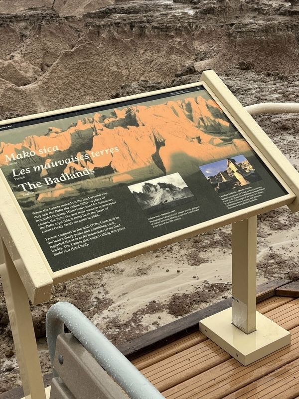
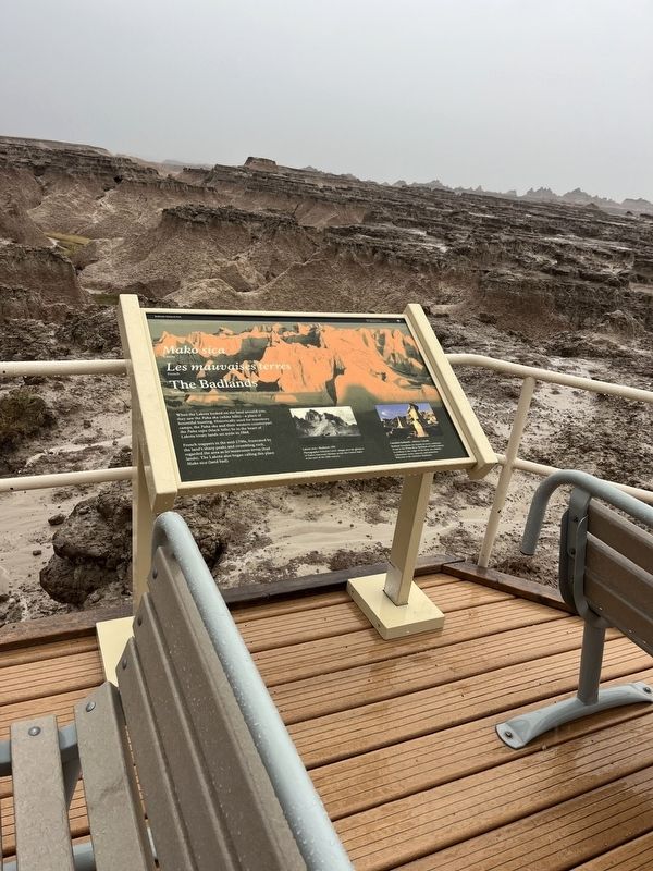
Mako sica/Les mauvaises terres/The Badlands
Badlands National Park
| — | National Park Service, U.S. Department of the Interior | — |
Photographed by Thomas Smith, May 17, 2026
1. THe Badlands Marker
Mako sica
Lakota
Les mauvaises terres
French
The Badlands
English
When the Lakota looked on the land around you, they saw the Paka ska (white hills)—a place of bountiful hunting. Historically used for transitory camps, the Paha ska and their western counterpart the Paha sapa (black hills) lie in the heart of Lakota treaty lands set aside
French trappers in the mid-1700s, frustrated by the land's sharp peaks and crumbling rock, regarded the area as fer maunaises terres (bad lands). The Lakota also began calling this place Mako sica (land bad).
[Captions:]
Lakota men — Badlands 1905
Photographer Edward Curtis' images provide glimpses of Native American lifeways across the United States at the turn of the 20th century.
Canadian badlands — Alberta, Canada
Badland formations are found on every continent. A visit to the White River Badlands of South Dakota is a tribute to the origin of the term: dry climate, sedimentary rocks, canyons, and pinnacles. Welcome to the definitive Badlands.
Erected by National Park Service, U.S. Department of the Interior.
Topics. This historical marker is listed
this page online
Location. 43° 54.379′ N, 102° 19.931′ W. Marker is near Wall, South Dakota, in Pennington County. It is in Badlands National Park. It is on Rim Road south of Sage Creek Road, on the left when traveling south. Touch for map. Marker is in this post office area: Wall SD 57790, United States of America. Touch for directions.

Regionally, this marker is in South Dakota’s West River, in the Badlands, and in Greater Rapid City. It is also in the American Lewis & Clark Corridor, on the prairies, and on the Northern Plains. Globally, it is in North America, the Western Hemisphere, the Western World, and the Anglosphere. Historically, it finds itself in what was once Rupert’s Land and also the Louisiana Purchase.
Other nearby markers. At least 8 other markers are within 12 miles of this marker, measured as the crow flies: Born of Volcanos (approx. 5½ miles away); The Big Badlands (approx. 5.6 miles away); Veterans Memorial (approx. 7½ miles away); The Carrol McDonald Post No. 246 World War Memorial
Photographed by Thomas Smith, May 17, 2026
2. THe Badlands Marker
Another marker is no longer nearby. Native American Culture (was approx. 12.1 miles away but has been permanently removed).
Additional commentary.
1.
I Just Found That this marker has been added already
— Submitted June 21, 2026, by Thomas Smith of Waterloo, Ill.
Credits. This page was last revised on July 20, 2026. It was originally submitted on June 21, 2026, by Thomas Smith of Waterloo, Ill. This page has been viewed 20 times since then. Photos: 1, 2. submitted on June 21, 2026, by Thomas Smith of Waterloo, Ill. • Devry Becker Jones was the editor who published this page.
