Central Business District in Melbourne, Victoria, Australia — Oceania
Archaeology and Artefacts
| — | Wesley Place Heritage Trail | — |
Photographed by Dean Barton-Ancliffe, June 3, 2026
1. Archaeology and Artefacts Marker
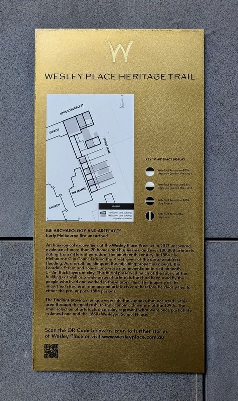
Archaeological excavations of the Wesley Place Precinct in 2017 uncovered evidence of more than 20 homes and businesses and over 100.000 artefacts dating from different periods of the nineteenth century. In 1854, the Melbourne City Council raised the street levels of the area to address flooding. As a result buildings on the adjoining properties along Little Lonsdale Street and Jones Lone were abandoned and buried beneath 1-2m thick layers of clay. This burial preserved much of the fabric of the buildings as well as a wide array of artifacts that had been used by the people who lived and worked in these properties. The majority of the unearthed structural remains and artefacts can therefore be clearly tied to either the pre- or post- 1854 periods.
The findings provide a unique view into the changes that occurred in this area through the gold rush, to the economic downturn of the 1890s. The small selection of artefacts on display represent what were once part of life in Jones Lane and the 1850s Wesleyan School House.
Erected by Wesley Place. (Marker Number B3.)
Topics. This historical marker is listed in these topic lists: Anthropology & Archaeology • Colonial Era • Settlements & Settlers. A significant historical year for this entry is 1854.
Location. 37° 48.581′ S, 144° 58.09′ E. Marker is in Melbourne, Victoria. It is in the Central Business District. It can be reached from Little Lonsdale Street 0.1 kilometers south of Bennetts Lane. Touch for map. Marker is at or near this postal address: 130 Lonsdale Street, Melbourne VIC 3000, Australia. Touch for directions.

Regionally, it is in Oceania, in Australasia, in the Pacific Ocean, in South Pacific, on the Pacific Rim, in the Western World, and in the Anglosphere. Historically, it finds itself in
this page online
Other nearby markers. At least 8 other markers are within walking distance of this marker: Wesley Place Archaeological Excavations (here, next to this marker); Caretaker's Cottage (a few steps from this marker); Former Leitrim Hotel (within shouting distance of this marker); Former School House (within shouting distance of this marker); Former Manse (within shouting distance of this marker); Nicholas Hall (within shouting distance of this marker); John Wesley Statue (within shouting distance of this marker); Wesley Church (within shouting distance of this marker). Touch for a list and map of all markers in Melbourne.
Also see . . . Stop B3: Archaeology and Artefacts. Wesley Place
Early Melbourne life unearthed(Submitted on June 21, 2026, by Dean Barton-Ancliffe of Rowville, Victoria.)
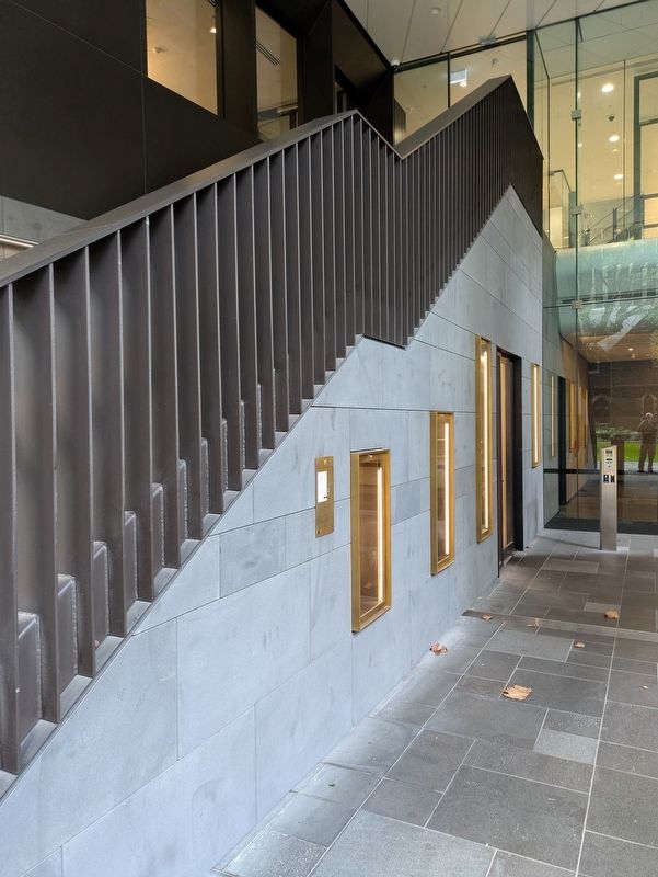
Archaeological excavations at Wesley Place uncovered evidence of more than 20 homes and businesses and over 100,000 artefacts dating from different periods of the nineteenth century. The findings provide a unique view into the changes that occurred in the area from the 1840s-and early 1850s, through the gold rush to the economic downturn of the 1890s. The small selection of artefactson display represent different aspects of life in Jones Lane and the 1850s Wesleyan School House.Photographed by Dean Barton-Ancliffe, June 3, 20262. Archaeology and Artefacts Marker and Archaeological Displays
An Aboriginal flaked glass scraper found in one of the Jones Lane residences, is evidence of the ingenuity and cultural continuity of the Traditional Owners of the land, utilizing newly available materials for traditional tool production.
Preservation and revelation
In Victoria, sites of potential historical archaeological significance are protected by the Heritage Act 2017 and are listed on the Victorian Heritage Inventory. Overseen by Heritage Victoria, any works that may disturb an archaeological site need official consent. At Wesley Place, the consent required archaeological investigation of the Jones Lane area to the north-east of the site and the location of the original 1850s Wesleyan School House, located to the south-east of the church.
Dr Vincent Clark & Associates excavated these areas of the site in 2017 over an eight-month period. The investigations uncovered rich evidence of the site’s early history, with artefacts revealing how life in this part of the city was lived, from the 1840s, through to the 1890s. A selection of the artefacts have been returned to Wesley Place, where they are now on display.
Credits. This page was last revised on June 22, 2026. It was originally submitted on June 21, 2026, by Dean Barton-Ancliffe of Rowville, Victoria. This page has been viewed 11 times since then. Photos: 1, 2. submitted on June 21, 2026, by Dean Barton-Ancliffe of Rowville, Victoria. • Andrew Ruppenstein was the editor who published this page.
