Central Falls in Providence County, Rhode Island — The American Northeast (New England)
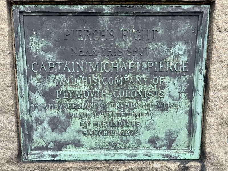
Pierce’s Fight
Photographed by G.W.Bartlett, June 22, 2026
1. Pierce’s Fight Marker
Near this spot Captain Michael Pierce and his company of Plymovth Colonists ambvshed and outnvmbered were almost annihilated by the Indians
March 26, 1676
Erected 1907 by the State of Rhode Island.
Topics and series. This memorial is listed in these topic lists: Colonial Era • Wars, US Indian. In addition, it is included in the King Philip's War 1675-1676 series list. A significant historical date for this entry is March 26, 1676.
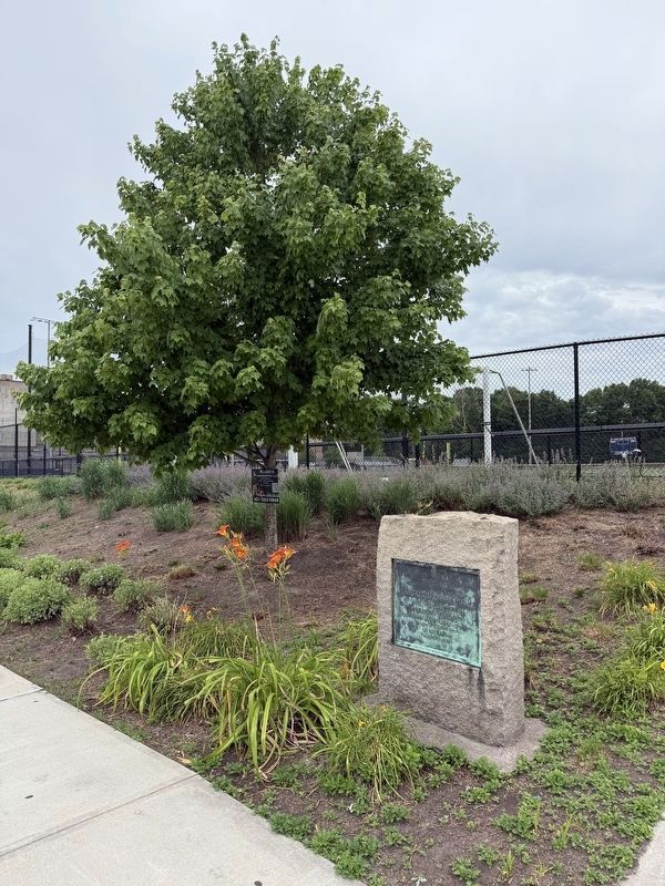
Location. 41° 53.644′ N, 71° 23.008′ W. Memorial is in Central Falls, Rhode Island, in Providence County. It is on High Street near Blackstone Street, on the left when traveling north. Located next to the driveway for Macomber Stadium. Touch for map. Memorial is in this post office area: Central Falls RI 02863, United States of America. Touch for directions.

Regionally, this memorial is in Greater Providence. It is also in the American Northeast, in New England, and on the Eastern Seaboard. Globally, it is in the North Atlantic Region, North America, the Western Hemisphere, the Western World, and the Anglosphere. Historically, it finds itself in what was once one of the original
this page online
Other nearby markers. At least 8 other markers are within walking distance of this marker: Pierce Park and Riverwalk (about 300 feet away, measured in a direct line); Jenks Park (approx. half a mile away); Sri Chinmoy Peace Bridge (approx. half a mile away); Turbine Power (approx. half a mile away); Waterpower & Dams (approx. half a mile away); c 1820 - 1934 (approx. half a mile away); A Bit About Arches (approx. half a mile away); The Old Neighborhood (approx. half a mile away). Touch for a list and map of all markers in Central Falls.
Related marker. Click here for another marker that is related to this marker.
Also see . . .
1. King Philip's War, by George W. Ellis, pub. 1906, Chapter XIII, pg. 191.
In vain Peirse, realizing too late the numbers confronting him, fell back to the river bank. Unable to draw off across the river, and galled by the fire from the opposite side, he formed his men in a circle, according to some chroniclers, or in two lines, back to back, and fought on in the vain hope that Captain Edmunds, whose co-operation he had requested that morning, would come up from Providence,(Submitted on June 22, 2026, by G.W.Bartlett of Hingham, Massachusetts.)only eight miles distant, and relieve him....Photographed by G.W.Bartlett, June 22, 20262. Pierce’s Fight Marker
2. The Bloodiest Day of King Philip's War, March 26, 1676. In this video, historian Stan Svec of "Fishing Historic Places" recounts the most significant actions of King Philip's War on March 26, 1676, including a detailed review of "Pierce's Fight" aka "the Battle of Central Falls".
March 26th, 1676 was a very bad day for the forces of the United Colonies during King Philip's War with Canonchet's Narragansett joining the war in full force alongside Metacom and the Confederated Tribes. On this day, a Sunday, Amerindian War making prowess will show itself fully as various warbands attack widely scattered homes, garrisons and communities.(Submitted on June 22, 2026, by G.W.Bartlett of Hingham, Massachusetts.)
3. The Captain Michael Pierce Fight, Commemorative Address, Sept. 21, 1907.
The commemorative address given by Hon. Edwin C. Pierce at the dedication exercises marking the site of "Pierce's Fight" in Central Falls, Rhode Island, on Saturday, Sept. 21, 1907 is included in a book of addresses(Submitted on June 22, 2026, by G.W.Bartlett of Hingham, Massachusetts.)and a poem compiled in memory of the occassion. "This is historic ground. It is the scene of one of the most tragic and most heroic events in early New England history...."Photographed by G.W.Bartlett, June 22, 20263. Pierce’s Fight MarkerThe marker is across from Pierce Park.

Credits. This page was last revised on July 4, 2026. It was originally submitted on June 22, 2026, by G.W.Bartlett of Hingham, Massachusetts. This page has been viewed 26 times since then. Photos: 1, 2, 3. submitted on June 22, 2026, by G.W.Bartlett of Hingham, Massachusetts. • Michael Herrick was the editor who published this page.
