Near Bacova in Bath County, Virginia — The American South (Mid-Atlantic)
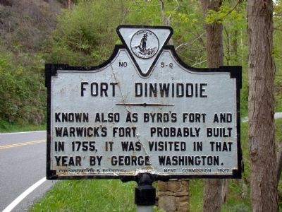
Fort Dinwiddie
Erected 1927 by Conservation & Development Commission. (Marker Number Q-5.)
Topics and series. This historical marker is listed in these topic lists: Colonial Era • Forts and Castles • War, French and Indian. In addition, it is included in the Former U.S. Presidents: #01 George Washington, the George Washington Slept Here, and the Virginia Department of Historic Resources (DHR) series lists. A significant historical year for this entry is 1755.
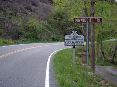
Location. 38° 4.85′ N, 79° 50.7′ W. Marker is near Bacova, Virginia, in Bath County. Marker is at the intersection of Virginia Route 39 and Dinwiddie Trail, on the right when traveling west on State Route 39. Touch for map. Marker is in this post office area: Bacova VA 24412, United States of America. Touch for directions.
Other nearby markers. At least 8 other markers are within 4 miles of this marker, measured as the crow flies. Bacova (approx. 1.8 miles away); Mountain Grove (approx. 2.7 miles away); West Warm Springs (approx. 2.8 miles away); a different marker also named West Warm Springs (approx. 2.8 miles away); Overshoot Wheel (approx. 3.8 miles away); Waterwheel Restaurant Building (approx. 3.8 miles away); The Dinwiddie Mantle (approx. 3.8 miles away); Confederate Memorial (approx. 3.9 miles away).
Also see . . . Vanderpool-L Fort Dinwiddie 1756. “Fort Dinwiddie (also known as Warwick's Fort; Byrd's Fort) was a prominent French and Indian War defense located on Jackson River, about 5 miles west of the present town of Warm Springs in Bath County, Virginia. It was erected in 1755. It served as a frontier defense until as late as 1789.” (Submitted on May 4, 2010.)
Credits. This page was last revised on June 16, 2016. It was originally submitted on May 4, 2010, by J. J. Prats of Powell, Ohio. This page has been viewed 1,490 times since then and 54 times this year. Photos: 1, 2. submitted on May 4, 2010, by J. J. Prats of Powell, Ohio.

