Ludlow Cave
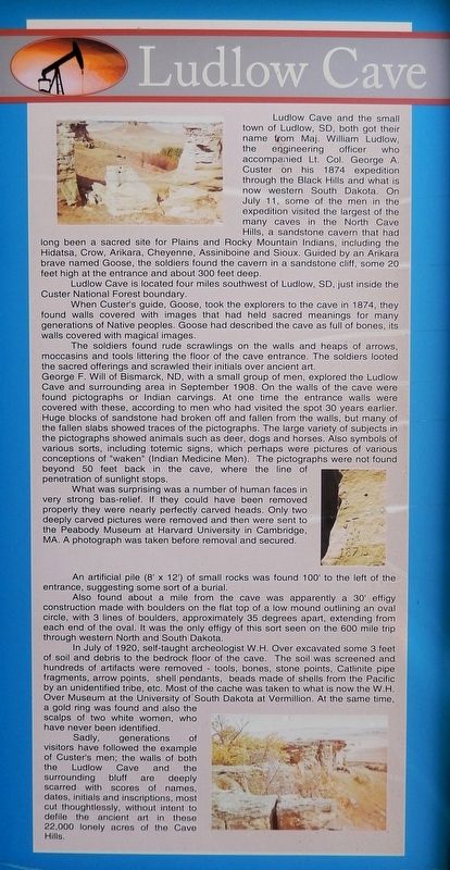
Ludlow Cave and the small town of Ludlow, SD, both got their name from Maj. William Ludlow, the engineering officer who accompanied Lt. Col. George A. Custer on his 1874 expedition through the Black Hills and what is now western South Dakota. On July 11, some of the men in the expedition visited the largest of the many caves in the North Cave Hills, a sandstone cavern that had long been a sacred site for Plains and Rocky Mountain Indians, including the Hidatsa, Crow, Arikara, Cheyenne, Assiniboine and Sioux. Guided by an Arikara brave named Goose, the soldiers found the cavern in a sandstone cliff, some 20 feet high at the entrance and about 300 feet deep.
Ludlow Cave is located four miles southwest of Ludlow, SD, just inside the Custer National Forest boundary.
When Custer's guide, Goose, took the explorers to the cave in 1874, they found walls covered with images that had held sacred meanings for many generations of Native peoples. Goose had described the cave as full of bones, its walls covered with magical images.
The soldiers found rude scrawlings on the walls and heaps of arrows, moccasins and tools littering the floor of the cave entrance. The soldiers looted the sacred offerings and scrawled their initials over ancient art.
George F. Will of Bismarck, ND, with a small group of men, explored the Ludlow Cave and surrounding area in September 1908. On the walls of the cave were found pictographs or Indian carvings. At one time the entrance walls were covered with these, according to men who had visited the spot 30 years earlier. Huge blocks of sandstone had broken off and fallen from the walls, but many of the fallen slabs showed traces of the pictographs. The large variety of subjects in the pictographs showed animals such as deer, dogs and horses. Also symbols of various sorts, including totemic signs,
this page online
What was surprising was a number of human faces in very strong bas-relief. If they could have been removed properly they were nearly perfectly carved heads. Only two deeply carved pictures were removed and then were sent to the Peabody Museum at Harvard University in Cambridge, MA. A photograph was taken before removal and secured.
An artificial pile (8' x 12') of small rocks was found 100' to the left of the entrance, suggesting some sort of a burial.
Also found about a mile from the cave was apparently a 30' effigy construction made with boulders on the flat top of a low mound outlining an oval circle, with 3 lines of boulders, approximately 35 degrees apart, extending from each end of the oval. It was the only effigy of this sort seen on the 600 mile trip through western North and South Dakota.
In July of 1920, self-taught archeologist W.H. Over excavated some 3 feet of soil and debris to the bedrock floor of the cave. The soil was screened

Sadly, generations of visitors have followed the example of Custer's men; the walls of both the Ludlow Cave and the surrounding bluff are deeply scarred with scores of names, dates, initials and inscriptions, most cut thoughtlessly, without intent to defile the ancient art in these 22,000 lonely acres of the Cave Hills.
Erected by Buffalo & Harding County, South Dakota.
Topics. This historical marker is listed in these topic lists: Anthropology & Archaeology • Arts, Letters, Music • Exploration • Indigenous Peoples and Communities. A significant historical date for this entry is July 11, 1874.
Location. 45° 34.854′ N, 103° 32.781′ W. Marker is in Buffalo, South Dakota, in Harding County. It can be reached from Theodore Roosevelt Expressway (CanAm Highway) (U.S. 85) just south of Connel Street (State Highway 20), on the left when traveling north. The marker is in Centennial Park. Touch for map. Marker is at or near this postal address: 91 US Highway 85, Buffalo SD 57720, United States of America. Touch for directions.

Regionally, this marker is in West River. It is also in the American Lewis & Clark Corridor, on the prairies, and on the Northern Plains. Globally, it is in North America, the Western Hemisphere, the Western World, and the Anglosphere. Historically, it finds itself in what was once Rupert’s Land and also the Louisiana Purchase.
Other nearby markers. At least 8 other markers are within walking distance of this marker: The Custer Black Hills Expedition of 1874 (here, next to this marker); Battle of the Slim Buttes (here, next to this marker); Medora - Deadwood Stage Line (here, next to this marker); Battle of the Crow Buttes (here, next to this marker); The Homesteaders (here, next to this marker); Sky Ranch for Boys (here, next to this marker); Tex Fletcher, the "Singing Cowboy" (here, next to this marker); Cattle Ranching in Harding County (here, next to this marker). Touch for a list and map of all markers in Buffalo.
Also see . . . Ludlow Cave (Wikipedia).
Excerpt: Ludlow Cave was first discovered and inhabited by various Native American tribes and their ancestors. Some rock art suggests the Cheyenne may have visited the site. The first archaeologist to visit the site was George Will, who published his findings in 1909. W.H. Over carried out an excavation in 1920 and uncovered hundreds of artifacts such as stone tools and other lithics, bones, and shell jewelry.(Submitted on June 24, 2026, by Cosmos Mariner of Cape Canaveral, Florida.)Ludlow Cave is a sacred site to multiple Native American peoples, including the Arikara, Hidatsa, Crow, Cheyenne, Assiniboine, and Siouan tribes. Several tribes of the Missouri River area believed Ludlow Cave was a portal through which game, particularly bison, entered from the spirit world to populate the vast herds on the Great Plains. The rock art inside and around Ludlow Cave varies in age from prehistoric to modern. Much of it consists of big game animals like bison. Hoofprint impressions are also located near the site and likely date to 1300–1700 AD. Other depictions are of humans or other animals. Many of these drawings resemble other local petroglyphs, such as that found at a site near Mobridge.
Over recorded at least 300 arrowheads made out of material like flint, agate, quartzite, and chalcedony; some still had the remains of the arrow shafts or fastenings attached. Other stone or bone tools included pipes, awls, and rounded fragments of stone that Over hypothesized might have been game pieces. Based on the typography of the arrowheads, Over suggested this oldest level might have been resulted from a Rocky Mountains-based tribe, possibly Shoshone, inhabiting the cave temporarily. Archaeologist William Duncan Strong further proposed the artifacts were left by an ancestral group to the Arikara who may have arrived from modern-day Nebraska.
Credits. This page was last revised on June 26, 2026. It was originally submitted on June 22, 2026, by Cosmos Mariner of Cape Canaveral, Florida. This page has been viewed 28 times since then. Photos: 1, 2. submitted on June 24, 2026, by Cosmos Mariner of Cape Canaveral, Florida.
