Warren in Bristol County, Rhode Island — The American Northeast (New England)
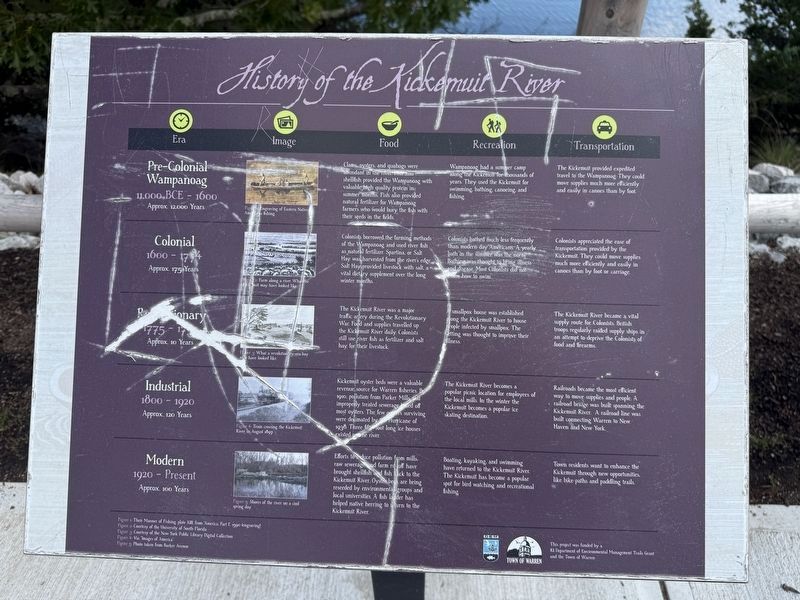
History of the Kickemuit River
| — | Warren Bike Path | — |
Photographed by G.W.Bartlett, June 24, 2026
1. History of the Kickemuit River Marker
Pre-Colonial Wampanoag (11,000 BCE - 1600) Approx. 12,000 years
Recreation: Wampanoag had a summer camp along the Kickemuit for thousands of years. They used the Kickemuit for swimming, bathing, canoeing and fishing.
Transportation: The Kickemuit provided expedited travel to the Wampanoag. They could move supplies much more efficiently and easily in canoes than by foot.
Recreation: Colonists bathed much less frequently than modern day Americans. A yearly bath in the summer was the norm. Bathing was thought to bring illness
this page online
Transportation: Colonists appreciated the ease of transportation provided by the Kickemuit. They could move supplies much more efficiently and easily in canoes than by foot or carriage.
Recreation: A smallpox house was established along the Kickemuit River to house people infected by smallpox. The setting was thought to improve their illness.
Transportation: The Kickemuit River became a vital supply route for Colonists. British troops regularly raided supply ships in an attempt to deprive the Colonists of food and firearms.
Photographed by G.W.Bartlett, June 24, 2026
2. History of the Kickemuit River Marker
Recreation: The Kickemuit River becomes a popular picnic location for employees of the local mills. In the winter the Kickemuit becomes a popular ice skating destination.
Transportation: Railroads become the most efficient way to move supplies and people. A railroad bridge was built spanning the Kickemuit River. A railroad line was built connecting Warren to New Haven and New York.
Recreation: Boating, kayaking, and swimming have returned to the Kickemuit River. The Kickemuit has become a popular spot for bird watching and recreational fishing.
Transportation: Town residents want to enhance the Kickemuit through new opportunities, like bike paths and paddling trails.
( photo captions )
Figure 1: Engraving of Eastern Native Americans Fishing.
Figure 2: Farm along a river. What the Kickemuit may have looked like.
Figure
Photographed by G.W.Bartlett, June 24, 2026
3. Kickemuit River
Figure 4: Train crossing the Kickemuit River in August 1897.
Figure 5: Shores of the river on a cold spring day.
Erected by Town of Warren.
Topics. This historical marker is listed in these topic lists: Parks & Recreational Areas • Waterways & Vessels.
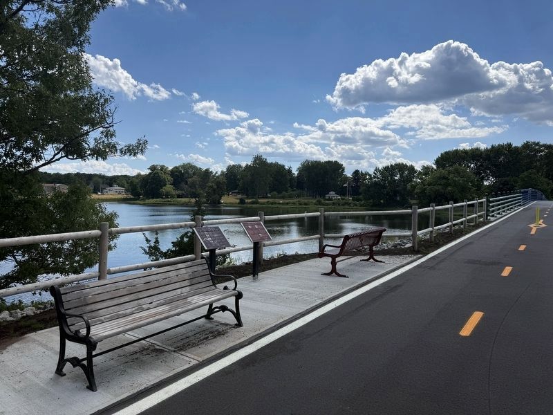
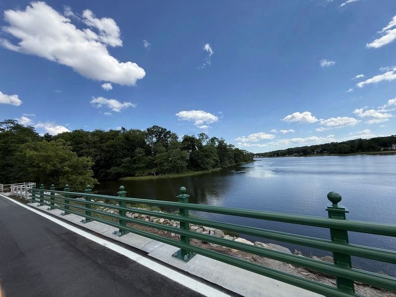
Location. 41° 43.565′ N, 71° 15.771′ W. Marker is in Warren, Rhode Island, in Bristol County. It can be reached from Asylum Road 0.3 miles west of Cole School Road, on the left when traveling north. Located along the Warren Bike Path on the new bridge crossing the Kickemuit River. Touch for map. Marker is in this post office area: Warren RI 02885, United States of America. Touch for directions.

Regionally, this marker is in Greater Providence and on Narragansett Bay. It is also in the American Northeast, in New England, and on the Eastern Seaboard. Globally, it is in the North Atlantic Region, North America, the Western Hemisphere, the Western World, and the Anglosphere. Historically, it finds itself in what was once one of the original Thirteen Colonies.
Photographed by G.W.Bartlett, June 24, 2026
4. Warren Recreation Park
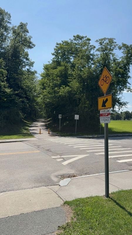
Park at Warren Recreation Park on the east side of Asylum Road, adjacent to the Warren Bike Path.
Other nearby markers. At least 8 other markers are within one mile of this marker, measured as the crow flies: Who was Hugh Cole? (here, next to this marker); In Memory of Hugh Cole (about 300 feet away, measured in a direct line); Early Warren and the start of King Philip's War (approx. 0.3 miles away); Vietnam Memorial (approx. ¾ mile away); Warren, RI (approx. one mile away); Washington St. (approx. one mile away); The Warren Armory (approx. 1.1 miles away); Baptist Church in Warren, R.I. (approx. 1.1 miles away). Touch for a list and map of all markers in Warren.
Also see . . . Kickemuit River (Wikipedia). (Submitted on June 30, 2026, by Michael Herrick of Southbury, Connecticut.)
Photographed by G.W.Bartlett, July 20, 2026
5. Asylum Road Entrance to East Bay Bike Path
Credits. This page was last revised on July 30, 2026. It was originally submitted on June 24, 2026, by G.W.Bartlett of Hingham, Massachusetts. This page has been viewed 38 times since then. Photos: 1, 2, 3. submitted on June 24, 2026, by G.W.Bartlett of Hingham, Massachusetts. 4. submitted on June 25, 2026, by G.W.Bartlett of Hingham, Massachusetts. 5. submitted on July 20, 2026, by G.W.Bartlett of Hingham, Massachusetts. • Michael Herrick was the editor who published this page.
