Near Charlestown in Clark County, Indiana — The American Midwest (Great Lakes)
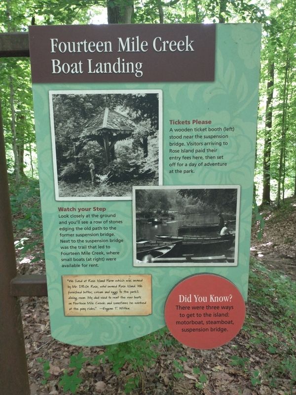
Fourteen Mile Creek Boat Landing
Photographed by Tom Bosse, June 13, 2026
1. Fourteen Mile Creek Boat Landing Marker
Tickets Please
A wooden ticket booth (left) stood near the suspension bridge. Visitors arriving to Rose Island paid their entry fees here, then set off for a day of adventure at the park.
Watch Your Step
Look closely at the ground and you’ll see a row of stones edging the old path to the former suspension bridge. Next to the suspension bridge was the trail that led to Fourteen Mile Creek, where small boats (at right) were available for rent.
“We lived at Rose Island Farm which was owned by Mr. D. B.G. Rose, who owned Rose Island. We furnished butter, cream and eggs to the park’s dining room. My dad used to rent the row boats on Fourteen Mile Creek and sometimes he worked at the pony rides.” – Eugene T. Witten
Did you know?
There were three ways to get to the island: motorboat, steamboat, suspension bridge.
Erected by Indiana Department of Natural Resources.
Topics and series. This historical marker is listed in these topic lists: Bridges & Viaducts • Parks & Recreational Areas • Waterways & Vessels. In addition, it is included in the Rose Island Amusement Park series list.
Location. 38° 25.551′ N,
this page online

Regionally, this marker is in Southern Indiana. It is also in the American Midwest, in the Ohio River Valley, and in the Corn Belt. Globally, it is in North America, the Western Hemisphere, the Western World, and the Anglosphere. Historically, it finds itself in what was once the territory of the Mississippian Culture and also the Northwest Territory.
Other nearby markers. At least 8 other markers are within walking distance of this marker: Getting to the Island by Suspension Bridge (here, next to this marker); Welcome to Rose Island! (within shouting distance of this marker); Reclaimed by Nature (within shouting distance of this marker); Building a Resort (within shouting distance of this marker); Timeline of Rose Island (within shouting distance of this marker); Travel back in time on Rose Island

Photographed by Tom Bosse, June 13, 2026
2. Fourteen Mile Creek Boat Landing Marker
Credits. This page was last revised on July 1, 2026. It was originally submitted on June 25, 2026, by Tom Bosse of Jefferson City, Tennessee. This page has been viewed 13 times since then. Photos: 1, 2. submitted on June 25, 2026, by Tom Bosse of Jefferson City, Tennessee. • Devry Becker Jones was the editor who published this page.
