Near Touchet in Walla Walla County, Washington — The American West (Northwest)
Battle of Walla Walla
Encounter on the Touchet

Photographed by Clayton Pickett, December 6, 2025
1. Battle of Walla Walla Marker
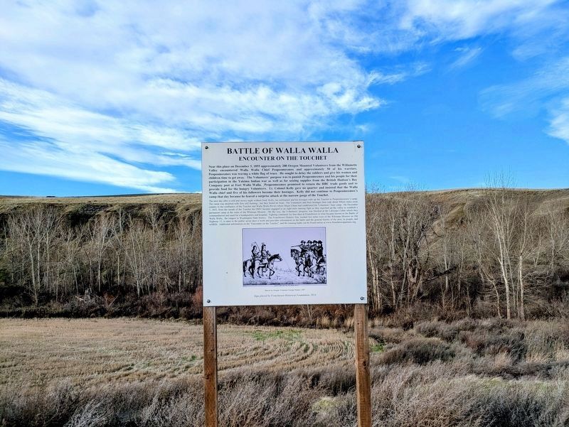
Near this place on December 5, 1855 approximately 200 Oregon Mounted Volunteers from the Willamette Valley encountered Walla Walla Chief Peopeomoxmox and approximately 50 of his warriors. Peopeomoxmox was waving a white flag of truce. He sought to delay the soldiers and give his women and children time to get away. The Volunteers' purpose was to punish Peopeomoxmox and his people for their participation in the Yakima Indian war as well as for seizing supplies from the British Hudson's Bay Company post at Fort Walla Walla. Peopeomoxmox promised to return the HBC trade goods and to provide food for the hungry Volunteers. Lt. Colonel Kelly gave no quarter and insisted that the Walla Walla chief and five of his followers become their hostages. Kelly did not continue to Peopeomoxmox's camp that day because he feared a surprise attack at the narrow gorge of the Touchet.
The next day after a cold and snowy night without food, Kelly, his militiamen and his hostages rode up the Touchet to Peopeomoxmox's camp. The camp was deserted with fires still burning, but they found no food. The Volunteers and their hostages then rode about fifteen miles cross country to the confluence of the Touchet and Walla Walla Rivers where Major Chinn had established the Volunteers' base camp. On December 7, 1855, from the mouth of the Touchet the OMV became engaged in an eight-mile running fight as they marched up the valley to establish a permanent camp at the ruins of the Whitman Mission. On the way, the Volunteers' progress was blocked at the Larocque Cabin which they commandeered and used for a headquarters and hospital. Fighting continued for four days at Frenchtown in what became known as the Battle of Walla Walla, the longest in Washington State history. The Frenchtown Historic Site, located two miles west of the Whitman Mission on Old Highway 12, is open to the public seven days a week and provides information on the battle and the general history of the area, its people, and wildlife. Additional information on the "Encounter on the Touchet" and the ensuing battle can be found online at www.frenchtownpartners.org.
(Photo Caption)
Sketch by Oregon Volunteer George Hunter, 1887
Erected 2014
this page online
Topics. This historical marker is listed in these topic lists: Indigenous Peoples and Communities • Settlements & Settlers • Wars, US Indian. A significant historical date for this entry is December 5, 1855.
Location. 46° 11.653′ N, 118° 38.483′ W. Marker is near Touchet, Washington, in Walla Walla County. It is on Touchet North Road 7.4 miles south of Washington Route 124, on the right when traveling south. Touch for map. Marker is in this post office area: Touchet WA 99360, United States of America. Touch for directions.

Regionally, this marker is in the Columbia Basin. It is also in the American Mountain West and in the Lewis & Clark Corridor. Globally, it is in North America, on the Pacific Rim, in the Western Hemisphere, in the Western World, and in the Anglosphere.
Other nearby markers. At least 8 other markers are within 12 miles of this marker, measured as the crow flies: The Lewis and Clark Expedition (within shouting distance of this marker); Johnson Bridge (approx. 5 miles away); Dangerous Rapids (approx. 10.4 miles away); French-Canadian Cabin Design (approx. 11.8 miles away); Hudson's Bay Company
Photographed by Clayton Pickett, December 6, 2025
2. Battle of Walla Walla Marker
Credits. This page was last revised on June 26, 2026. It was originally submitted on June 25, 2026, by Clayton Pickett of Richland, Washington. This page has been viewed 17 times since then. Photos: 1. submitted on June 26, 2026, by Clayton Pickett of Richland, Washington. 2. submitted on June 25, 2026, by Clayton Pickett of Richland, Washington. • James Hulse was the editor who published this page.
