Buffalo in Harding County, South Dakota — The American Midwest (Upper Plains)
Harding County, South Dakota

Photographed by Cosmos Mariner, August 24, 2023
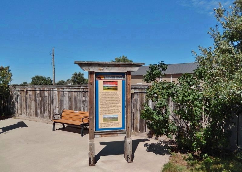
1. Harding County, South Dakota Marker
Harding County, the extreme northwestern county of South Dakota, has an area of 2,682 square miles. It is almost square, being approximately 54 by 51 miles, with Buffalo being centrally located. The area is semi-arid, with an average rainfall of 14 inches a year.
The greater part of the county is rolling and rugged prairie with cattle and sheep ranches occupying most of the territory. The eastern and northeastern part of the county is the area where agriculture is economically important, with farmers planting mainly wheat, corn, oats and barley.
The county also has areas of numerous high rocky buttes and mesas, known as the North and South Cave Hills in the north, the East and West Short Pine Hills in the southwest, and the Slim Buttes in the east. Many of these areas are part of the Custer National Forest. These hills are timbered with ponderosa pine and cedar and contain springs of cold water. The canyons are timbered with deciduous trees such as ash, cottonwood, elm, and wild fruit.
Scenic badlands and rugged mud buttes also occur in the county. The principal such area is known as the Jump-Off which extends across the west central part of Harding County beginning about 12 miles west of Buffalo. In the badlands and mud butte areas paleontologists have uncovered many species of prehistoric animals including tyrannosaurus, triceratops, and various other fossils.
Although there are no natural lakes in Harding County, the development of dams has resulted in some artificial lakes, the largest being Gardner Lake. It is located three miles west and two miles north of Buffalo and provides swimming, boating and other recreational activities. Some dams have been stocked by the State Game, Fish and Parks Department to provide fishing.
Wild game in the area includes deer, antelope, pheasants, and grouse which provide
this page online
South Dakota's largest commercial oil field Is located In Harding County. It begins approximately 10 miles north of Buffalo and extends into North Dakota and Montana.
Tourists, who are passing through Harding County, can add to their vacation trip by spending a few hours enjoying the “off-the-beaten-track” scenery our area has to offer.
This painting by local artist Axel Sacrison depicts the pronghorn, usually called “antelope”, which are common to Harding County. They were almost driven to extinction nationwide by hunting during the homesteading and The Depression eras. The Antelope Range Station, 12 miles east of Buffalo, was one of two reserves created in the 1940's to save the pronghorn from extinction. They now roam the prairie in abundant numbers. Harding County is well-known for its excellent antelope hunting.
Erected by Buffalo & Harding County, South Dakota.
Topics. This historical marker is listed in these topic lists: Agriculture • Animals • Paleontology • Parks & Recreational Areas.
Location. 45° 34.866′ N,
Photographed by Cosmos Mariner, August 24, 2023
2. Harding County, South Dakota Marker
The marker is on the heritage walkway in Centennial Park.

Regionally, this marker is in West River. It is also in the American Lewis & Clark Corridor, on the prairies, and on the Northern Plains. Globally, it is in North America, the Western Hemisphere, the Western World, and the Anglosphere. Historically, it finds itself in what was once Rupert’s Land and also the Louisiana Purchase.
Other nearby markers. At least 8 other markers are within walking distance of this marker: Harding County Post Offices (here, next to this marker); The Buffalo "Paints Himself Red" (a few steps from this marker); Energy Production in Harding County (a few steps from this marker); Tipperary (a few steps from this marker); Cattle Ranching in Harding County (a few steps from this

3. Marker detail: Antelope Painting by local artist Axel Sacrison
Also see . . . Antelope Range and Livestock Research Station (Wikipedia).
Excerpt: The Antelope Range and Livestock Research Station is operated by South Dakota State University and its extension programs to improve ranching in the U.S. State of South Dakota. The site is 8,300 acres large, the largest of SDSU's research stations. This land was owned by the state and operated as a pronghorn antelope preserve until 1947, when it was transferred to the agricultural university for research into "the balance between cattle and sheep production and protection and renewal of range resources". Current work focuses on sustainable beef and sheep production on rangeland. There are 120 head of beef cow and 400 sheep now on the range. North Dakota State University operates a similar research station at Hettinger, North Dakota, which often partners with SDSU's Antelope station for sheep research.(Submitted on June 26, 2026, by Cosmos Mariner of Cape Canaveral, Florida.)
Credits. This page was last revised on June 26, 2026. It was originally submitted on June 25, 2026, by Cosmos Mariner of Cape Canaveral, Florida. This page has been viewed 19 times since then. Photos: 1, 2, 3. submitted on June 26, 2026, by Cosmos Mariner of Cape Canaveral, Florida.
