Cozy Corner in Springfield in Hampden County, Massachusetts — The American Northeast (New England)
A Fortified Village of the Agawam Indians

Photographed by G.W.Bartlett, June 26, 2026
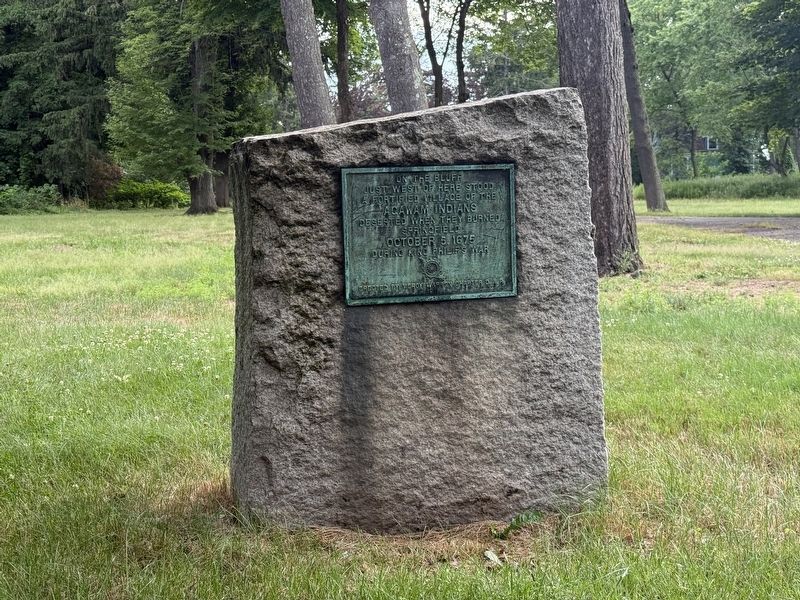
1. Fortified Village of the Agawam Indians Marker
just west of here stood
a fortified village of the
Agawam Indians
deserted when they burned
Springfield
October 5, 1675
during King Philip's War
Erected by Mercy Warren Chapter D.A.R.
1911
Erected 1911 by Mercy Warren Chapter D.A.R.
Topics and series. This memorial is listed in these topic lists: Indigenous Peoples and Communities • Wars, US Indian. In addition, it is included in the Daughters of the American Revolution (DAR), and the King Philip's War 1675-1676 series lists. A significant historical date for this entry is October 5, 1675.
Location. 42° 4.869′ N, 72° 34.563′ W. Memorial is in Springfield, Massachusetts, in Hampden County. It is in Cozy Corner. It is on Longhill Street (Massachusetts Route 83), on the right when traveling south. Touch for map. Memorial is at or near this postal address: 240 Longhill Street, Springfield MA 01108, United States of America. Touch for directions.

Regionally, this memorial is in the Knowledge Corridor and in Pioneer Valley. It is also in the American Northeast and in New England. Globally, it is in North America, the Western Hemisphere, the Western World, and the Anglosphere. Historically, it finds itself in what was once one of the original Thirteen Colonies.
Other nearby markers. At
this page online
Related markers. Click here for a list of markers that are related to this marker.
Also see . . .
1. Dr. Philip Kilroy House - Springfield Preservation Trust. History - 240 Longhill Street is known as both the Doctor Phillip Kilroy House and the Congregation of the Mission Covenant, this property was built in 1895 by Dr. Phillip Kilroy on the site of the famous “Storrs Lot” which was the site of the stockaded fortress from where Native Americans loyal to King Philip (Metacomet) based their attack on Springfield in October 1675. The site was also one of the first archeological dig sites in the United States with workers excavating the stockaded fortress
Photographed by G.W.Bartlett, June 26, 2026
2. Fortified Village of the Agawam Indians Marker
2. History of Springfield (1636-1886), pub. 1888, pg. 160. The Agawam Indians had up to this time remained quietly in their wigwams on the river-side, and in their fort that overlooked the beautiful bend of the river. This fort was situated upon what is known as the Storrs lot, on the old Long Hill road, below Mill River. . . . . . .A little plateau on a prominent spur of a hill, with abrupt declination shaped like a sharply truncated cone, afforded natural advantages for a fort. There is a deep ravine on the south side, which was probably the fortified approach to the fort. Many stone arrow-heads and hatchets have been found in this ravine, and on the plateau pottery and pestles for bruising corn have been turned up by the plough. (Submitted on June 30, 2026, by G.W.Bartlett of Hingham, Massachusetts.)

Photographed by G.W.Bartlett, June 28, 2026
3. Fortified Village of the Agawam Indians Marker

Photographed by G.W.Bartlett, June 28, 2026
4. Fortified Village of the Agawam Indians Marker
Credits. This page was last revised on July 2, 2026. It was originally submitted on June 27, 2026, by G.W.Bartlett of Hingham, Massachusetts. This page has been viewed 41 times since then. Photos: 1, 2. submitted on June 27, 2026, by G.W.Bartlett of Hingham, Massachusetts. 3, 4. submitted on June 29, 2026, by G.W.Bartlett of Hingham, Massachusetts. • Andrew Ruppenstein was the editor who published this page.
