
Quaboag Plantation in West Brookfield in Worcester County, Massachusetts — The American Northeast (New England)
The Fortified House
Photographed by G.W.Bartlett, June 26, 2026
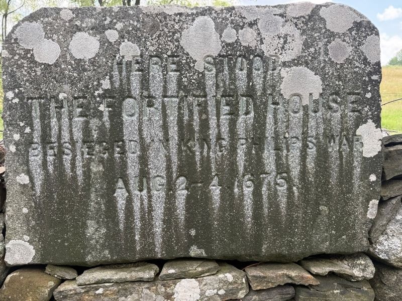
1. The Fortified House Marker
Here stood
the fortified house
besieged in King Philip’s War
Aug. 2-4 1675
Topics and series. This memorial is listed in these topic lists: Colonial Era • Forts and Castles • Settlements & Settlers • Wars, US Indian. In addition, it is included in the King Philip's War 1675-1676 series list. A significant historical date for this entry is August 2, 1675.
Location. 42° 13.755′ N, 72° 7.41′ W. Memorial is in West Brookfield, Massachusetts, in Worcester County. It is in Quaboag Plantation. It is on Foster Hill Road just west of George Allen Road, on the left when traveling west. Touch for map. Memorial is in this post office area: West Brookfield MA 01585, United States of America. Touch for directions.

Regionally, this memorial is in the Quiet Corner and in Greater Worcester. It is also in the American Northeast and in New England. Globally, it is in North America, the Western Hemisphere, the Western World, and the Anglosphere. Historically, it finds itself in what was once one of the original Thirteen Colonies.
Other nearby markers. At least 8 other markers are within walking distance of this marker: John Ayres
this page online
Related marker. Click here for another marker that is related to this marker. The "Wheeler's Surprise" marke in nearby New Braintree.
Also see . . .
1. Captain Thomas Wheeler's Narrative. 1675. Old South Leaflets No. 155. Library of Congress.
A True Narrative of the Lord's Providences in various dispensations towards Captain Edward Hutchinson of Boston and my self, and those that went with us into the Nipmuck country, and also to Quabaug, alias Brookfield: The said Captain Hutchinson having a commission from the Honoured Council of this Colony to treat with several Sachems in those parts in order to the publick peace, and my self being also ordered by(Submitted on June 29, 2026, by G.W.Bartlett of Hingham, Massachusetts.)the said council to accompany him with part of my troop for security from any danger that might be from the Indians: And to assist him in the transaction of matters committed to him.Photographed by G.W.Bartlett, June 26, 20262. The Fortified House Marker

2. The destruction of Brookfield 1675.
An historical reconstruction of events based on archaeological evidence presented by Robert Wilder of Quaboag Research for the Quaboag Historical Society of West Brookfield.(Submitted on June 29, 2026, by G.W.Bartlett of Hingham, Massachusetts.)
3. Ipswich, the Brookfield Massacre and King Philip's War.
In May 1660, a group of colonists moved from Ipswich to the Indian town of Quaboag in Western Massachusetts, which they renamed Brookfield. Indian attacks known as “King Philip’s War” resulted in the destruction of Brookfield and the deaths of a dozen settlers on August 2, 1675. English soldiers, accompanied by Mohegan allies, were eventually able to break the siege at Brookfield, with casualties on both sides.(Submitted on June 29, 2026, by G.W.Bartlett of Hingham, Massachusetts.)
4. Willard Memoir: The Life and Times of Major Simon Willard pub. 1858, pg. 243.

Photographed by G.W.Bartlett, June 26, 2026
3. The Fortified House Marker
On the second day of August, Captains Hutchinson and Wheeler, while proceeding with their party of horse some four or five miles beyond Quabaog, accompanied by several of the principal men of that town, in order to treat concerning peace with the Nipmucks at Meminimissett — according to a promise made by the Nipmucks to enter into negotiations on that day — were suddenly attacked; and eleven of their number, including Hutchinson, were killed. The rest of the troops barely succeeded in reaching the town; the Indians following close upon their traces, and burning all the dwelling-houses, with most of the other buildings in the place, except the one in which the inhabitants and soldiers had taken refuge.(Submitted on June 29, 2026, by G.W.Bartlett of Hingham, Massachusetts.)
5. King Philip's War 350 - Siege of Brookfield (Ayres' Garrison House). Bryan Burlingham presents a well-researched and fully referenced overview of the events related to this marker.
The video was shot at the site of Ayres' Garrison House, located in West Brookfield, Massachusetts. It is here that the Siege of Brookfield occurred, right after Wheeler's(Submitted on July 6, 2026, by G.W.Bartlett of Hingham, Massachusetts.)Surprise, which happened in present-day New Braintree.Photographed by G.W.Bartlett, June 26, 20264. The Fortified House Marker

Photographed by G.W.Bartlett, June 28, 2026
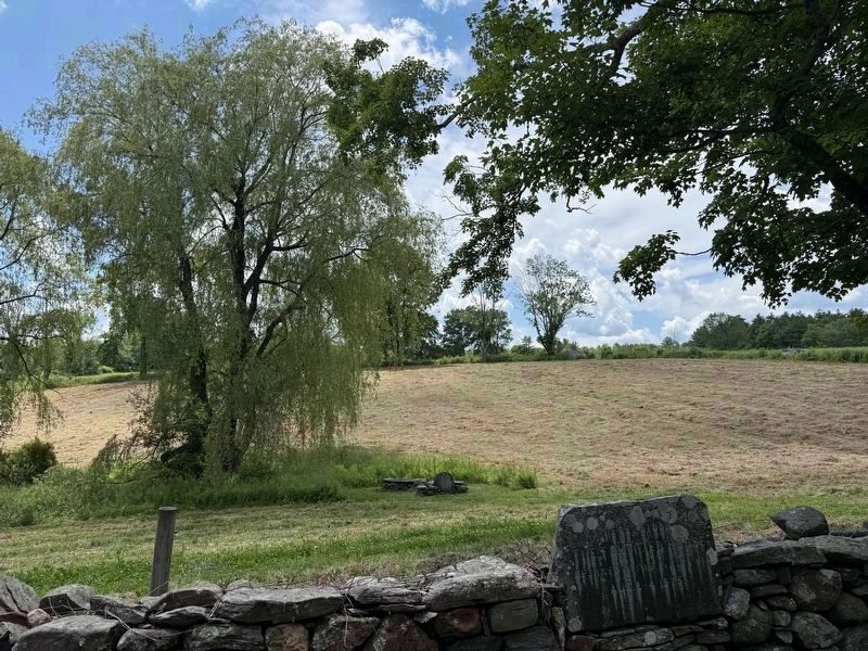
5. The Fortified House Marker
In the foreground on the wall. The well and marker are beneath the willow.
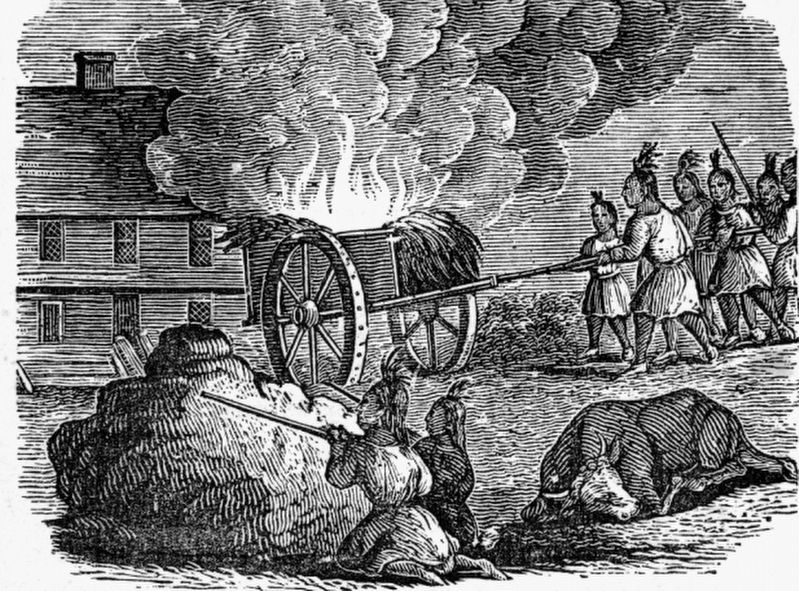
6. Attack on Brookfield
This scene composed of the 1675 3-day siege at the fortified garrison in Quaboag, depicts Nipmuck warriors rolling a burning cart down the hill towards the colonists sheltering in the building while others hide behind the rock at the top of the hill to shoot their muskets from a protected position. The artwork is included at the link from the Historic Ipswich link on this page.
Credits. This page was last revised on July 13, 2026. It was originally submitted on June 27, 2026, by G.W.Bartlett of Hingham, Massachusetts. This page has been viewed 34 times since then. Photos: 1, 2, 3, 4. submitted on June 27, 2026, by G.W.Bartlett of Hingham, Massachusetts. 5. submitted on June 28, 2026, by G.W.Bartlett of Hingham, Massachusetts. 6. submitted on July 6, 2026, by G.W.Bartlett of Hingham, Massachusetts. • Michael Herrick was the editor who published this page.
