Metro Center in Springfield in Hampden County, Massachusetts — The American Northeast (New England)
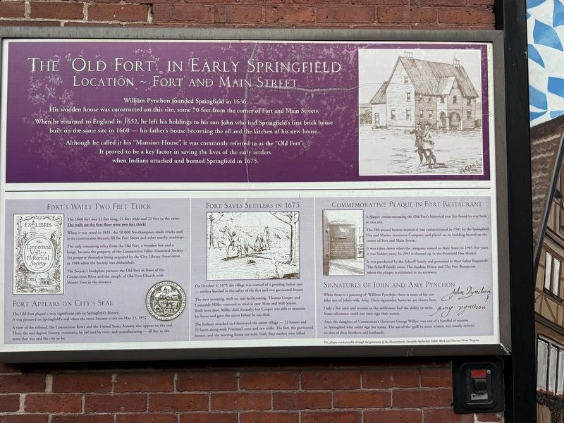
The “Old Fort” in Early Springfield
Location ~ Fort and Main Street
Photographed by G.W.Bartlett, June 26, 2026
1. The “Old Fort” in Early Springfield Marker
Location ~ Fort and Main Street
William Pynchon founded Springfield in 1636.
His wooden house was constructed on this site, some 70 feet from the corner of Fort and Main Streets.
When he returned to England in 1653, he left his holdings to his son John who had Springfield's first brick house built on the same site in 1660 -- his father's house becoming the ell and the kitchen of his new house.
Although he called it his "Mansion House", it was commonly referred to as the "Old Fort". It proved to be a key factor in saving the lives of the early settlers when Indians attacked and burned Springfield in 1675.
Fort's Walls Two Feet Thick
The 1660 fort was 42 feet long, 21 feet wide and 21 feet to the eaves. The walls on the first floor were two feet thick!
When it was razed in 1831, the 50,000 Northampton-made bricks used in its construction became fill for Fort Street and other nearby roadways.
The only remaining relics from the Old Fort, a wooden box and a hinge, became the property of the Connecticut Valley Historical Society (its property thereafter being acquired by the City
this page online
The Society's bookplate pictures the Old Fort in front of the Connecticut River and the steeple of Old First Church with Mount Tom in the distance.
Fort Appears on City's Seal
The Old Fort played a very significant role in Springfield's history. It was pictured on Springfield's seal when the town became a city on May 25, 1852.
A view of the railroad, the Connecticut River and the United States Armory also appear on the seal. Thus, the seal depicts history, commerce by rail and by river, and manufacturing -- all key to the town that was and the city to be.
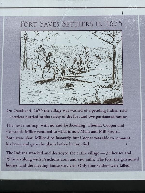
Fort Saves Settlers in 1675
On October 4, 1675 the village was warned of a pending Indian raid -- settlers hurried to the safety of the fort and two garrisoned houses.
The next morning, with no raid forthcoming, Thomas Cooper and Constable Miller ventured to what is now Main and Mill Streets. Both were shot. Miller died instantly, but Cooper was able to remount his horse and gave the alarm before he too died.
The Indians attacked and destroyed the entire village -- 32 houses and 25 barns along with Pynchon's corn

Photographed by G.W.Bartlett, June 26, 2026
2. Fort's Walls Two Feet Thick
Fort Appears on City's Seal
Fort Appears on City's Seal
Commemorative Plaque in Fort Restaurant
A plaque commemorating the Old Fort's historical past has found its way back to this site.
The 280-pound bronze memorial was commissioned in 1901 by the Springfield Fire and Marine Insurance Company and placed on its building located on the corner of Fort and Main Streets.
It was taken down when the company moved to State Street in 1905. For years it was hidden away. In 1993 it showed up in the Brimfield Flea Market.
It was purchased by the Scherff family and presented to their father Rupprecht. The Sherff family owns The Student Prince and the Fort Restaurant where the plaque is exhibited in its entryway.
Signatures of John and Amy Pynchon
While there is a painting of William Pynchon, there is none of his son John nor of John's wife, Amy. Their signatures, however, are shown here.
Only a few men and women in the settlement had the ability to write. Some selectmen could not even sign their names.
Amy, the daughter of Connecticut's Governor George Willys, was one of a handful
Photographed by G.W.Bartlett, June 26, 2026
3. Fort Saves Settlers in 1675
This plaque made possible through the generosity of the Massachusetts Turnpike Authority's Public Work and Tourism Grant Program
Erected by Massachusetts Turnpike Authority.
Topics and series. This memorial is listed in these topic lists: Colonial Era • Forts and Castles • Settlements & Settlers • Wars, US Indian. In addition, it is included in the King Philip's War 1675-1676 series list.
Location. 42° 6.22′ N, 72° 35.62′ W. Memorial is in Springfield, Massachusetts, in Hampden County. It is in Metro Center. It is on Fort Street north of E Columbus Avenue, on the left when traveling north. Touch for map. Memorial is at or near this postal address: 8 Fort Street, Springfield MA 01103, United States of America. Touch for directions.

Regionally, this memorial is in the Knowledge Corridor and in Pioneer Valley. It is also in the American Northeast and in New England. Globally, it is in North America, the Western Hemisphere,

Photographed by G.W.Bartlett, June 26, 2026
4. Commemorative Plaque in Fort Restaurant
Signatures of John and Amy Pynchon
Signatures of John and Amy Pynchon
Other nearby markers. At least 8 other markers are within walking distance of this marker: Board of Trade Block (about 300 feet away, measured in a direct line); Fuller Block (about 400 feet away); Stacy Building (about 500 feet away); Trinity Block (about 600 feet away); Home of the Duryea Automobile (about 600 feet away); Springfield Steam Power Company Block (about 600 feet away); Wells and Bicycle Blocks (about 700 feet away); Stearns Building (about 700 feet away). Touch for a list and map of all markers in Springfield.
Related markers. Click here for a list of markers that are related to this marker.
Also see . . .
1. History of Springfield, Massachusetts (1636-1886), pub. 1888, pg. 146.
In about 1659 John Pynchon had planned to build the finest house in New England outside of Boston. He made it at once a garrison, a residence, and a court-house. He bargained with Francis Hacklington, a Northampton man, for the brick, — in all 50,000, for which he paid a little over $2,000. This(Submitted on June 30, 2026, by G.W.Bartlett of Hingham, Massachusetts.)building was probably completed in 1661, and was situated where Fort street now is. It was the most important structure in this valley for many years, and remained a historic landmark on our Main street until well into the present centuryPhotographed by G.W.Bartlett, June 28, 20265. Commemorative Plaque in Entryway

2. William Pynchon (Wikipedia). (Submitted on July 5, 2026, by Michael Herrick of Southbury, Connecticut.)
3. Springfield, Massachusetts (Wikipedia). (Submitted on July 5, 2026, by Michael Herrick of Southbury, Connecticut.)
Photographed by G.W.Bartlett, June 26, 2026
6. The “Old Fort” in Early Springfield Marker
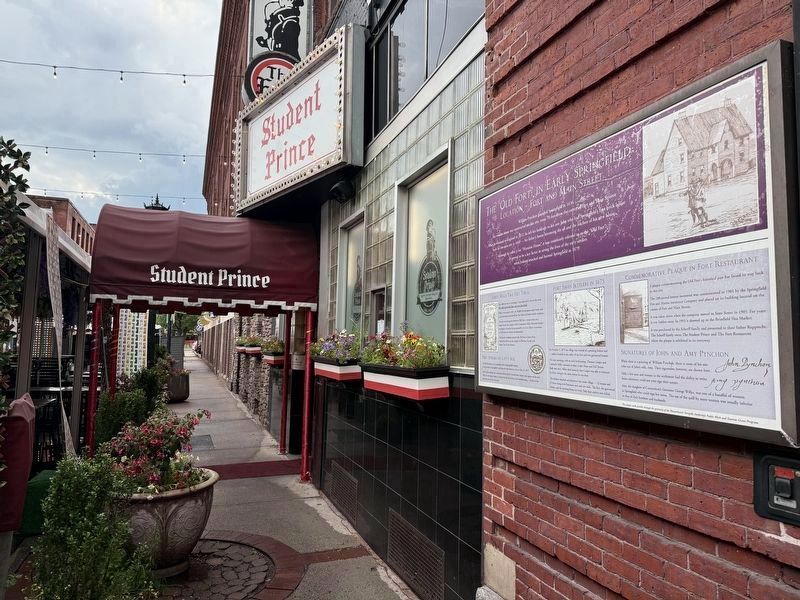
Fort Street is blocked off for pedestrian traffic and outdoor dining. Restaurant address is on Main Street, but main entrance is on Fort Street.
Credits. This page was last revised on July 13, 2026. It was originally submitted on June 27, 2026, by G.W.Bartlett of Hingham, Massachusetts. This page has been viewed 38 times since then. Photos: 1, 2, 3, 4. submitted on June 27, 2026, by G.W.Bartlett of Hingham, Massachusetts. 5. submitted on July 5, 2026, by G.W.Bartlett of Hingham, Massachusetts. 6. submitted on June 27, 2026, by G.W.Bartlett of Hingham, Massachusetts. • Michael Herrick was the editor who published this page.
