Glenville in Greenwich in Western Region, Connecticut — The American Northeast (New England)
The Merritt Parkway
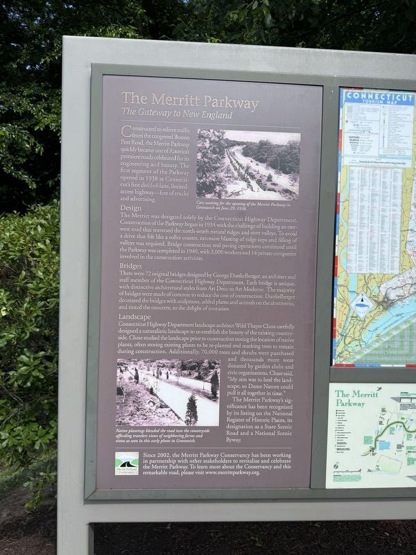
Constructed to relieve traffic from the congested Boston Post Road, the Merritt Parkway quickly became one of America's premiere roads celebrated for its engineering and beauty. The first segment of the Parkway opened in 1938 as Connecticut's first divided-lane, limited- access highway-free of trucks and advertising.
Design
The Merritt was designed solely by the Connecticut Highway Department. Construction of the Parkway began in 1934 with the challenge of building an east- west road that traversed the north-south natural ridges and river valleys. To avoid a drive that felt like a roller coaster, extensive blasting of ridge tops and filling of valleys was required. Bridge construction and paving operations continued until the Parkway was completed in 1940, with 2,000 workers and 14 private companies involved in the construction activities.
Bridges
There were 72 original bridges designed by George Dunkelberger, an architect and staff member of the Connecticut Highway Department. Each bridge is unique, with distinctive architectural styles from Art Deco to Art Moderne. The majority of bridges were made of concrete to
this page online
Landscape
Connecticut Highway Department landscape architect Weld Thayer Chase carefully designed a naturalistic landscape to re-establish the beauty of the existing countryside. Chase studied the landscape prior to construction noting the location of native plants, often storing existing plants to be re-planted and marking trees to remain during construction. Additionally, 70,000 trees and shrubs were purchased and thousands more were donated by garden clubs and civic organizations. Chase said, "My aim was to heal the landscape, so Dame Nature could pull it all together in time." The Merritt Parkway's significance has been recognized by its listing on the National Register of Historic Places, its designation as a State Scenic Road and a National Scenic Byway.
Since 2002, the Merritt Parkway Conservancy has been working in partnership with other stakeholders to revitalize and celebrate the Merritt Parkway. To learn more about the Conservancy and this
Photographed by Devry Becker Jones (CC0), June 21, 2026
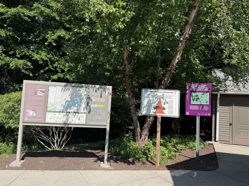
2. Several signs at the Greenwich service plaza along Merritt Parkway.
[Captions:]
Cars waiting for the opening of the Merritt Parkway in Greenwich on June 29, 1938.
Native plantings blended the road into the countryside affording travelers views of neighboring farms and vistas as seen in this early photo in Greenwich.
Erected by Merritt Parkway Conservancy.
Topics. This historical marker is listed in these topic lists: Horticulture & Forestry • Parks & Recreational Areas • Roads & Vehicles. A significant historical date for this entry is June 29, 1938.
Location. 41° 2.464′ N, 73° 40.398′ W. Marker is in Greenwich in Western Region, Connecticut. It is in Glenville. It is on Merritt Parkway, on the right. The marker stands on the grounds of the Route 15 Greenwich Southbound Service Plaza. Touch for map. Marker is at or near this postal address: 2000 Merritt Pkwy, Greenwich CT 06831, United States of America. Touch for directions.

Regionally, this marker is on the Connecticut Shoreline and in Greater Bridgeport. It is also in the American Northeast, in New England, and on the Eastern Seaboard. Globally, it is in the North Atlantic Region,
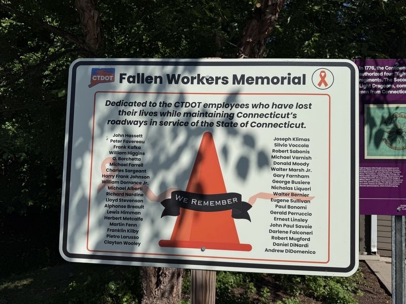
Other nearby markers. At least 8 other markers are within 3 miles of this marker, measured as the crow flies: Second Continental Light Dragoons (here, next to this marker); Greenwich Ninth District Veterans Memorial (approx. half a mile away); Rye Korean War Veterans Memorial (approx. 1.9 miles away in New York); Crawford Park (approx. 1.9 miles away in New York); Hero's Walkway (approx. 1.9 miles away in New York); Abraham Bush Homestead (approx. 2 miles away in New York); Port Chester Vietnam War Memorial (approx. 2.1 miles away in New York); Luigi Del Bianco Memorial (approx. 2.3 miles away in New York). Touch for a list and map of all markers in Greenwich.
Credits. This page was last revised on June 28, 2026. It was originally submitted on June 28, 2026, by Devry Becker Jones of Washington, District of Columbia. This page has been viewed 19 times since then. Photos: 1, 2, 3. submitted on June 28, 2026, by Devry Becker Jones of Washington, District of Columbia.
