
Brookfield in Worcester County, Massachusetts — The American Northeast (New England)
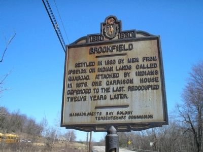
Brookfield
1630 -- 1930
Photographed by Bill Coughlin, April 13, 2009
1. Brookfield Marker
Settled in 1660 by men from Ipswich on Indian lands called Quaboac. Attacked by Indians in 1675. One garrison house defended to the last. Reoccupied twelve years later.
Erected 1930 by Massachusetts Bay Colony-Tercentenary Commission.
Topics and series. This historical marker is listed in these topic lists: Colonial Era • Indigenous Peoples and Communities • Settlements & Settlers. In addition, it is included in the King Philip's War 1675-1676, and the Massachusetts Bay Colony—Tercentenary Commission Markers series lists. A significant historical year for this entry is 1660.
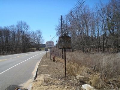
Location. 42° 13.122′ N, 72° 7.178′ W. Marker is in Brookfield, Massachusetts, in Worcester County. It is on East Main Street (Massachusetts Route 9) near Ridge Road, on the right when traveling west. Marker is located at the Brookfield / West Brookfield border. Touch for map. Marker is at or near this postal address: 244 E Main St, West Brookfield MA 01585, United States of America. Touch for directions.

Regionally, this marker is in the Quiet Corner and in Greater Worcester. It is also in the American Northeast and in New
this page online
Other nearby markers. At least 8 other markers are within walking distance of this marker: Foster Hill Road (approx. ¼ mile away); Civil War Memorial (approx. 0.4 miles away); Boston Post Road (approx. 0.6 miles away); John Ayres (approx. ¾ mile away); The Fortified House (approx. ¾ mile away); Thomas and Mary Millett’s Home Site (approx. 0.9 miles away); Gen. Henry Knox Trail (approx. 0.9 miles away); First Burial Ground (approx. 0.9 miles away). Touch for a list and map of all markers in Brookfield.
Related markers. Click here for a list of markers that are related to this marker. To better understand the relationship, study each marker in the order shown.
Also see . . .
1. Historical markers erected by Massachusetts Bay Colony. Original 1930 publication by the Commonwealth of Massachusetts of Tercentenary Commission Markers, commemorating the three hundredth anniversary of the Massachusetts Bay Colony. (Submitted
Photographed by Bill Coughlin, April 13, 2009
2. Marker on W Main Street
2. Retreat from the Ambush and the Siege of Brookfield.
Wheeler’s Surprise, and the ensuing Siege of Brookfield, was a battle between Nipmuc Indians under Muttawmp and the English of the Massachusetts Bay Colony under the command of Capt. Thomas Wheeler and Capt. Edward Hutchinson in August of 1675, during King Phillip’s War.(Submitted on April 21, 2026, by G.W.Bartlett of Hingham, Massachusetts.)
3. An Account of Old Quabaug, Indian and English occupation 1647-1676. -- Capt. Wheeler's Narrative. "On Wednesday, August the 4th. the Indians fortified themselves at the meeting house, and the barn, belonging to our house, which they fortified both at the great doors, and at both ends, with posts, rails, boards, and hay, to save themselves from our shot. They also devised other stratagems, to fire our house, on the night following, namely, they took a cart, and filled it with flax, hay and candlewood, and other combustible matter, and set up planks, fastened to the cart, to save themselves from the danger of our shot." (Submitted on
Photographed by G.W.Bartlett, June 26, 2026
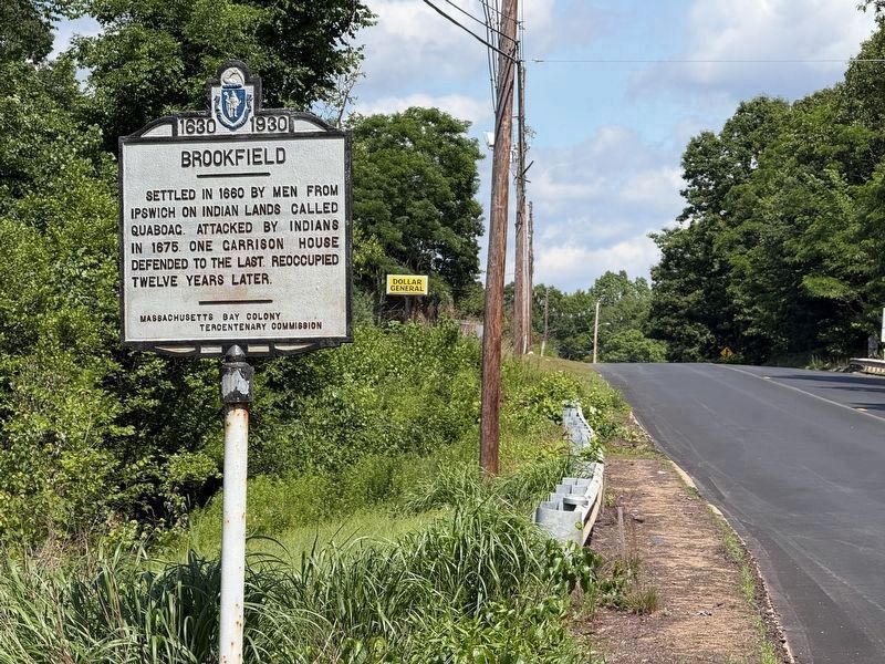
3. Brookfield Marker
View looking eastbound on West Main St. (Route 9)

4. Attack on Brookfield
Credits. This page was last revised on July 9, 2026. It was originally submitted on May 3, 2009, by Bill Coughlin of Woodland Park, New Jersey. This page has been viewed 1,863 times since then and 64 times this year. Last updated on June 29, 2026, by G.W.Bartlett of Hingham, Massachusetts. Photos: 1, 2. submitted on May 3, 2009, by Bill Coughlin of Woodland Park, New Jersey. 3. submitted on June 27, 2026, by G.W.Bartlett of Hingham, Massachusetts. 4. submitted on April 17, 2026, by G.W.Bartlett of Hingham, Massachusetts. • Devry Becker Jones was the editor who published this page.
