Waterford in County Waterford, Munster, Ireland — Irish South-West ((Éire) North Atlantic Ocean)
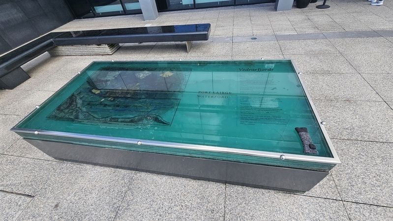
Vedrarfjordr
Photographed by Ian Lefkowitz, May 16, 2026
1. Vedrarfjordr Marker

Bunaíodh Port Láirge sa bhliain 914 agus tá sé níos sine ná na príomhchathracha go léir i dTuaisceart na hEorpa seachas Páras agus Londain. Is í an t-aon chathair Éireannach amháin a choimeád a logainm Lochlannach — Vedrarfjordr — focal Sean-Lochlannach a chiallaíonn ‘tearmann ón bhfarraige ghaofar’ nó ‘cuan geimhridh’.
Bhaist na hÉireannaigh Port Láirge ar an gcathair.
Bhí uisce ar dhá imeall na lonnaíochta triantánaí — ó thuaidh Abhainn na Siúire agus anseo riasc taoide a bhí á húsáid mar chuan don bhaile mór a d’fhorbair ar an talamh níb airde os a comhair. Ba anseo a d’fheistigh na heachtránaithe Lochlannacha a mórlonga fada.
Thóg na Lochlannaigh múr agus claí cré d’fhonn a lonnaíocht a chosaint. Tá falla cloiche ón 13ú céad thall agus leanann sé líne na gcosaintí Lochlannacha.
San 18ú céad draenáladh an limistéar seo agus bunaíodh Malla foirmiúil le crainn ar an dá thaobh.
Founded in 914, Waterford is older than all the North European capitals except Paris and London. It is the only Irish city to retain its Viking place name — Vedrarfjordr — an Old Norse word meaning ‘haven from the windy
this page online
The Irish named the city, Port Láirge, the port of the thigh.
The triangular settlement was bounded on two sides by water — on the north by the river Suir and here by a tidal marsh that was used as a harbour for the town that developed on the higher ground opposite. It was here that the Viking adventurers moored their great long ships.
The Vikings built an earthen bank and ditch to defend their settlement. The 13th century stone wall opposite follows the line of the earlier Viking defences.
In the 18th century this area was drained and a formal tree-lined Mall was established.
Topics. This historical marker is listed in these topic lists: Anthropology & Archaeology • Waterways & Vessels. A significant historical year for this entry is 914 CE.
Location. 52° 15.556′ N, 7° 6.411′ W. Marker is in Waterford, Munster, in County Waterford. It can be reached from the intersection of The Mall and Bank Lane, on the left when traveling west. Touch for map. Marker is at or near this postal address: 28 The Mall, Waterford, Munster X91 AYF4, Ireland. Touch for directions.

Regionally, this marker is in the Ancient East.
Photographed by Ian Lefkowitz, May 16, 2026
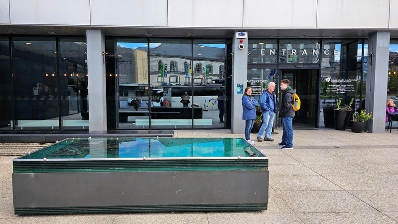
2. Vedrarfjordr Marker
This glass marker is aptly located in front of the House of Waterford, the producers of Waterford Crystal.
Other nearby markers. At least 8 other markers are within walking distance of this marker: Theatre Royal / City Hall (within shouting distance of this marker); Vincent Wallace (within shouting distance of this marker); Richard H. Ryland (within shouting distance of this marker); Thomas Francis Meagher / Tomás Proinsias Ó Meachair (within shouting distance of this marker); In ómós do na Gael / Irish Service Memorial (within shouting distance of this marker); September 11th 2001 (within shouting distance of this marker); Cearnóg an Bhunreachta / Constitution Square (within shouting distance of this marker); “No Pasaran” (within shouting distance of this marker). Touch for a list and map of all markers in Waterford.
Credits. This page was last revised on June 30, 2026. It was originally submitted on June 30, 2026, by Ian Lefkowitz of New York, New York. This page has been viewed 17 times since then. Photos: 1, 2. submitted on June 30, 2026, by Ian Lefkowitz of New York, New York. • Andrew Ruppenstein was the editor who published this page.
