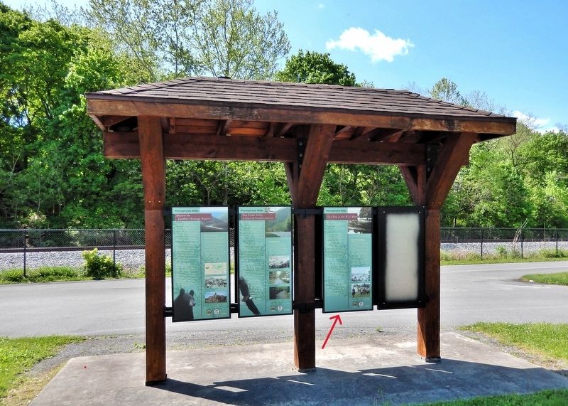
Fair Play in the Wild West
Pennsylvania Wilds
| — | Pine Creek Rail Trail | — |

“I remember well the day independence was declared on the plains of Pine Creek...”
—Anna Jackson Hamilton, 1858, recalling, at age 90, the gathering under the Tiadaghton Elm on July 4, 1776.
In the mid-1700s, much of Pennsylvania was still frontier. Indian tribes struggled to maintain their footing here as settlers pressed steadily westward. In 1768, regional tribes deeded part of central Pennsylvania to the Commonwealth. Though Indians still claimed lands west of Lycoming Creek, many settlers believed that Pine Creek formed the western boundary of deeded lands. For 15 years, settlers squatted on this disputed land between the two creeks and north of the West Branch the Susquehanna.
Beyond the jurisdiction of provincial law, settlers created their own system of justice, which they called Fair Play. Disputes over land claims inevitably arose. Settlers elected a three-person commission to resolve disagreements, and from 1768 to 1785, their word was law. If a squatter refused to follow their decrees, he was placed in a boat and set adrift on the river.
On July 4, 1776, the same day that the Continental Congress announced independence from Britain, the Fair Play men gathered at the Tiadaghton Elm to sign their own Declaration of Independence. Their brief dominion ended in 1784 when Indian tribes signed a treaty deeding all remaining Pennsylvania lands to the Commonwealth.
The Legend behind the Naming of Jersey Shore
Thomas Forster and Reuben Manning of New Jersey were among the first settlers of this place now called Jersey Shore. In 1789, Forster built his home on “Long Island”, an island in the West Branch of the Susquehanna across from downtown Jersey Shore one mile west of here. Manning lived along the river's shore. From there he could gaze across to Long Island, just as he had gazed at Long Island, NY, from
this page online
[photo captions]
• This elm tree, which witnessed the gathering of Fair Play men to declare their independence in 1776, grew to more than 17 feet in circumference during its estimated 300-year life span. It succumbed to Dutch elm disease in 1975.
• Jersey Shore in 1854
• Each year on July 4, residents commemorate the Fair Play Declaration of Independence.
Erected by Lumber Heritage Region of Pennsylvania, Pennsylvania Department of Conservation and Natural Resources, and Pennsylvania Wilds.
Topics. This historical marker is listed in these topic lists: Indigenous Peoples and Communities • Settlements & Settlers • Waterways & Vessels. A significant historical date for this entry is July 4, 1776.
Location. 41° 12.095′ N, 77° 16.819′ W. Marker is in Jersey Shore, Pennsylvania, in Lycoming County. It can be reached from the intersection of Railroad Street and Humes Street, on the left when traveling west. The marker

Regionally, this marker is in the Pennsylvania Wilds and in the Susquehanna Valley. It is also in the American Northeast, in the Mid-Atlantic, in Appalachia, and specifically in Northern Appalachia. Globally, it is in North America, the Western Hemisphere, the Western World, and the Anglosphere. Historically, it finds itself in what was once the Haudenosaunee (Iroquois) Confederacy and also one of the original Thirteen Colonies.
Other nearby markers. At least 8 other markers are within walking distance of this marker: Pine Creek Valley — A Story of Transformations (here, next to this marker); Discover the Lumber Heritage Region (here, next to this marker); Restoration and Renewal (here, next to this marker); Continuing Commitment (here, next to this marker); Altered States (here, next to this marker); In the Beginning (here, next to this marker); Jersey Shore Cemetery War Memorial (approx. 0.7 miles away); Pine Creek Presbyterian Church (approx. 0.8 miles away). Touch for a list and map of all markers in Jersey Shore.
Related markers. Click here for a list of markers that are related to this marker. The Tiadaghton Elm
Also see . . . Line of Property (Wikipedia).
Excerpt: The Line of Property is the name commonly given to the line dividing Indian lands from those of the Thirteen Colonies, which were established in the 1768 Treaty of Fort Stanwix between British officials and the Iroquois tribes. In western Pennsylvania, it is referred to as the Purchase line.(Submitted on July 1, 2026, by Cosmos Mariner of Cape Canaveral, Florida.)From Jersey Shore to this point there are two competing interpretations. The first interpretation is that the line was intended to follow the principal (west) branch of Towanda Creek which runs eastward along the base of the very prominent north face of Barclay Mountain (which forms the northernmost range of the Endless Mountains) from Canton, Pennsylvania to Towanda. Then the question is how the line was intended to run from Jersey Shore to Towanda Creek. This creek rises a few miles south of Canton at the watershed divide that marks the tri-point between Tioga County, Pennsylvania, Bradford County, Pennsylvania, and Lycoming County, Pennsylvania. Most likely, the line was intended to reach the Towanda Creek headwaters along the headwaters of Lycoming Creek, which flows southwest along the base of Barclay Mountain to Roaring Branch, Pennsylvania, where it is joined by Roaring Branch which itself follows the base of Laurel Hill upstream in the same direction from a watershed divide at Jackson Corners on US 15.
A second interpretation is based primarily on the existence of a Burnett's Ridge in Lycoming County on the east of PA14 beginning at Bodines south of Ralston, Pennsylvania and running east into Sullivan County, Pennsylvania; on its plateau are the headwaters of Schrader Creek, a major tributary of Towanda Creek which flows to the south of Barclay Mountain. The line would presumably follow Pleasant Stream upstream from Lycoming Creek at Marsh Hill, Pennsylvania to the watershed divide near Wheelerville in Sullivan County and then down Schrader Creek; this is the route later taken by the Susquehanna and New York Railroad and is the easiest and most direct footpath between the two branches of the Susquehanna River.
The difficulty with the second interpretation is that it would require the line to follow Lycoming Creek which flows into the West Branch just west of Williamsport, Pennsylvania, not Pine Creek. The line would then have continued some miles down the Susquehanna from Pine Creek before turning into the hills.
The second interpretation would have been in favor of the Indians, adding the valley lands from Jersey Shore to Williamsport and a large hunting area at the headwaters of Pine Creek to their portion. This interpretation led to the settlers on the north bank of the Susquehanna between Pine and Lycoming Creeks to be outside the authority of Pennsylvania, until further treaties were signed.
Credits. This page was last revised on July 1, 2026. It was originally submitted on July 1, 2026, by Cosmos Mariner of Cape Canaveral, Florida. This page has been viewed 17 times since then. Photos: 1, 2. submitted on July 1, 2026, by Cosmos Mariner of Cape Canaveral, Florida.
