Near McDowell in Highland County, Virginia — The American South (Mid-Atlantic)
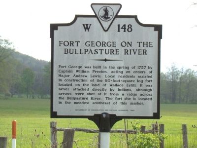
Fort George on the Bullpasture River
Erected 1985 by Department of Conservation and Historic Resources. (Marker Number W-148.)
Topics and series. This historical marker is listed in these topic lists: Colonial Era • Forts and Castles. In addition, it is included in the Virginia Department of Historic Resources (DHR) series list. A significant historical year for this entry is 1757.
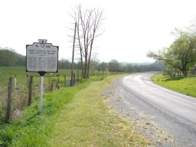
Location. 38° 16.212′ N, 79° 32.394′ W. Marker is near McDowell, Virginia, in Highland County. Marker is at the intersection of Bullpasture River Road (County Route 678) and County Route 612, on the left when traveling south on Bullpasture River Road. Marker is 5.9 miles south of US 250. Route 612 is posted for 4-wheel drive vehicles only. Touch for map. Marker is at or near this postal address: 6006 Bullpasture River Rd, Mc Dowell VA 24458, United States of America. Touch for directions.
Other nearby markers. At least 8 other markers are within 5 miles of this marker, measured as the crow flies. A Reconnaissance In Force (approx. 4.9 miles away); An Attack Repulsed (approx. 5 miles away); A Spectacular Show (approx. 5 miles away); The Guns of Cemetery Hill (approx. 5 miles away); McDowell Presbyterian Church (approx. 5.1 miles away); The Church and Cemetery (approx. 5.1 miles away); The Battle Rages (approx. 5.1 miles away); Battle of McDowell (approx. 5.1 miles away). Touch for a list and map of all markers in McDowell.
Credits. This page was last revised on July 7, 2021. It was originally submitted on May 8, 2010, by J. J. Prats of Powell, Ohio. This page has been viewed 1,106 times since then and 66 times this year. Photos: 1, 2, 3. submitted on May 8, 2010, by J. J. Prats of Powell, Ohio.


