Wichita in Sedgwick County, Kansas — The American Midwest (Upper Plains)
The Chisholm Trail
Photographed by William Fischer, Jr., November 12, 2011
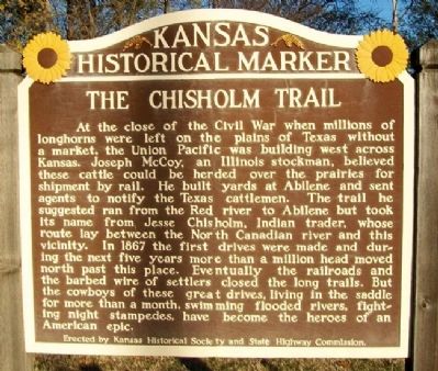
1. The Chisholm Trail Marker
At the close of the Civil War when millions of longhorns were left on the plains of Texas without a market, the Union Pacific was building west across Kansas. Joseph McCoy, an Illinois stockman, believed these cattle could be herded over the prairies for shipment by rail. He built yards at Abilene and sent agents to notify the Texas cattlemen. The trail he suggested ran from the Red river to Abilene but took its name from Jesse Chisholm, Indian trader, whose route lay between the North Canadian river and this vicinity. In 1867 the first drives were made and during the next five years more than a million head moved north past this place. Eventually the railroads and the barbed wire of settlers closed the long trails. But the cowboys of these great drives, living in the saddle for more than a month, swimming flooded rivers, fighting night stampedes, have become the heroes of an American epic.
Erected by Kansas Historical Society and State Highway Commission. (Marker Number 62.)
Topics and series. This historical marker is listed in these topic lists: Agriculture • Animals • Railroads & Streetcars •
this page online
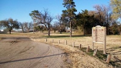
Location. Marker is missing. It was located near 37° 45.636′ N, 97° 20.172′ W. Marker was in Wichita, Kansas, in Sedgwick County. It was on Broadway 0.3 miles north of I-235 Exit 15, on the right when traveling north. The marker stands at a roadside pulloff. Touch for map. Marker was at or near this postal address: 4161 North Broadway, Wichita KS 67219, United States of America. Touch for directions.

Regionally, this marker was in the American Midwest, in the Corn Belt, on the prairies, and on the Southern Plains. Globally, it was in North America, the Western Hemisphere, the Western World, and the Anglosphere. Historically, it found itself in what was once the Louisiana Purchase.
Other nearby markers. At least 8 other markers are within 4 miles of this location, measured as the crow flies: A different marker also named Indian Treaties of 1865 (approx. 2.7 miles away); Bicentennial of the Birth of George Washington (approx. 3.6 miles away); Memorial '70 (approx. 3.6 miles away); a different
Photographed by William Fischer, Jr., November 12, 2011
2. The Chisholm Trail Marker
Another marker is no longer nearby. Indian Treaties of 1865 (was approx. 2.7 miles away but has been replaced with another marker now near it).
Also see . . .
1. Chisholm Trail in Kansapedia. (Submitted on November 15, 2012, by William Fischer, Jr. of Reynoldsburg, Ohio.)
2. Chisholm Trail in The Handbook of Texas Online. (Submitted on November 15, 2012, by William Fischer, Jr. of Reynoldsburg, Ohio.)

Photographed by Jeff Leichsenring, July 1, 2026
3. The Chisholm Trail Marker Site
Credits. This page was last revised on July 7, 2026. It was originally submitted on November 15, 2012, by William Fischer, Jr. of Reynoldsburg, Ohio. This page has been viewed 2,097 times since then and 201 times this year. Last updated on July 3, 2026, by Jeff Leichsenring of Garland, Texas. Photos: 1, 2. submitted on November 15, 2012, by William Fischer, Jr. of Reynoldsburg, Ohio. 3. submitted on July 3, 2026, by Jeff Leichsenring of Garland, Texas. • Devry Becker Jones was the editor who published this page.
