
Quaboag Plantation in West Brookfield in Worcester County, Massachusetts — The American Northeast (New England)
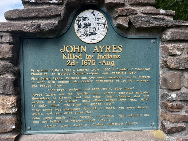
John Ayres
Killed by Indians
2d - 1675 - Aug.
Photographed by G.W.Bartlett, June 26, 2026
1. John Ayres Marker
By graunt of the Great & General Court, 1660 a founder of "Quaboag Plantation" an isolated frontier outpost, now Brookfield 1960.
First Sergt. Ayres, Prichard and Coy were massacred "on an affayre to meet with the Indians who declare themselves to be our enemyes and reduce them."
"Set upon, scalped and none left to bury them."
"Ayres Tavern was the 'fortified house' wherein tounefolk defended themselves as flaming roof and walls, from brimstone shot with arrows, balls of wildefire, carts aflame heaped with flax. Water to slake thirst, was spent to quench fires."
"The towne was abandoned for lack of shoos, noe more stockins, shurts, and corn cribs burnt flat."
John Ayres' family only, returned to rebuild. Many eighth-in-line sons are builders of America today. One is Fairfax Ayres, donor to, Quaboag Historical Society.
Erected by Quaboag Historical Society.
Topics and series. This memorial is listed in these topic lists: Colonial Era • Settlements & Settlers • Wars, US Indian. In addition, it is included in the King Philip's War 1675-1676 series list. A significant historical date for this entry is August 2, 1675.
Location. 42° 13.754′ N,
this page online

Regionally, this memorial is in the Quiet Corner and in Greater Worcester. It is also in the American Northeast and in New England. Globally, it is in North America, the Western Hemisphere, the Western World, and the Anglosphere. Historically, it finds itself in what was once one of the original Thirteen Colonies.
Other nearby markers. At least 8 other markers are within walking distance of this marker: The Fortified House (within shouting distance of this marker); Thomas and Mary Millett’s Home Site (about 700 feet away, measured in a direct line); First Burial Ground (approx. 0.2 miles away); Boston Post Road (approx. 0.2 miles away); George Whitefield (approx. ¼ mile away); Judge Jebediah Foster (approx. 0.3 miles away); Brookfield (approx.
Photographed by G.W.Bartlett, June 26, 2026
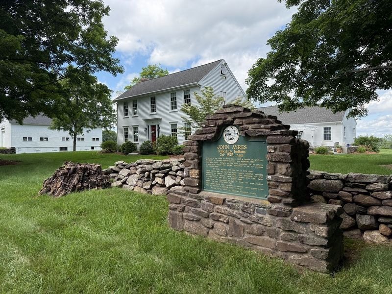
2. John Ayres Marker
View north to the farm house
Related marker. Click here for another marker that is related to this marker. Sergt. John Ayres, Corporal John Coye, and Sergt. Joseph Prichard were slain in the New Braintree Nipmuck ambush of colonial militia known as Wheeler's Surprise.
Also see . . . History of North Brookfield, pub. 1887 - Chapter III First Settlement, 1660-1676. This grant is dated May 31, 1660.
From the scanty records extant, it is believed that John Warner, John Ayres, Wm. Prichard, and perhaps one other (who doubtless were of the petitioners) came to Quabaug in the summer of 1660, for the purpose of selecting the place for the new settlement. The first care of explorers, at that time, in locating a town site, was to find "conveniency of home-lots, meadow lots, and planting fields." (Submitted on June 29, 2026, by G.W.Bartlett of Hingham, Massachusetts.)
Photographed by G.W.Bartlett, June 26, 2026
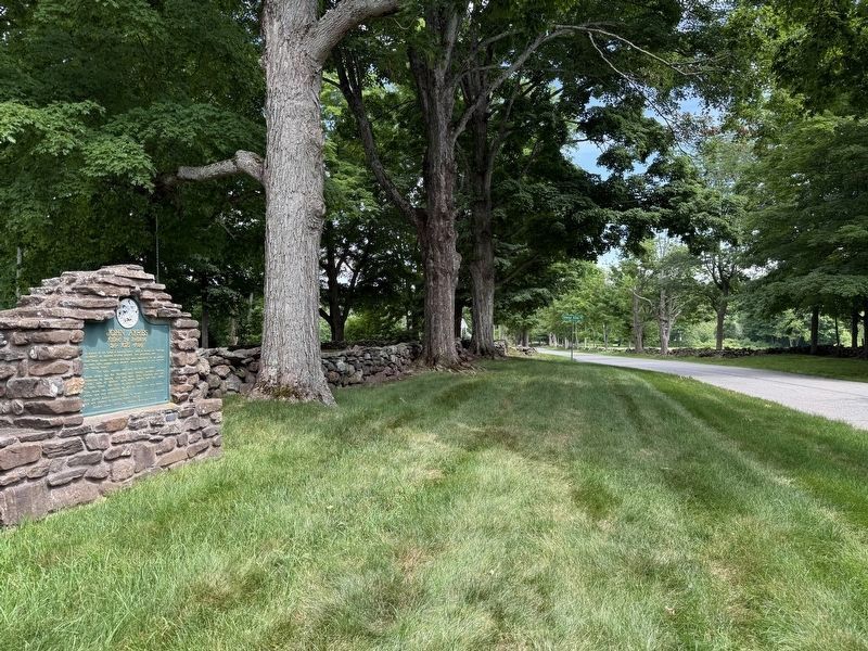
3. John Ayres Marker
View looking southeast along Foster Hill Road to George Allen Road street sign.
Credits. This page was last revised on July 6, 2026. It was originally submitted on June 27, 2026, by G.W.Bartlett of Hingham, Massachusetts. This page has been viewed 26 times since then. Last updated on July 3, 2026, by G.W.Bartlett of Hingham, Massachusetts. Photos: 1, 2, 3. submitted on June 27, 2026, by G.W.Bartlett of Hingham, Massachusetts. • Devry Becker Jones was the editor who published this page.
