The Inukshuk
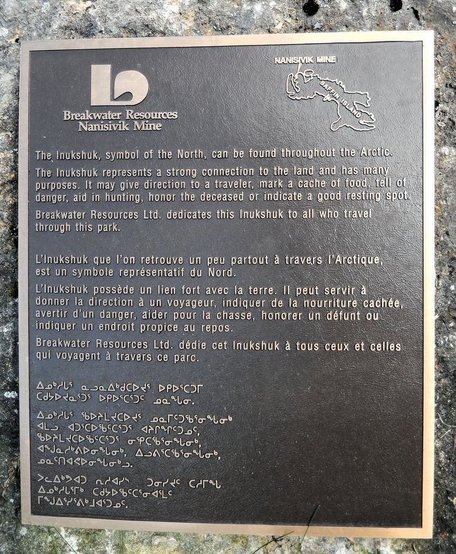

The Inukshuk represents a strong connection to the land and has many purposes. It may give direction to a traveler, mark a cache of food, tell of danger, aid in hunting, honor the deceased or indicate a good resting spot. Breakwater Resources Ltd. dedicates this Inukshuk to all who travel through this park.
L'Inukshuk possède un lien fort avec la terre. Il peut servir à donner la direction à un voyageur, indiquer de la nourriture cachée, avertir d'un danger, aider pour la chasse, honorer un défunt ou indiquer un endroit propice au repos.
Breakwater Resources Ltd. dédie cet Inukshuk à tous ceux et celles qui voyagent à travers ce parc.
Erected by Breakwater Resources, Ltd.
Topics. This historical marker is listed in these topic lists: Anthropology & Archaeology • Indigenous Peoples and Communities.
Location. 47° 27.14′ N, 79° 38.414′ W. Marker is in Temiskaming
this page online

Regionally, this marker is in Northeastern Ontario and specifically in Northern Ontario. It is also in Central Canada. Globally, it is in North America, the Great North Woods, the Western Hemisphere, the Western World, and the Anglosphere. Historically, it finds itself in what was once a British colony, the Viceroyalty of New France, the Haudenosaunee (Iroquois) Confederacy, and Rupert’s Land.
Other nearby markers. At least 8 other markers are within walking distance of this marker: Living Underground at Coober Pedy (a few steps from this marker); Calcite Breccia (within shouting distance of this marker); School of Mines and RockWalk Park / L'École des Mines et le Parc RockWalk (within shouting distance of this marker); William H. Wright Building Art Deco Sculpture

Also see . . . Inukshuk (Wikipedia).
Excerpt: A type of stone landmark or cairn built and used by Inuit, including Iñupiat, Kalaallit, Yupik, and other peoples of the North American Arctic. These structures are found in northern Canada, Greenland, and Alaska. This combined region, north of the Arctic Circle, is dominated by the tundra biome and has areas with few natural landmarks.(Submitted on July 4, 2026, by Cosmos Mariner of Cape Canaveral, Florida.)The inuksuk may historically have been used for navigation, as a point of reference, a marker for travel routes, fishing places, camps, hunting grounds, places of veneration, drift fences used in hunting, or to mark a food cache. The Iñupiat in northern Alaska used inuksuit to assist in the herding of caribou into contained areas for slaughter. Varying in shape
and size, the inuksuit have ancient roots in Inuit culture.Historically, the most common types of inuksuit are built with stone placed upon stone. The simplest type is a single stone positioned in an upright manner. The size of some inuksuit suggests that the construction was often a communal effort. At Inuksuk Point (Enukso Point) on Baffin Island, there are more than 100 inuksuit. The site was designated a National Historic Site of Canada in 1969.
Credits. This page was last revised on July 5, 2026. It was originally submitted on July 4, 2026, by Cosmos Mariner of Cape Canaveral, Florida. This page has been viewed 19 times since then. Photos: 1, 2. submitted on July 4, 2026, by Cosmos Mariner of Cape Canaveral, Florida.
