
Ottawa River
⎯⎯⎯
Rivière des Outaouais
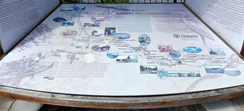

A bird's-eye-view of the Ottawa Valley illustrates its most important natural feature the Ottawa River. One of the great rivers on the continent and the second largest in eastern Canada, the Ottawa is approximately 1271 km long draining a watershed of 140,000 km2. Most of the Ottawa River lies within the Canadian Shield, a highland underlain by Precambrian bedrock spanning the continent. Its predominantly acidic, erosion-resistant substrate sustains vast forests essential to the production of the largest supply of fresh water in the world. From this expansive reservoir flow rivers of immense ecological and economic importance: the St Lawrence, the Saguenay, the Nelson, the Eastmain, the Churchill and the Ottawa.
The Ottawa River cradles the natural and cultural heart of western Quebec and eastern Ontario. Originally it nurtured plants and animals that recolonized vast regions of Canada following the end of continental glaciation 11,000 years ago. Then Canada's first Aboriginal peoples established themselves here some 9,000 years ago, followed by Europeans in pursuit of furs, timber and
this page online
Vue du ciel, la rivière des Outaouais est le principal élément naturel de la vallée du même nom. Cette splendide rivière, la deuxième plus grande dans l'est du Canada, possède un bassin hydrographique de 140 000 km2 et s'étend sur plus de 1 271 km, en majeure partie dans le Bouclier canadien. Le sous-sol de ce massif, constitué de roches précambriennes dont la plupart sont acides et résistantes à l'érosion, nourrit de vastes forêts essentielles à la constitution, du plus grand bassin d'eau douce au monde. Outre la rivière des Outaouais, y prennent leur source des cours d'eau extrêmement importants des points de vue écologique et économique soit le Saint-Laurent, le Saguenay, le Nelson, la Eastmain et le Churchill.
La rivière des Outaouais délimite le noyau naturel
Topics. This historical marker is listed in these topic lists: Exploration • Indigenous Peoples and Communities • Settlements & Settlers • Waterways & Vessels.
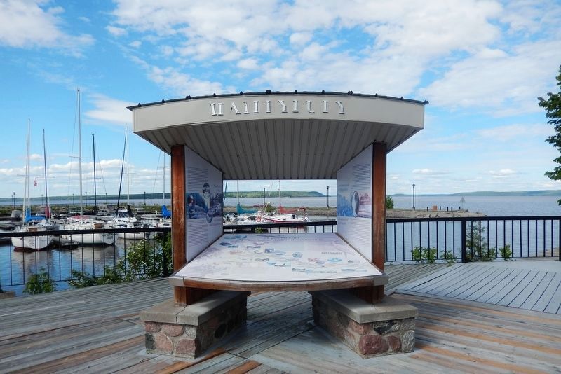
Location. 47° 26.928′ N, 79° 37.811′ W. Marker is in Temiskaming Shores, Ontario, in Timiskaming District. It is in Haileybury. It can be reached from the intersection of Farr Drive and Main Street, on the right when traveling north. The marker is in an interpretive kiosk at Haileybury Harbour Place. Touch for map. Marker is at or near this postal address: 451 Farr Drive, Temiskaming Shores ON P0J 1K0, Canada. Touch for directions.

Regionally, this marker is in Northeastern Ontario and specifically in Northern Ontario. It is also in Central Canada. Globally, it is in North America, the Great North Woods, the Western Hemisphere, the Western World, and the Anglosphere. Historically, it finds itself in what was once a British colony, the Viceroyalty of New France, the Haudenosaunee (Iroquois) Confederacy, and Rupert’s Land.
Other nearby markers. At least 8 other markers are within walking distance of this marker: Settlement and Conflagration / Colonisation et Destruction (here, next to this marker); The Haileybury Fire (within shouting distance of this marker); Haileybury Waterfront / Le Waterfront de Haileybury (about 90 meters away, measured in a direct line); Historic Winter Road (about 150 meters away); Charles Cobbold Farr (approx. 0.3 kilometers away); Court House / Le Palais de Justice (approx. 0.4 kilometers away); Haileybury World War I Cenotaph (approx. 0.4 kilometers away); The Convent / Le couvent (approx. 0.4 kilometers away). Touch for a list and map of all markers in Temiskaming Shores.
Also see . . . Ottawa River (Canadian Encyclopedia).
(by James H. Marsh & Nathan Baker) Excerpt: The Ottawa River watershed is the traditional territory of the Algonquin people, who trace their roots back to the first occupants of the land. Indigenous people have inhabited the region since roughly 6,500 BCE.(Submitted on July 5, 2026, by Cosmos Mariner of Cape Canaveral, Florida.)For First Nations, the Ottawa was the primary transportation route to the western interior. The Algonquin controlled the territory. They were semi-nomadic people who hunted, gathered, farmed, trapped and fished along the Ottawa River and its tributaries.
The French were the first known Europeans to have contact with the Algonquin people. This took place when the two peoples began trading around the turn of the 17th century at Tadoussac. In 1613, Samuel de Champlain travelled as far as Allumette Island on the Ottawa. In 1615, he travelled via the Ottawa, the Mattawa River and the French River to Georgian Bay. This became a major fur-trading route.
The Algonquin remained allies of the French until the Seven Years War (1755–63) and the British Conquest. In 1760, when Britain had won the battle for the North American colonies, the Algonquin signed a treaty of neutrality between the two European forces. The British did not keep their guarantee, made in the Royal Proclamation of 1763, to protect First Nations’ lands from appropriation by settlers. After the American Revolutionary War (1775–83), they responded to the influx of Loyalists in the colony by buying up land in individual sales with other nations. Some of these sales included Algonquin land, even though the Algonquin were consulted by neither party.
Log rafts descended the Ottawa even before it ceased to be the prime route of the fur trade. Philemon Wright showed that the route was feasible in 1806, and the British demand for pine grew. In 1854, the Reciprocity Treaty secured free access for Canadian lumber into the US market. The timber trade pervaded the social life of the valley. Armies of men lived in crude shanties during winter and descended on civilization with their rafts in spring.
Credits. This page was last revised on July 10, 2026. It was originally submitted on July 4, 2026, by Cosmos Mariner of Cape Canaveral, Florida. This page has been viewed 10 times since then. Photos: 1, 2. submitted on July 5, 2026, by Cosmos Mariner of Cape Canaveral, Florida.
