Cobalt in Timiskaming District, Ontario — Central Canada (North America)
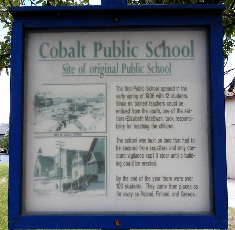
Cobalt Public School
Site of Original Public School
Photographed by Cosmos Mariner, June 2, 2022
1. Cobalt Public School Marker
The first Public School opened in the early spring of 1906 with 12 students. Since no trained teachers could be enticed from the south, one of the settlers — Elizabeth MacEwan, took responsibility for teaching the children.
The school was built on land that had to be secured from squatters and only constant vigilance kept it clear until a building could be erected.
By the end of the year there were over 100 students. They came from places as far away as Poland, Finland and Greece.
Topics. This historical marker is listed in these topic lists: Education • Immigration • Settlements & Settlers. A significant historical year for this entry is 1906.
Location. 47° 23.628′ N, 79° 41.212′ W. Marker is in Cobalt, Ontario, in Timiskaming District. It is on Cobalt Street just north of Miller Street, on the right when traveling north. Touch for map. Marker is in this post office area: Cobalt ON P0J 1C0, Canada. Touch for directions.

Regionally, this marker is in Northeastern Ontario and specifically in Northern Ontario. It is also in Central Canada. Globally, it is in North America, the Great North Woods, the Western
this page online
Other nearby markers. At least 8 other markers are within walking distance of this marker: Cobalt Street & Grandview Hill / La rue Cobalt et la côte Grandview (within shouting distance of this marker); The Cobalt Town Hall / L'hôtel-de-ville de Cobalt (about 180 meters away, measured in a direct line); Cobalt Mining Camp (about 180 meters away); Silver Mining in Canada / Production de L'argent au Canada (about 210 meters away); Willet Green Miller (about 210 meters away); Centennial Time Capsule (about 210 meters away); City of Cobalt Shaft / Le puits de mine de la Ville de Cobalt (about 210 meters away); Sinking Bucket (about 210 meters away). Touch for a list and map of all markers in Cobalt.
Also see . . .
1. Schools and Churches (Cobalt Historical Society).
Presents a 1910 photo of Cobalt’s first public school — a clapboard one-room schoolhouse.(Submitted on July 6, 2026, by Cosmos Mariner of Cape Canaveral, Florida.)
2. On the Silver Trail: Cobalt: Cradle of the Demon Metals, Birth of a Mining Superpower.

Photographed by Cosmos Mariner, June 2, 2022
2. Cobalt Public School Marker
Looking east from Cobalt Street.
Excerpt: …An often-cited example is that of Elizabeth MacEwan, a prospector’s wife and Cobalt’s first woman settler, who described in a memoir how she was treated with chivalrous respect and enjoyed teaching Sunday school in a tent…(Submitted on July 6, 2026, by Cosmos Mariner of Cape Canaveral, Florida.)

Photographed by Cosmos Mariner, June 2, 2022
3. Cobalt Public School Bell, 1907
The historical marker is visible in the right background, edge-on, beside the sidewalk.
Credits. This page was last revised on July 8, 2026. It was originally submitted on July 5, 2026, by Cosmos Mariner of Cape Canaveral, Florida. This page has been viewed 11 times since then. Photos: 1, 2, 3. submitted on July 6, 2026, by Cosmos Mariner of Cape Canaveral, Florida.
