Duffield in Scott County, Virginia — The American South (Mid-Atlantic)
Lost No Longer!
Natural Tunnel State Park
| — | Virginia State Parks, Department of Conservation and Recreation | — |
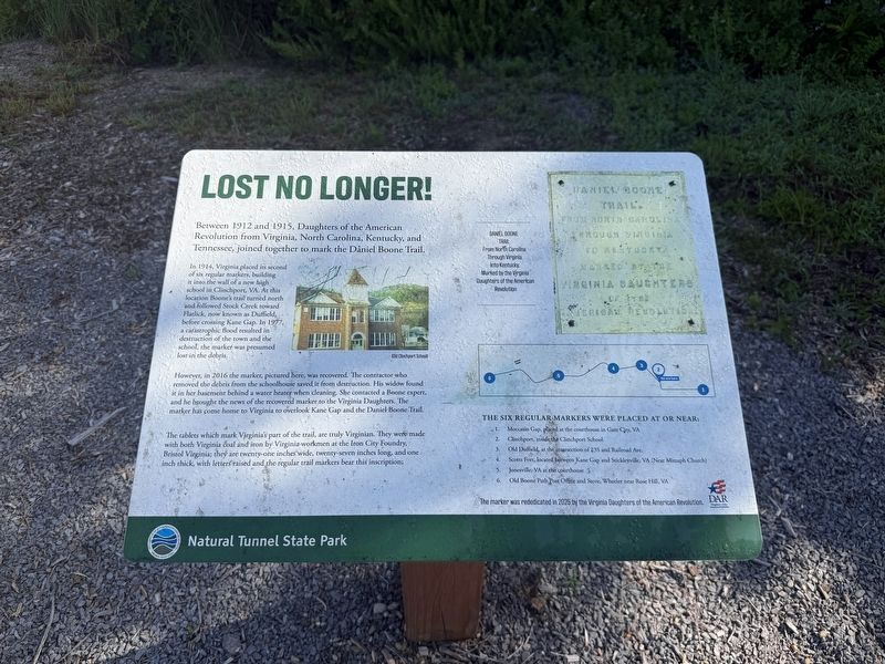
Between 1912 and 1915, Daughters of the American Revolution from Virginia, North Carolina, Kentucky, and Tennessee, joined together to mark the Daniel Boone Trail.
In 1914, Virginia placed its second of six regular markers, building it into the wall of a new high school in Clinchport, VA. At this location Boone's trail turned north and followed Stock Creek toward Flatlick, now known as Duffield, before crossing Kane Gap. In 1977, a catastrophic flood resulted in destruction of the town and the school, the was presumed lost in the debris.
However, in 2016 the marker, pictured here, was recovered. The contractor who removed the debris from the schoolhouse saved it from destruction. His widow found it in her basement behind a water heater when cleaning. She contacted a Boone expert, and he brought the news of the recovered marker to the Virginia Daughters. The marker has come home to Virginia to overlook Kane Gap and the Daniel Boone Trail.
The tablets which mark Virginia's part of the trail, are truly Virginian. They were made with both Virginia coal and iron by Virginia workmen at the Iron City Foundry, Bristol
this page online
Daniel Boone
Trail
From North Carolina
through Virginia
into Kentucky.
Marked by the Virginia
Daughters of the American
Revolution
The six regular markers werep laced at or near:
1. Moccasin Gap, placed at the coutrhouse in Gate City, VA
2. Clinchport, inside the Clinchport School
3. Old Duffield, at the intersection of 23S and Railroad Ave.
4. Scotts Fort, located between Kane Gap and Stickleyville, VA (Near Mitzaph Church)
5. Jonesville, VA at the courthouse
6. Old Boone Path Post Office and Store, Wheeler near Rose Hill, VA
The marker was rededicated in 2025 by the Virginia Daughters of the American Revolution.
Erected 2025 by Virginia State Parks, Department of Conservation and Recreation.
Topics. This historical marker is listed in these topic lists: Communications • Fraternal or Sororal Organizations • Roads & Vehicles • Women. A significant historical year for this entry is 1912.
Location. 36° 42.836′ N, 82° 48.351′ W. Marker
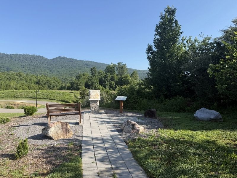

Regionally, this marker is in the Tri-Cities Area and in Southwest Virginia. It is also in the American South, specifically in the Upper South, in Appalachia, and specifically in Southern Appalachia. Globally, it is in North America, the Western Hemisphere, the Western World, and the Anglosphere. Historically, it finds itself in what was once the original Cherokee Nation, the territory of the Mississippian Culture, one of the original Thirteen Colonies, one of the Confederate States of America, and the Antebellum South.
Other nearby markers. At least 8 other markers are within 4 miles of this marker, measured as the crow flies: Daniel Boone Trail (here, next to this marker); The Crooked Road / Duffield (approx. ¾ mile away); a different marker also named Daniel Boone Trail (approx. ¾ mile away); Carter’s Fort (approx. 3 miles away); a different marker also named Carter’s Fort (approx. 3.2 miles away); Lee County / Scott County (approx. 3.3 miles away); The Natural Tunnel Route (approx. 3½ miles away); Scott County / Lee County (approx. 3.9 miles away). Touch for a list and map of all markers in Duffield.
Credits. This page was last revised on July 7, 2026. It was originally submitted on July 7, 2026, by Devry Becker Jones of Washington, District of Columbia. This page has been viewed 18 times since then. Photos: 1, 2. submitted on July 7, 2026, by Devry Becker Jones of Washington, District of Columbia.
