De Cocksdorp in Texel, North Holland, Netherlands — Northwestern Europe
Vuurtoren
⎯⎯⎯
Lighthouse
Photographed by Andrew Ruppenstein, June 1, 2026
1. Vuurtoren / Lighthouse Marker

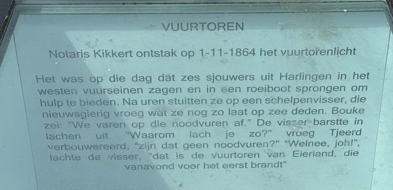
Notaris Kikkert ontstak op 1-11-1864 het vuurtorenlicht
Het was op die dag dat zes sjouwers uit Harlingen in het westen vuurseinen zagen en in een roeiboot sprongen om hulp te bieden. Na uren stuitten ze op een schelpenvisser, die nieuwsgierig vroeg wat ze nog zo laat op zee deden. Bouke zei: "We varen op die noodvuren af." De visser barstte in lachen uit. "Waarom lach je zo?" vroeg Tjeerd verbouwereerd, "zijn dat geen noodvuren?" "Welnee, joh!", lachte de visser, "dat is de vuurtoren van Eierland, die vanavond voor het eerst brandt"
Lighthouse
Notary Kikkert lit the lighthouse beam on November 1, 1864.
It was on that day that six laborers from Harlingen spotted distress signals to the west and jumped into a rowboat to offer assistance. After several hours, they came across a shell fisherman, who curiously asked what they were doing out at sea so late. Bouke said, "We're heading toward those distress signals." The fisherman burst out laughing. "Why are you laughing?" Tjeerd asked, bewildered. "Aren't those distress signals?" "Not at all, mate!" the fisherman
this page online
Erected 2016.
Topics and series. This historical marker is listed in these topic lists: Man-Made Features • Waterways & Vessels. In addition, it is included in the Lighthouses series list. A significant historical date for this entry is November 1, 1864.
Location. 53° 9.302′ N, 4° 52.211′ E. Marker is in De Cocksdorp, Noord-Holland (North Holland), in Texel. It is at the intersection of Kikkertstraat and Klimpstraat, on the right when traveling east on Kikkertstraat. Touch for map. Marker is at or near this postal address: 2 Kikkertstraat, De Cocksdorp, Noord-Holland 1795 AD, Netherlands. Touch for directions.

Regionally, this marker is on the German Wadden Sea. Globally, it is in Europe, the European Union, Atlantic Europe, the Benelux Low Countries, the Schengen Area, Western Europe, and the Western World. Historically, it finds itself in what was once the Holy Roman Empire.
Other nearby markers. At least 8 other markers are within walking distance of this marker: De Cocksdorp (within shouting distance of this marker); De Niuewe Aanleg
Photographed by Andrew Ruppenstein, June 1, 2026
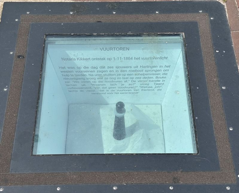
2. Vuurtoren / Lighthouse Marker - wide view
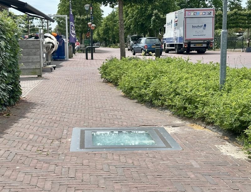
This is one of four subterranean historical markers set into the sidewalk on the south side of Kikkertstraat.
Also see . . . Eierland Lighthouse (Wikipedia). Excerpt:
The Eierland Lighthouse is a lighthouse on the northernmost tip of the Dutch island of Texel. It is named for the former island Eierland.(Submitted on July 9, 2026.)
The lighthouse was designed by Quirinus Harder and construction began on 25 July 1863. The lighthouse was built on top of a 20-metre high sand dune, and was lit on 1 November 1864. At that time, the distance from the lighthouse to the sea was 3 kilometres.
Initially the lighthouse had a kerosene lamp. The current (electrical) lamp is a 2000 watt Philips fluorescent lamp, producing 2.85 million candela,and the light is focused with a number of Fresnel lenses. It has two automatically engaged spare lamps.Photographed by Andrew Ruppenstein, June 1, 20263. Vuurtoren / Lighthouse Marker - wider view
The lighthouse was originally red, but in the course of time that colour faded to pink. In 1977 the tower was covered with a red plastic coating. Since 1982 the lighthouse is a Rijksmonument.
Photographed by Andrew Ruppenstein, June 1, 2026
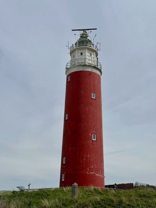
4. Vuurtoren / Lighthouse
The lighthouse is about 1500 meters north of the marker. Harlingen, the origin of the would be rescuers, is approximately 25 km to the east, across the Waddenzee.

L. Bakker, courtesy Noord-Hollands Archief, circa 1910
5. Eierland Texel Lighthouse
The lighthouse as seen here is somewhat taller and skinnier than in the previous photo, as repairs to the damage done to it during the Georgian Uprising of WWII caused the tower to be shortened and covered with an exterior shell.
Credits. This page was last revised on July 10, 2026. It was originally submitted on July 9, 2026, by Andrew Ruppenstein of Lamorinda, California. This page has been viewed 19 times since then. Photos: 1, 2, 3, 4, 5. submitted on July 9, 2026, by Andrew Ruppenstein of Lamorinda, California.
