Tazewell in Tazewell County, Virginia — The American South (Mid-Atlantic)
Fort Witten
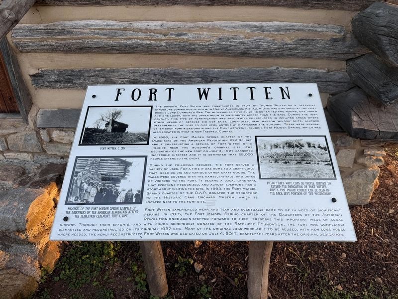
The original Fort Witten was constructed in 1774 by Thomas Witten as a defensive structure during hostilities with Native Americans. A small militia was stationed at the fort during Lord Dunmore’s War. The blockhouse style building contained two rooms, one upper and one lower, with the upper room being slightly larger than the base. During the 18th century, this type of fortification was frequently constructed in isolated areas where other means of defense did not exist. Loopholes, very narrow window slits, allowed defenders in the fort to fire upon anyone who attacked the building. There were several other such fortifications along the Clinch River, including Fort Maiden Spring, which was also located in what is now Tazewell County.
In 1926, the Fort Maiden Spring chapter of the Daughters of the American Revolution (D.A.R.) set about constructing a replica of Fort Witten on a hillside near the building's original site. The dedication of the new fort on July 4, 1927 garnered incredible interest and it is estimated that 25,000 people attended the event.
During the following decades, the fort served a variety of
this page online
Fort Witten experienced wear and tear and eventually came to be in need of significant repairs. In 2015, the Fort Maiden Spring chapter of the Daughters of the American Revolution once again stepped forward to help preserve this important piece of local history. Through their efforts, and with funds generously donated by the Ratcliffe Foundation, the fort was completely dismantled and reconstructed on its original 1927 site. Many of the original logs were able to be reused, with new logs added where needed. The newly reconstructed Fort Witten was dedicated on July 4, 2017, exactly 90 years after the original dedication.
[Captions:]
Fort Witten, c 1927.
Members of the Fort Maiden Spring Chapter

Fields filled with cars as people arrived to attend the dedication of Fort Witten, July 4, 1927. Pisgah Church can be seen in theback left portion of the photograph.
Topics. This historical marker is listed in these topic lists: Colonial Era • Forts and Castles • Settlements & Settlers • Wars, US Indian. A significant historical date for this entry is July 4, 1927.
Location. 37° 7.164′ N, 81° 34.422′ W. Marker is in Tazewell, Virginia, in Tazewell County. It is on Crab Orchard Road (Business U.S. 19/460) south of Trail of the Lonesome Pine (U.S. 19/460), on the right when traveling south. Touch for map. Marker is at or near this postal address: 3665 Crab Orchard Rd, Tazewell VA 24651, United States of America. Touch for directions.

Regionally, this marker is in Southwest Virginia. It is also in the American South, specifically in the Upper South, in Appalachia, and specifically in Southern Appalachia. Globally, it is in North America, the Western Hemisphere, the Western World, and the Anglosphere. Historically, it finds itself in what was once the territory of the Mississippian Culture, one of the original Thirteen Colonies, one of the Confederate States of America, and the Antebellum South.
Other nearby markers. At least 8 other markers are within 3 miles of this marker, measured as the crow flies: 250th Anniversary of the United States of America (here, next to this marker); Big Crab Orchard or Witten’s Fort (a few steps from this marker); Fincastle Turnpike (within shouting distance of this marker); Thomas Whitten (about 300 feet away, measured in a direct line); Pisgah United Methodist Church (about 600 feet away); Indian-Settler Conflicts (approx. 1.7 miles away); Tazewell (approx. 2.7 miles away); Roark’s Gap Incident (approx. 2.7 miles away). Touch for a list and map of all markers in Tazewell.
Other markers no longer nearby. Big Crab Orchard Or Witten’s Fort (was a few steps from this marker but has been replaced with another marker now near it); a different marker also named Pisgah United Methodist Church (was about 600 feet away but has been replaced with another marker now near it).
Credits. This page was last revised on July 9, 2026. It was originally submitted on July 9, 2026, by Devry Becker Jones of Washington, District of Columbia. This page has been viewed 11 times since then. Photos: 1, 2. submitted on July 9, 2026, by Devry Becker Jones of Washington, District of Columbia.
