Florence in Lauderdale County, Alabama — The American South (East South Central)
Byler Road Begins
⎯⎯⎯
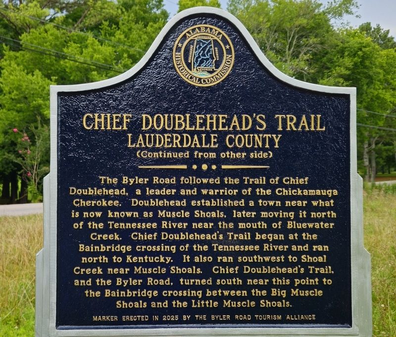
Chief Doublehead’s Trail
Lauderdale County

Photographed by David Curott, July 9, 2026
1. Byler Road Begins Marker
On December 16, 1819, two days after Alabama became a state, the Alabama state legislature authorized construction of the Byler Road. Captain John Byler supervised the construction of the road, built between 1820-1823. The Byler Road began here, crossing Shoal Creek on a bridge built on three limestone pillars, which still stand in the creek. The road ran by the Wilderness Inn to Bainbridge Ferry, and then further on, following county lines. The Byler Road brought travelers into northwest and west Alabama and allowed cotton to be transported south to Tuscaloosa.
Reverse Side
The Byler Road followed the Trail of Chief Doublehead, a leader and warrior of the Chickamauga Cherokee. Doublehead established a town near what is now known as Muscle Shoals, later moving it north of the Tennessee River near the mouth of Bluewater Creek. Chief Doublehead's Trail began at the Bainbridge crossing of the Tennessee River and ran north to Kentucky. It also ran southwest to Shoal Creek near Muscle Shoals. Chief Doublehead's Trail, and the Byler Road, turned south near this point to the Bainbridge crossing between the Big Muscle Shoals
this page online
Erected 2025 by Byler Road Tourism Alliance and Alabama Historical Commission.
Topics. This historical marker is listed in these topic lists: Indigenous Peoples and Communities • Roads & Vehicles. A significant historical date for this entry is December 16, 1819.
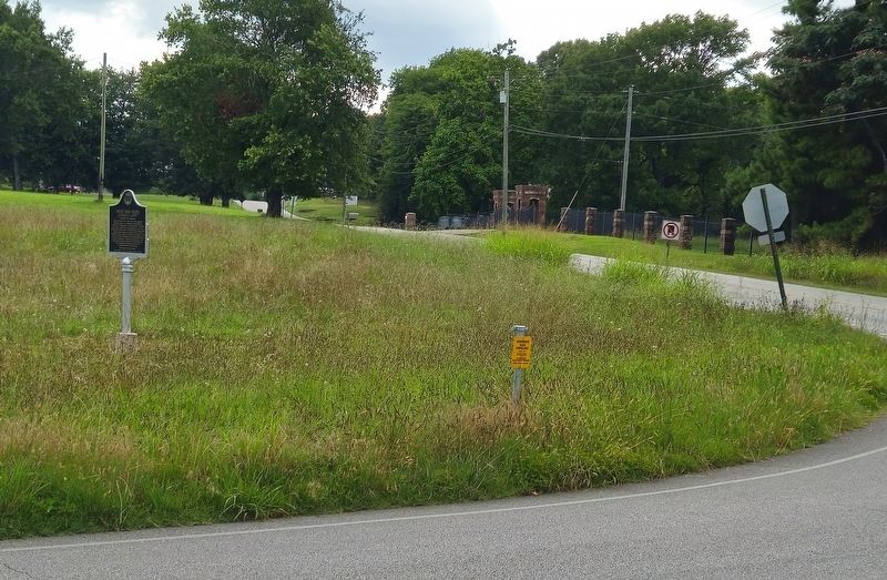
Location. 34° 52.386′ N, 87° 36.258′ W. Marker is in Florence, Alabama, in Lauderdale County. It is at the intersection of Church Street (County Road 30) and Church Road and Bailey Spring Road, on the right when traveling east on Church Street. Touch for map. Marker is at or near this postal address: 4185 Co Rd 30, Florence AL 35634, United States of America. Touch for directions.

Regionally, this marker is in North Alabama and in the Shoals. It is also in the American South, specifically in the Deep South, in Appalachia, and specifically in Southern Appalachia. Globally, it is in North America, a Gulf of Mexico state, the Western Hemisphere, the Western World, and the Anglosphere. Historically, it finds itself in what was once the territory of the Mississippian Culture, one of the Confederate States of America, and the Antebellum South.
Photographed by David Curott, July 9, 2026
2. Chief Doublehead's Trail
Lauderdale County
Other nearby markers. At least 8 other markers are within 4 miles of this marker, measured as the crow flies: St. Florian Historic District (approx. 1.1 miles away); Tate Springs Estate Early 1800’s (approx. 1.2 miles away); St. Michael's Catholic Church (approx. 1.2 miles away); Wilson Family Cemetery 19th Century / Slave Cemetery 19th Century (approx. 2.1 miles away); Shoals Creek Preserve Tract (approx. 2.4 miles away); Andrew Jackson's Military Road (approx. 3.1 miles away); Deibert Park (approx. 3.3 miles away); Larimore Home (approx. 3.6 miles away). Touch for a list and map of all markers in Florence.
Photographed by David Curott, July 9, 2026
3. marker in field
Credits. This page was last revised on July 13, 2026. It was originally submitted on July 9, 2026, by David Curott of Florence, Alabama. This page has been viewed 60 times since then. Photos: 1, 2, 3. submitted on July 9, 2026, by David Curott of Florence, Alabama. • James Hulse was the editor who published this page.
