
Cedar Lake in Lake County, Indiana — The American Midwest (Great Lakes)
Cedar Lake Has Always Been an Oasis For People
Early Inhabitants at Cedar Lake
Water provides necessities for life and respite
| — | 1600 - 1840 | — |
Photographed by Lou Donkle, June 17, 2026
1. Cedar Lake Has Always Been an Oasis For People Marker
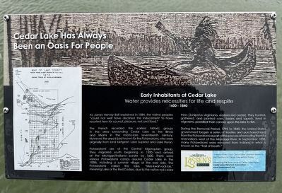
As James Hervey Ball explained in 1884, the native peoples "could not well have declined the inducement to have resorted here for council, pleasure, rest and food."
The French recorded the earliest historic groups in the area surrounding Cedar Lake as the Illinois and Miami in the mid-to-late seventeenth century. However, the area is best known for the Potawatomi, who were originally from land between Lake Superior and Lake Huron.
Potawatomi are of the Central Algonquian group. They migrated south beginning in 1500 and arrived at the Michigan/Indiana border by 1600. There were various Potawatomi camps around Cedar Lake in the 1830s, including a summer village at the east side. The Potawatomi called the lake, "Mes-kwah-ock-bis," meaning Lake of the Red Cedars, due to the native red cedar trees (Juniperus virginiana, eastern red cedar). They hunted, gathered, and planted corn, beans and squash, lived in wigwams, paddled their canoes upon the lake to fish.
During the Removal Period, 1795 to 1840, the United States government began a series of treaties and purchased land from the Potawatomi as part of the process of
this page online
The Museum at Lassen's Resort on Cedar Lake
To learn more and experience a steam boat trip across Cedar Lake, visit The Story of Cedar Lake exhibit today!
Presenting the Relevance of Cedar Lake History - Cedar Lake Historical Association - www.lassensresort.org
[Captions:]
Map of Lake County taken from a map drawn by H.S. Ball - 1873
Indian Trails by Beulah Brannon - 1966
Trails on Map:
• Sauk • Cedar Lake • Pottawotomie • Calumet Beach • Tolleston Beach • Calumet River • Lake Shore • Dunes • Lake Prairie
Erected by Cedar Lake Historical Association.
Topics. This historical marker is listed in these topic lists: Exploration • Indigenous Peoples and Communities • Parks & Recreational Areas. A significant historical year for this entry is 1600.
Location. 41° 22.09′ N, 87° 25.56′ W. Marker is in Cedar Lake, Indiana, in Lake County. It can be reached from Constitution Avenue north of East Lakeshore Drive, on the right when traveling west. The marker
Photographed by Lou Donkle, June 17, 2026
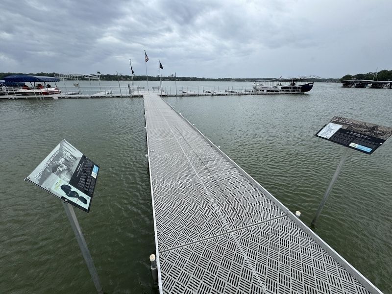
2. Marker located half-way out on pier

Regionally, this marker is in Northwest Indiana and in the Calumet Region. It is also in the American Midwest and in the Corn Belt. Globally, it is in North America, on the Great Lakes, in the Western Hemisphere, in the Western World, and in the Anglosphere. Historically, it finds itself in what was once the territory of the Mississippian Culture and also the Northwest Territory.
Other nearby markers. At least 8 other markers are within 5 miles of this marker, measured as the crow flies: A Quick Trip Across the Lake to Your Resort (here, next to this marker); Carnegie Center 1908 (approx. 4.6 miles away); Old Sheriff's House & Jail (approx. 4.6 miles away); Lake County Sheriff's House and Jail 1882 (approx. 4.6 miles away); Cheshire Hall (approx. 4.6 miles away); Crown Point World War II Veterans Memorial (approx. 4.6 miles away); The Old Bank (approx. 4.7 miles away); Crown Theatre (approx. 4.7 miles away).
Credits. This page was last revised on July 11, 2026. It was originally submitted on July 11, 2026, by Lou Donkle of Valparaiso, Indiana. This page has been viewed 13 times since then. Photos: 1, 2. submitted on July 11, 2026, by Lou Donkle of Valparaiso, Indiana. • Devry Becker Jones was the editor who published this page.
