Boykins in Southampton County, Virginia — The American South (Mid-Atlantic)
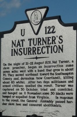
Nat Turner's Insurrection
Photographed by Richard E. Miller, September 27, 2009
1. Nat Turner's Insurrection Marker
On the night of 21-22 August 1831, Nat Turner, a slave preacher, began an insurrection some seven miles west with a band that grew to about 70. They moved northeast toward the Southampton County seat, Jerusalem (now Courtland), killing about 60 Whites. After two days militiamen and armed civilians quelled the revolt. Turner was captured on 30 October, tried and convicted, and hanged 11 November; some 30 blacks were hanged or expelled from Virginia. In response to the revolt, the General Assembly passed harsher slave laws and censored abolitionists.
Erected 1991 by Virginia Department of Historic Resources. (Marker Number U-122.)
Topics and series. This historical marker is listed in these topic lists: Abolition & Underground RR • African Americans • Law Enforcement • Religion & Religious Structures. In addition, it is included in the Virginia Department of Historic Resources (DHR) series list. A significant historical date for this entry is August 21, 1831.
Location. This marker has been replaced by another marker nearby. It was located near 36° 37.143′ N, 77° 11.336′ W. Marker was in Boykins, Virginia, in Southampton County. It was on Maherrin Road (Virginia Route 35) south of Cross Keys Road, on the right when traveling south. Marker was south of Courtland and the Southampton Parkway (US Highway 58) and north of the town of Boykins near the North Carolina border. Touch for map. Marker was in this post office area: Boykins VA 23827, United States of America. Touch for directions.

Regionally, this marker was in Coastal Virginia and in the Hampton Roads Metropolitan Area. It was also in the American South, specifically in the Upper South, and in the Tidewater. Globally, it was in North America, the Western Hemisphere, the Western World, and the Anglosphere. Historically, it found itself
this page online
Other nearby markers. At least 8 other markers are within 7 miles of this location, measured as the crow flies: A different marker also named Nat Turner's Insurrection (here, next to this marker); Dr. J.M. Bland (approx. 1.9 miles away); Thomaston (approx. 5½ miles away); a different marker also named "Thomaston" (approx. 5½ miles away); Nottoway Indian History (approx. 6.1 miles away); From Barter… To Buffer… (approx. 6.1 miles away); 1705 Nottoway Reservation (approx. 6.1 miles away); Dred Scott And The Blow Family (approx. 6.7 miles away). Touch for a list and map of all markers in Boykins.
Another marker is no longer nearby. Blackhead Signpost Road (was approx. 6.1 miles away but has been confirmed missing).
Related markers. Click here for a list of markers that are related to this marker. These are other markers that pertain to the Nat Turner rebellion.
Also see . . .
1. PBS' Africans in America: Nat Turner. (Submitted on September 28, 2009, by Richard E. Miller of Oxon Hill, Maryland.)
2. Nat Turner's Slave Rebellion.
Photographed by Richard E. Miller, September 27, 2009
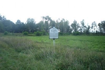
2. Nat Turner's Insurrection Marker
view looking south.
3. “Nat Turner” (song). Written by Joe DeFilippo and performed by the R.J. Phillips Band. (Submitted on August 5, 2019.)
Additional keywords. Southampton Insurrection; slave resistance; rebellion.
Photographed by Richard E. Miller, September 27, 2009
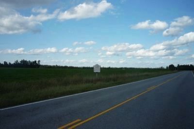
3. Meherrin Road (VA 35) and the Nat Turner's Insurrection Marker
view looking north toward Cross Keys Road.

Via Wikipedia Commons
4. "The Discovery of Nat Turner"
Wood engraving illustrating Benjamin Phipps's capture of Nat Turner (1800-1831) on October 30, 1831. The original print is in the Bettman Archive and was reproduced for Wikipedia from the Encyclopedia Virginia.
Click for more information.
Click for more information.
Credits. This page was last revised on August 28, 2026. It was originally submitted on September 28, 2009, by Richard E. Miller of Oxon Hill, Maryland. This page has been viewed 15,275 times since then and 402 times this year. Last updated on July 11, 2026, by Jaclyn Bruner of College Park, Maryland. Photos: 1, 2, 3, 4. submitted on September 28, 2009, by Richard E. Miller of Oxon Hill, Maryland. • Bernard Fisher was the editor who published this page.
