
Cross Plains in Callahan County, Texas — The American South (West South Central)
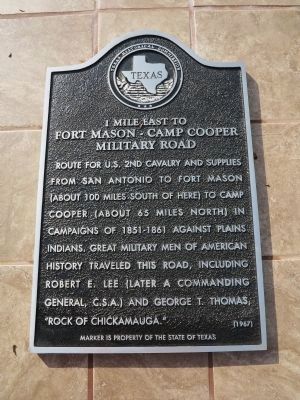
Fort Mason-Camp Cooper Military Road
Photographed by Richard Denney
1. Fort Mason-Camp Cooper Military Road Marker
Fort Mason-Camp Cooper
Military Road
Erected 1967 by Texas Historical Commission. (Marker Number 1995.)
Topics. This historical marker is listed in these topic lists: Forts and Castles • Roads & Vehicles • Wars, US Indian.
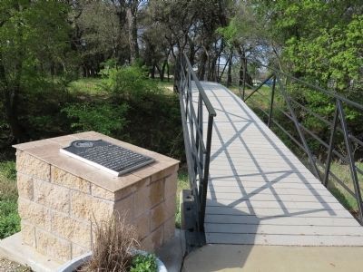
Location. 32° 7.276′ N, 99° 10.582′ W. Marker is in Cross Plains, Texas, in Callahan County. It is on Southwest Fifth Street (State Highway 36) 0.2 miles west of South Comal Street. Marker is located in Treadaway Park at the north foot of the pedestrian bridge over Turkey Creek. Touch for map. Marker is in this post office area: Cross Plains TX 76443, United States of America. Touch for directions.

Regionally, this marker is in Big Country. Globally, it is in North
this page online
Other nearby markers. At least 8 other markers are within 10 miles of this marker, measured as the crow flies: Home of Robert E. Howard (approx. ¼ mile away); Cross Plains Cemetery (approx. 0.4 miles away); Pioneer Cemetery War Memorial (approx. 5.7 miles away); Pioneer Cemetery (approx. 5.7 miles away); Old Cottonwood Cemetery (approx. 5.8 miles away); Site of Cottonwood Springs (approx. 6.1 miles away); Cottonwood Bank and Post Office (approx. 6.1 miles away); Atwell Cemetery (approx. 9.8 miles away). Touch for a list and map of all markers in Cross Plains.
Another marker is no longer nearby. Fort Mason-Camp Cooper Military Road (was about 300 feet away, measured in a direct line but has been replaced with another marker now near it).
Related marker. Click here for another marker that is related to this marker. This marker has replaced the linked marker.
Photographed by Richard Denney
2. Fort Mason-Camp Cooper Military Road Marker
Photographed by Duane Hall, December 25, 2014
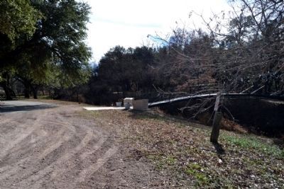
3. Pedestrian Bridge Over Turkey Creek
Credits. This page was last revised on July 13, 2026. It was originally submitted on May 1, 2014. This page has been viewed 989 times since then and 27 times this year. Last updated on July 11, 2026. Photos: 1, 2. submitted on April 30, 2014, by Richard Denney of Austin, Texas. 3. submitted on December 26, 2014, by Duane Hall of Abilene, Texas. • Devry Becker Jones was the editor who published this page.
