
Mound Township near Luverne in Rock County, Minnesota — The American Midwest (Upper Plains)
Prairie Passage
⎯⎯⎯
Tallgrass Prairie
⎯⎯⎯
Prairie Passage Route
March 14, 2026
1. Prairie Passage side of marker
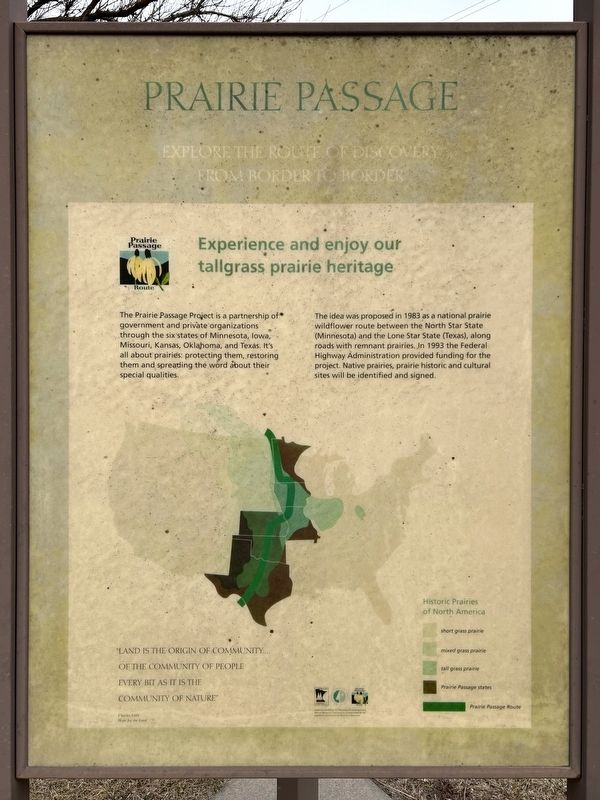
Prairie Passage
Explore the Route of Discovery from Border to Border
Prairie Passage Route
Experience and enjoy our tallgrass prairie heritage
The Prairie Passage Project is a partnership of government and private organizations through the six states of Minnesota, Iowa, Missouri, Kansas, Oklahoma, and Texas. It's all about prairies: protecting them, restoring them and spreading the word about their special qualities.
The idea was proposed in 1983 as a national prairie wildflower route between the North Star State (Minnesota) and the Lone Star State (Texas), along roads with remnant prairies. In 1993 the Federal Highway Administration provided funding for the project. Native prairies, prairie historic and cultural sites will be identified and signed.
"Land is the origin of community... of the community of people every bit as it is the community of nature"
Charles Little
Hope for the Land
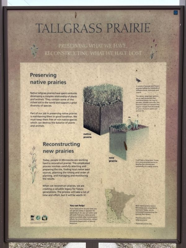
Tallgrass Prairie
Preserving What We Have, Reconstructing What We Have Lost
Preserving native prairies
Native tallgrass prairies have spent centuries developing a complex relationship of plants and animals.
this page online
Part of our job in preserving native prairies is maintaining them in good condition. We must keep them free of non-native species which can destroy the balance of plants and animals.
A variety of grasses and flowers provide habitat for hundreds of different birds, mammals and insects.
The dense, deep root systems are so well protected that individual plants can live for decades, possibly centuries. This beautiful dark soil contains the organic richness from thousands of years of prairie plant and animal life.
native prairie
new prairie
It will take a long time, if ever, for a reconstructed prairie to develop the richness and complexity of a native prairie.
Reconstructing new prairies
Today, people in Minnesota are working hard to reconstruct prairies. This complicated process involves carefully selecting and preparing the site, finding local native seed sources, planning the timing and order of planting, and managing and monitoring the results.
When we reconstruct prairies, we are creating a valuable legacy for future
March 14, 2026
2. Tallgrass Prairie side of marker
You can help!
If you have prairie on your land, you can get tax credits or payment for preserving it. Or, you can collect and sell seeds from your native prairie plants to promote other reconstruction efforts. For more information, contact Minnesota Department of Natural Resources.
Most native prairie land in Minnesota was converted to farmland. Today, we are committed to protecting the prairies that remain.
Prairie Passage Route of Minnesota
Discover the stories of the prairies in Minnesota
Prairie Passage Route
Wallace C. Dayton · Old Mill State Park · Marshall County Museum · Pankratz Memorial Prairie · Glacial Ridge Project · Pembina Trail · Tympanuchus · Chicog · Agassiz Dunes · Twin Valley Prairie · Blazing Star Prairie · Buffalo River State Park · MSUM Regional Science Center · Bluestem Prairie · Headwaters of the Red River of the North · Prairie Wetlands Learning Center · Ottertail Prairie · Seven Sisters Prairie · Verlyn Marth Prairie · Glacial Lakes State Park · Ordway Prairie · Plover Prairie · Chippewa Prairie · Upper Sioux Agency State Park · Birch Coulee Battlefield · Lower Sioux Agency Historic Site · Camden State Park · Hole-in-the-Mountain Prairie · Wilder Museum · Prairie Coteau · Sod House at Sandborn · Jeffers Petroglyphs · Pipestone National Monument · Wolf Lake · Blue Mounds State Park · Des Moines River · Big Island State Park · Shooting Star Wildflower Route
for more information contact:
Prairie Passage Coordinator
Minnesota Dept. of Transportation
M.S. 620
395 John Ireland Blvd.
St. Paul, MN 55155
(651) 284-3765
Animals

March 14, 2026
3. Prairie Passage Route side of marker
Plants of the tallgrass prairie
Erected by the Minnesota Environment and Natural Resources Trust Fund as recommended by the Legislative Commission on Natural Resources.
Topics. This historical marker is listed in these topic lists: Environment • Roads & Vehicles. A significant historical year for this entry is 1983.
Location. 43° 41.646′ N, 96° 12.779′ W. Marker is near Luverne, Minnesota, in Rock County. It is in Mound Township. It is on U.S. 75 0.4 miles north of 141st Street, on the right when traveling south. Located by the Wayside Chapel. Touch for map. Marker is in this post office area: Luverne MN 56156, United States of America. Touch for directions.

Regionally, this marker is in Southwest Minnesota. It is also in the American Midwest, in the Corn Belt, and on the Great Plains. Globally, it is in North America, the Western Hemisphere, the Western World, and the Anglosphere. Historically, it finds itself in what was once Rupert’s Land, the territory of the Mississippian Culture, and the Louisiana Purchase.
Other nearby markers. At least 8 other markers are within 15 miles of this
March 14, 2026
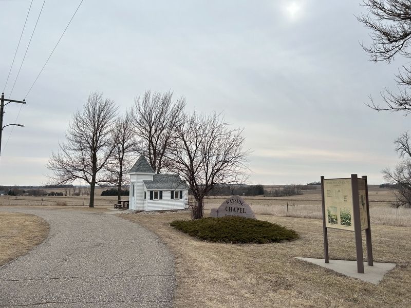
4. Prairie Passage / Tallgrass Prairie / Prairie Passage Route Marker
March 14, 2026
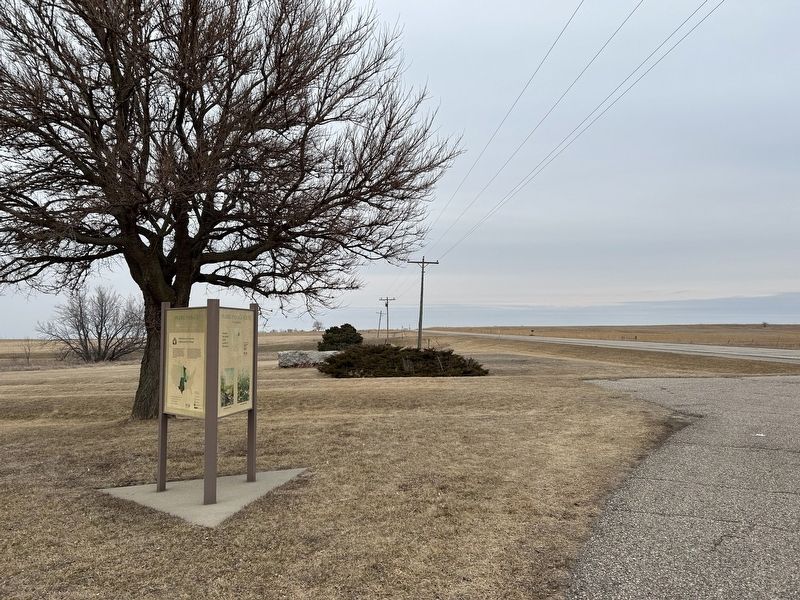
5. Prairie Passage / Tallgrass Prairie / Prairie Passage Route Marker
Credits. This page was last revised on July 12, 2026. It was originally submitted on July 12, 2026. This page has been viewed 13 times since then. Photos: 1, 2, 3, 4, 5. submitted on July 12, 2026.
