
Glenridge in St. Catharines in Niagara Region, Ontario — Central Canada (North America)
Weather Station: Stormy Weather
Photographed by Kevin Westell, July 12, 2026
1. Weather Station: Stormy Weather - Marker
Niagara Region
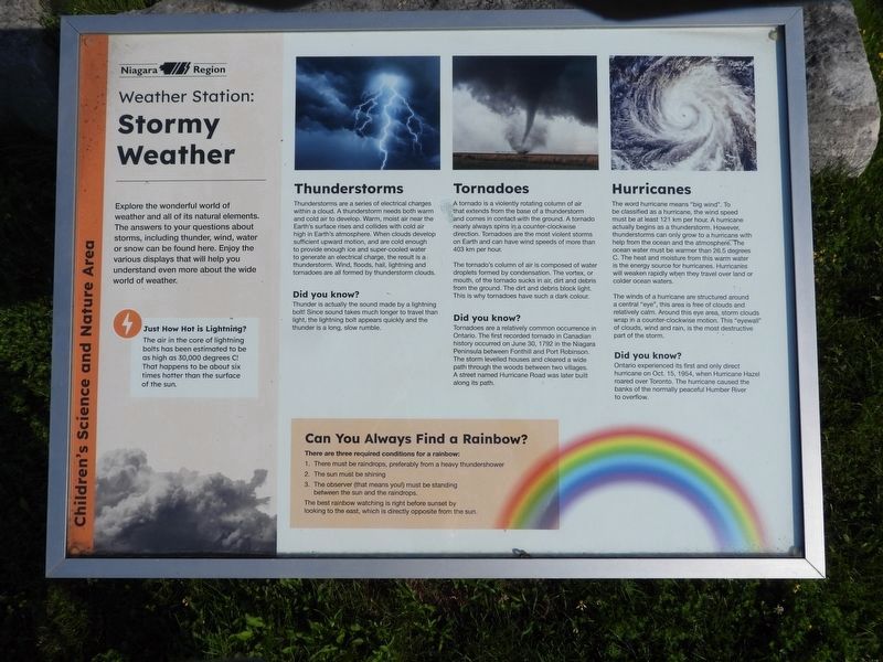
Weather Station: Stormy Weather
Explore the wonderful world of weather and all of its natural elements. The answers to your questions about storms, including thunder, wind, water or snow can be found here. Enjoy the various displays that will help you understand even more about the wide world of weather.
Just How Hot is Lightning? The air in the core of lightning bolts has been estimated to be as high as 30,000 degrees C! That happens to be about six times hotter than the surface of the sun.
Thunderstorms: Thunderstorms are a series of electrical changes within a cloud. A thunderstorm needs both warm and cold air to develop. Warm, moist air near the Earth's surface rises and collides with cold air high in Earth's atmosphere. When clouds develop sufficient upward motion, and are cold enough to provide enough ice and super-cooled water to generate an electrical charge, the result is a thunderstorm. Wind, floods, hail, lightning and tornadoes are all formed by thunderstorm clouds.
Did you know? Thunder is actually the sound made
this page online
Tornadoes: A tornado is a violently rotating column of air that extends from the base of a thunderstorm and comes in contact with the ground. A tornado nearly always spins in a counter-clockwise direction. Tornadoes are the most violent storms on Earth and can have wind speeds of more than 403 km per hour.
The tornado's column of air is composed of water droplets formed by condensation. The vortex, or mouth, of the tornado sucks in air, dirt and debris from the ground. The dirt and debris block light. This is why tornadoes have such a dark colour.
Did you know? Tornadoes are a relatively common occurrence in Ontario. The first recorded tornado in Canadian history occurred on June 30, 1792 in the Niagara Peninsula between Fonthill and Port Robinson. The storm levelled houses and cleared a wide path through the woods between two villages. A street named Hurricane Road was later built along its path.
Hurricanes: The word hurricane means "big wind".

Photographed by Kevin Westell, July 12, 2026
2. The "Weather Station", within the Children's Science and Nature Area
Photo faces south-west from the "Earth Tunnels" area. The "Weather Station" has 4 educational panels.
The winds of a hurricane are structured around a central "eye", this area is free of clouds and relatively calm. Around this eye area, storm clouds wrap in a counter-clockwise motion. This "eyewall" of clouds, wind and rain, is the most destructive part of the storm.
Did you know? Ontario experienced its first and only direct hurricane on Oct 15, 1964, when Hurricane Hazel roared over Toronto. The hurricane caused the banks of the normally peaceful Humber River to overflow.
Can You Always Find a Rainbow? There are three required conditions for a rainbow:
1. There must be raindrops, preferably from a heavy thundershower
2. The sun must be shining
3. The observer
Photographed by Kevin Westell, July 12, 2026
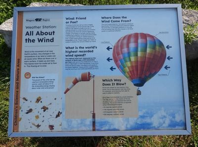
3. Weather Station: educational panel about wind
The best rainbow watching is right before sunset by looking to the east, which is directly opposite from the sun.
Erected by Niagara Region.
Topics. This historical marker is listed in these topic lists: Environment • Parks & Recreational Areas. A significant historical year for this entry is 1792.
Location. 43° 7.31′ N, 79° 14.359′ W. Marker is in St. Catharines, Ontario, in Niagara Region. It is in Glenridge. It can be reached from Sir Isaac Brock Way, on the right when traveling west. The marker is within the Glenridge Quarry Naturalization Site, 200 metres walk north of parking, within the Children's Science and Nature Area. Touch for map. Marker is at or near this postal address: 1860 Sir Isaac Brock Way, St Catharines ON L2T 1W2, Canada. Touch for directions.

Regionally, this marker is on Ontario’s Golden Horseshoe and in Niagara Canada. It is also in Central Canada. Globally, it is in North America, on the Great Lakes, in the Western Hemisphere, in the Western World, and in the Anglosphere. Historically, it finds itself in

Photographed by Kevin Westell, July 12, 2026
4. Weather Station - educational panel about sun and clouds
Other nearby markers. At least 8 other markers are within walking distance of this marker: A Brief History of Time (within shouting distance of this marker); Renewable Energy: Solar and Wind Power (within shouting distance of this marker); The Solar System (within shouting distance of this marker); Renewable Energy: Water Power (within shouting distance of this marker); Summit Overlook (approx. 0.2 kilometers away); History of the Site - Use as a Quarry and a Landfill (approx. 0.3 kilometers away); Land Acknowledgement (approx. 0.3 kilometers away); History of the Niagara Escarpment (approx. 0.3 kilometers away). Touch for a list and map of all markers in St. Catharines.
Photographed by Kevin Westell, July 12, 2026
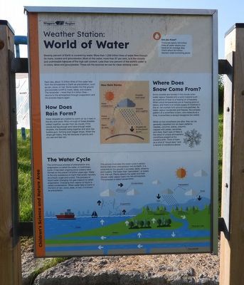
5. Weather Station - marker about water
Credits. This page was last revised on July 13, 2026. It was originally submitted on July 13, 2026, by Kevin Westell of St. Catharines, Ontario. This page has been viewed 9 times since then. Photos: 1, 2, 3, 4, 5. submitted on July 13, 2026, by Kevin Westell of St. Catharines, Ontario.
