Caledon Village in Peel Region, Ontario — Central Canada (North America)
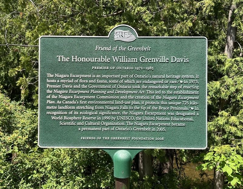
The Honourable William Grenville Davis
Premier of Ontario 1971-1985
| — | Friends of the Greenbelt | — |
Photographed by Tim Boyd, July 12, 2026
1. The Honourable William Grenville Davis Marker
Erected 2008 by Friends of the Greenbelt Foundation.
Topics. This historical marker is listed in these topic lists: Charity & Public Work • Environment • Natural Features. A significant historical year for this entry is 1973.
Location. 43° 48.229′ N, 79° 59.581′ W. Marker
this page online

Regionally, this marker is in Greater Toronto, specifically on the Golden Horseshoe, and in the Toronto Metropolitan Area. It is also in Central Canada. Globally, it is in North America, on the Great Lakes, in the Western Hemisphere, in the Western World, and in the Anglosphere. Historically, it finds itself in what was once a British colony, the Viceroyalty of New France, the Haudenosaunee (Iroquois) Confederacy, and Rupert’s Land.
Other nearby markers. At least 8 other markers are within 10 kilometers of this marker, measured as the crow flies: Rockside (approx. 6.3 kilometers away); The Founding of Erin (approx. 6.8 kilometers away); Erin Cenotaph (approx. 6.8 kilometers away); Mill History in Erin Village (approx. 6.8 kilometers away); Future Past 2412 (approx. 6.8 kilometers away); Stanley Park Gates and Arch (approx.

Photographed by Tim Boyd, July 12, 2026
2. The Honourable William Grenville Davis Marker
Also see . . . Ontario’s Greenbelt. The Canadian Encyclopedia website entry:
The roots of the Greenbelt go back to the 1960s and 1970s, as awareness for environmental protection was increasing. A milestone in the Greenbelt’s creation happened in 1973 when the Niagara Escarpment Planning and Development Act was implemented to ensure that any development on the Niagara Escarpment would be compatible with the natural environment. Other turning points occurred in 1990 when the Escarpment was designated a UNESCO World Biosphere Reserve, and in 2001, when 190,000 hectares of the Oak Ridges Moraine, a natural heritage system vital to providing clean water for Ontarians, were also protected by law.(Submitted on July 13, 2026, by Tim Boyd of Hamilton, Ontario.)
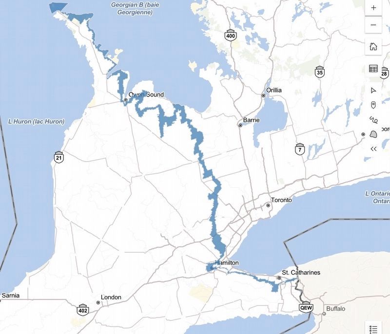
3. The Niagara Escarpment Plan boundary
Source: Government of Ontario (used under open government licence)

4. The Honourable William G. Davis, official portrait
The Legislative Assembly of Ontario (used under open government licence)
Credits. This page was last revised on August 7, 2026. It was originally submitted on July 13, 2026, by Tim Boyd of Hamilton, Ontario. This page has been viewed 11 times since then. Photos: 1, 2, 3, 4. submitted on July 13, 2026, by Tim Boyd of Hamilton, Ontario. • Andrew Ruppenstein was the editor who published this page.
