Cambridge in Lamoille County, Vermont — The American Northeast (New England)
Grand Army of the Republic Highway
Photographed by Dennis Gilkenson, July 10, 2026
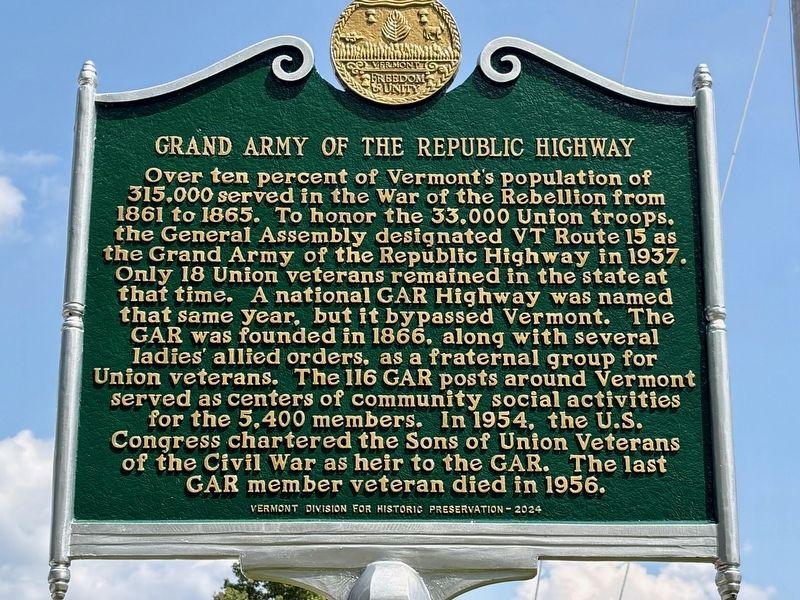
1. Grand Army of the Republic Highway Marker
Over ten percent of Vermont's population of 315,000 served in the War of the Rebellion from 1861 to 1865. To honor the 33,000 Union troops, the General Assembly designated VT Route 15 as the Grand Army of the Republic Highway in 1937. Only 18 Union veterans remained in the state at that time. A national GAR Highway was named that same year, but it bypassed Vermont. The GAR was founded in 1866, along with several ladies' allied orders, as a fraternal group for Union veterans. The 116 GAR posts around Vermont served as centers of community social activities for the 5,400 members. In 1954, the U.S. Congress chartered the Sons of Union Veterans of the Civil War as heir to the GAR. The last GAR member veteran died in 1956.
Erected 2024 by Vermont Division for Historic Preservation.
Topics. This historical marker is listed in these topic lists: Fraternal or Sororal Organizations • Roads & Vehicles • War, US Civil. A significant historical year for this entry is 1937.
Location. 44° 38.697′ N, 72° 52.602′ W. Marker is in Cambridge, Vermont, in Lamoille County. It is at the intersection of South Main Street (Vermont
this page online

Regionally, this marker is in Vermont’s Green Mountains. It is also in the American Northeast and in New England. Globally, it is in North America, the Great North Woods, the Western Hemisphere, the Western World, and the Anglosphere. Historically, it finds itself in what was once the Vermont Republic.
Other nearby markers. At least 8 other markers are within 9 miles of this marker, measured as the crow flies: G.A.R. Cambridge, VT (within shouting distance of this marker); Cambridge-Jeffersonville Veterans Monument (approx. 2.3 miles away); Cambridge Junction Bridge (approx. 3.1 miles away); Cambridge Rail Era History I (approx. 3.1 miles away); Cambridge Rail Era History II (approx. 3.1 miles away); Udney Hay (approx. 5.1 miles away); Mount Mansfield Natural Area (approx. 8½ miles away); 10th Mountain Division World War II Memorial Highway (approx. 8.9 miles away). Touch for a list and map of all markers in Cambridge.
Also see . . . Vermont Route 15 (Wikipedia).

Photographed by Dennis Gilkenson, July 10, 2026
2. Grand Army of the Republic Highway Marker
Vermont Route 15 is known as the Grand Army of the Republic Highway,[1] a designation shared nationally with U.S. Route 6.(Submitted on July 15, 2026, by Michael Herrick of Southbury, Connecticut.)
Credits. This page was last revised on July 15, 2026. It was originally submitted on July 14, 2026, by Dennis Gilkenson of Saxtons River, Vermont. This page has been viewed 16 times since then. Photos: 1, 2. submitted on July 14, 2026, by Dennis Gilkenson of Saxtons River, Vermont. • Bernard Fisher was the editor who published this page.
