Near Manassas in Prince William County, Virginia — The American South (Mid-Atlantic)
Wilmer McLean's Yorkshire
From Front Lawn to Front Parlor
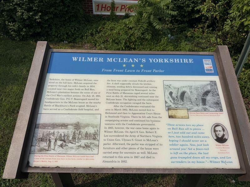
Yorkshire, the home of Wilmer McLean, once stood on the hill here. McLean acquired the property through his wife's family in 1854. Located near two major fords on Bull Run, McLean's plantation became the scene of one of the Civil War's earliest actions. On July 18, 1861, Confederate Gen. P.G.T. Beauregard moved his headquarters to the McLean house as the nearby Battle of Blackburn's Ford erupted. McLean's barn served as a Confederate field hospital, and the farm was under constant Federal artillery fire. A shell supposedly struck the kitchen chimney, sending debris downward and ruining a meal being prepared for Beauregard. As the First Battle of Manassas raged several miles west on July 21, skirmishing continued near the McLean home. The fighting and the subsequent Confederate occupation ravaged the farm.
After the Confederates evacuated the area in March 1862, McLean moved first to Richmond and then to Appomattox Court House in Southside Virginia. There he felt safe from the campaigning armies and continued his business ventures with the Confederate government. In 1865, however, the war came home again to Wilmer McLean.
this page online
"These armies tore my place on Bull Run all to pieces … so I just sold out and came here, two hundred miles away, hoping I should naver see a soldier again. Now, just look around you! Not a fence-rail is lefton the place, the last guns trampled down all my crops, and Lee surrenders in my house." — Wilmer McLean
[Captions:]
During the First Battle of Manassas, Wilmer McLean would have had a view of the terrain from near here on his farm, similar to this scene. Harper's Weekly, Aug. 3, 1861
McLean Barn Ruins and Cornerstone (inset) Courtesy Manassas National Battlefield Park
Wilmer McLean Courtesy Manassas National Battlefield Park
Erected by Virginia Civil War Trails.
Topics and series. This historical marker is listed in this topic list: War, US Civil. In addition, it is included in the Virginia Civil War Trails
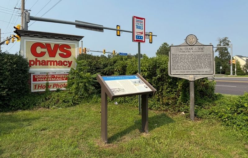
Location. 38° 47.588′ N, 77° 26.871′ W. Marker is near Manassas, Virginia, in Prince William County. It is at the intersection of Centreville Road (Route 28) and Yorkshire Lane, on the left when traveling north on Centreville Road. Touch for map. Marker is at or near this postal address: 7492 Centreville Rd, Manassas VA 20111, United States of America. Touch for directions.

Regionally, this marker is in the Washington Metropolitan Area, in Northern Virginia, and in the Piedmont. It is also in the American South, specifically in the Upper South, in the Mid-Atlantic, and on the Eastern Seaboard. Globally, it is in the North Atlantic Region, North America, the Western Hemisphere, the Western World, and the Anglosphere. Historically, it finds itself in what was once the territory of the Mississippian Culture, one of the original Thirteen Colonies, one of the Confederate States of America, and the Antebellum South.
Other nearby markers. At least 8 other markers are within one mile of this marker, measured as the crow flies: McLean Farm (a few steps from this marker); Wilmer McLean after the Civil War (about 300 feet away, measured in a direct line); Mitchell's Ford (approx. 0.6 miles away); Blackburn's Ford (approx. 0.7 miles away); a different marker also named Blackburn’s Ford (approx. 0.7 miles away); Veterans Memorial (approx. one mile away); The Naylor Family (approx. 1.1 miles away); Union Mills Historic Site (approx. 1.1 miles away). Touch for a list and map of all markers in Manassas.
Other markers no longer nearby. Wilmer McLean’s Yorkshire (was here, next to this marker but has been replaced with another marker now near it); a different marker also named Blackburn’s Ford (was approx. 0.7 miles away but has been replaced with another marker now near it).
Related marker. Click here for another marker that is related to this marker. This marker has replaced the linked marker.
Credits. This page was last revised on July 14, 2026. It was originally submitted on July 14, 2026, by Devry Becker Jones of Washington, District of Columbia. This page has been viewed 30 times since then. Photos: 1, 2. submitted on July 14, 2026, by Devry Becker Jones of Washington, District of Columbia.
