Bristol in Bristol County, Rhode Island — The American Northeast (New England)
Silver Creek Salt Marsh
Restoring Tidal Flow to a Degraded Marsh
| — | East Bay Bike Path | — |
Photographed by G.W.Bartlett, July 13, 2026
1. Silver Creek Salt Marsh Marker
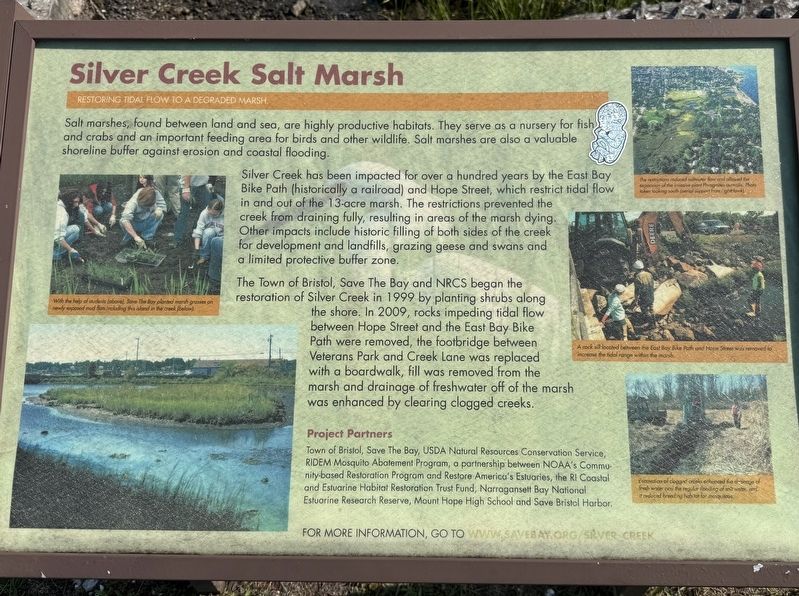
Salt marshes, found between land and sea, are highly productive habitats. They serve as a nursery for fish and crabs and an important feeding area for birds and other wildlife. Salt marshes are also a valuable shoreline buffer against erosion and coastal flooding.
Silver Creek has been impacted for over a hundred years by the East Bay Bike Path (historically a railroad) and Hope Street, which restrict tidal flow in and out of the 13-acre marsh. The restrictions prevented the creek from draining fully, resulting in areas of the marsh dying. Other impacts include historic filling of both sides of the creek for development and landfills, grazing geese and swans and a limited protective buffer zone.
The Town of Bristol, Save The Bay and NRCS began the restoration of Silver Creek in 1999 by planting shrubs along the shore. In 2009, rocks impeding tidal flow between Hope Street and the East Bay Bike Path were removed, the footbridge between Veterans Park and Creek Lane was replaced with a boardwalk, fill was removed from the marsh and drainage of freshwater off of the marsh was enhanced by clearing clogged creeks.
this page online
Project Partners
Town of Bristol, Save The Bay, USDA Natural Resources Conservation Service, RIDEM Mosquito Abatement Program, a partnership between NOAA's Community-based Restoration Program and Restore America's Estuaries, the RI Coastal and Estuarine Habitat Restoration Trust Fund, Narragansett Bay National Estuarine Research Reserve, Mount Hope High School and Save Bristol Harbor.
[Captions:]
— With the help of students(above), Save The Bay planted marsh grass on newly exposed mud flats including this island in the creek.
— The restrictions reduced saltwater flow and allowed the expansion of the invasive plant Phragmites australis. Photo taken looking south (arial support from LightHawk)
— A rock sill located between the East Bay Bike Path and Hope Street was removed to increase the tidal range within the marsh.
— Excavation of clogged creeks enhanced the drainage of fresh water and the regular loading of salt water, andit reduced breeding habitat for mosquitos.
Erected by Town of Bristol.
Topics. This historical marker is listed in these topic lists: Bridges & Viaducts • Environment
Photographed by G.W.Bartlett, July 13, 2026
2. Silver Creek Salt Marsh Marker
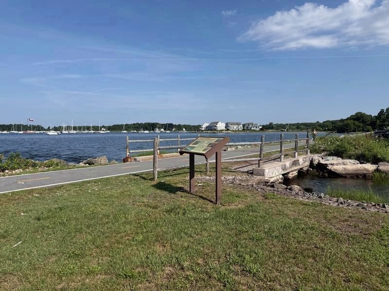
The East Bay Bike Path bridge crosses Silver Creek just behind the marker.
Location. 41° 40.621′ N, 71° 16.742′ W. Marker is in Bristol, Rhode Island, in Bristol County. It is on Hope Street (Rhode Island Route 114) just north of Washington Street, on the right when traveling south. Located next to the East Bay Bike Path bridge over Silver Creek. Touch for map. Marker is in this post office area: Bristol RI 02809, United States of America. Touch for directions.

Regionally, this marker is in Greater Providence and on Narragansett Bay. It is also in the American Northeast, in New England, and on the Eastern Seaboard. Globally, it is in the North Atlantic Region, North America, the Western Hemisphere, the Western World, and the Anglosphere. Historically, it finds itself in what was once one of the original Thirteen Colonies.
Other nearby markers. At least 8 other markers are within walking distance of this marker: Environmental Resiliency in Bristol (about 400 feet away, measured in a direct line); Memorial to Bristol Naval Veterans (approx. 0.2 miles away); General Lafayette (approx. 0.2 miles away); Liberty Tree Memorial
Photographed by G.W.Bartlett, July 13, 2026
3. Silver Creek Salt Marsh Marker
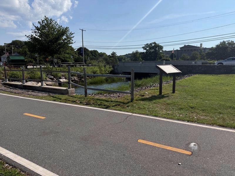
The East Bay Bike Path is in the foreground. Hope Street (Route 114) is in the background.
Also see . . . Save the Bay. (Submitted on July 23, 2026.)
Photographed by G.W.Bartlett, July 13, 2026
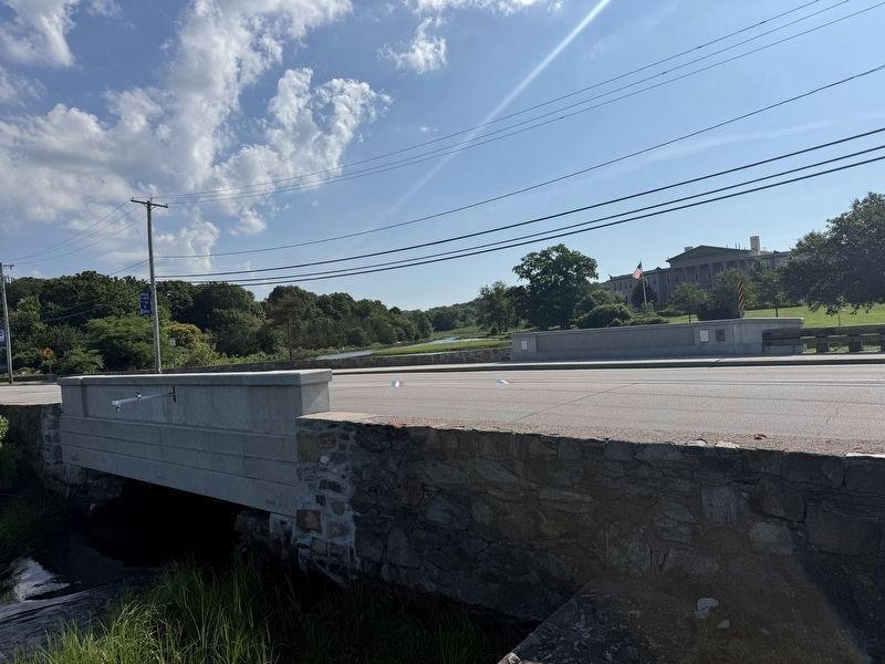
4. Silver Creek Bridge #153

Photographed by G.W.Bartlett, July 13, 2026
5. Silver Creek Salt Marsh
Credits. This page was last revised on September 24, 2026. It was originally submitted on July 16, 2026, by G.W.Bartlett of Hingham, Massachusetts. This page has been viewed 21 times since then. Photos: 1, 2, 3, 4, 5. submitted on July 16, 2026, by G.W.Bartlett of Hingham, Massachusetts. • Michael Herrick was the editor who published this page.
