Oella in Baltimore County, Maryland — The American Northeast (Mid-Atlantic)
The Banneker Rain Garden
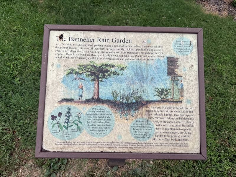
Rain falls onto the Museum roof, parking lot and other hard surfaces where it cannot soak into the ground. Instead, rain runs off these hard surfaces quickly, picking up pollution and eroding away soil. Gullies form, trails wash out and valuable soil from Banneker’s property washes into Cooper’s Branch, the Patapsco River and finally the Chesapeake Bay. Plants and animals living in and along these waterways suffer from the excess soil and pollution after rain storms.
The Park and Museum installed this rain garden to reduce storm water runoff and cereate valuable habitat. Two downspouts carry rainwater, falling on the Museum's roof, to the garden where it slowly soaks into the ground. Beautiful, easy-to-maintain native plants grow in our garden providing habitat for important wildlife like butterfiles, birds and bees.
[Sidebars:]
Rain Gardens =
• less water pollution
• less soil erosion
• clean groundwater
• native habitat
Did you know? Family stories tell how Benjamin Banneker's mother was a local herbalist who used native plants to treat her family and neighbors when they were sick. Look for some of these native medicinal plants in our rain garden.
Swamp Milkweed • Great Blue Lobelia • White Turtlehead
How can you create native habitat and control storm water damage in your yard to protect local waterways and the Chesapeake Bay?
Erected by Maryland
this page online
Topics. This historical marker is listed in these topic lists: African Americans • Horticulture & Forestry • Science & Medicine • Women.
Location. 39° 16.129′ N, 76° 46.507′ W. Marker is in Oella, Maryland, in Baltimore County. It can be reached from Oella Avenue north of Old Frederick Road, on the left when traveling north. Touch for map. Marker is at or near this postal address: 213 Oella Ave, Catonsville MD 21228, United States of America. Touch for directions.

Regionally, this marker is in the Baltimore Metro Region and in Central Maryland. It is also in the American Mid-Atlantic, in the Chesapeake Bay Region, and on the Eastern Seaboard. Globally, it is in the North Atlantic Region, North America, the Western Hemisphere, the Western World, and the Anglosphere. Historically, it finds itself in what was once one of the original

Other nearby markers. At least 8 other markers are within walking distance of this marker: 20th Anniversary (within shouting distance of this marker); Banneker's Cabin (within shouting distance of this marker); Benjamin Banneker (within shouting distance of this marker); Robert Bannaky (about 400 feet away, measured in a direct line); Banneker's Orchard (about 700 feet away); The Stone Farmhouse (about 700 feet away); a different marker also named Benjamin Banneker (approx. half a mile away); Edges of Earth's Crust Collided Here (approx. 0.9 miles away). Touch for a list and map of all markers in Oella.
Additional commentary.
1. About the marker
This sign has been included in the database because of the information about Benjamin Banneker's mother.
— Submitted July 18, 2026, by Devry Becker Jones of Washington, District of Columbia.
Credits. This page was last revised on July 18, 2026. It was originally submitted on July 18, 2026, by Devry Becker Jones of Washington, District of Columbia. This page has been viewed 11 times since then. Photos: 1, 2. submitted on July 18, 2026, by Devry Becker Jones of Washington, District of Columbia.
