Mount Evelyn in Yarra Ranges Shire, Victoria, Australia — Oceania
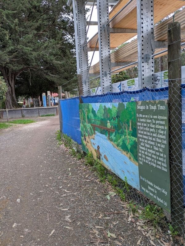
Swaggies in Tough Times
| — | The Timeline Community Arts Project | — |

Photographed by Dean Barton-Ancliffe, June 18, 2026
1. Swaggies in Tough Times Marker
Painted by Pembroke Secondary College Sponsored by Kuranga Native Nursery and Paperbark Café
Erected by Mt Evelyn Township Improvement Committee.
Topics. This historical marker is listed in these topic lists: Colonial Era • Parks & Recreational Areas • Settlements & Settlers. A significant historical year for this entry is 1890.
Location. 37° 47.158′ S, 145° 22.772′ E. Marker is in Mount Evelyn, Victoria, in Yarra Ranges Shire. It is on Wray Crescent 0.1 kilometers north of York Road (Victoria Route C402). Touch for map. Marker is at or near this postal address: 26 York Road, Mount Evelyn VIC 3796, Australia. Touch for directions.

Regionally,
this page online
Other nearby markers. At least 8 other markers are within walking distance of this marker: The First Train (here, next to this marker); The Berry Farm (here, next to this marker); Peace after War (a few steps from this marker); Bullock Teams and Timber (a few steps from this marker); Scouts 80 Years in Mt Evelyn (a few steps from this marker); The Wurrundjeri (a few steps from this marker); The Aqueduct from Silvan (within shouting distance of this marker); The Army Camp (within shouting distance of this marker). Touch for a list and map of all markers in Mount Evelyn.
Also see . . . The History and Traditions of the Australian Swagman. Bevlea Ross Blog
Origins and Definition(Submitted on July 18, 2026, by Dean Barton-Ancliffe of Rowville, Victoria.)
The name “swagman” refers to itinerant workers who travelled the vast Australian outback, typically on foot, during the late 19th and early 20th centuries. The name comes from the “swag” they carried—a bedroll or bundle containing theirpossessions. Their meagre possessions were wrapped in a blanket or canvas and slung over the shoulder. Swagmen, also known as “swaggies”, roamed the countryside searching for work, primarily in rural and agricultural areas. While the majority of swagmen were men, there was the occasional woman.Photographed by Dean Barton-Ancliffe, June 18, 20262. Swaggies in Tough Times Marker along the Rail Trail
Historical Context
The rise of the swagman can be traced back to the economic conditions and social upheavals of 19th-century Australia. During this period, Australia experienced significant growth and development, driven by the gold rushes of the 1850s and the expansion of pastoral and agricultural industries. However, this growth was also accompanied by economic instability. This, in turn, led to high unemployment, leading many men to take the road searching for work.
Swagmen became particularly prominent during the economic depression of the 1890s. With jobs scarce and many rural properties struggling, the swaggies played a crucial role in the labour force. They would travel from station to station, offering their services in exchange for food, shelter, and a small wage. This transient lifestyle became a defining feature of the Australian rural landscape.
Credits. This page was last revised on July 24, 2026. It was originally submitted on July 18, 2026, by Dean Barton-Ancliffe of Rowville, Victoria. This page has been viewed 10 times since then. Photos: 1, 2. submitted on July 18, 2026, by Dean Barton-Ancliffe of Rowville, Victoria. • Andrew Ruppenstein was the editor who published this page.
