Calhoun Isles in Minneapolis in Hennepin County, Minnesota — The American Midwest (Upper Plains)
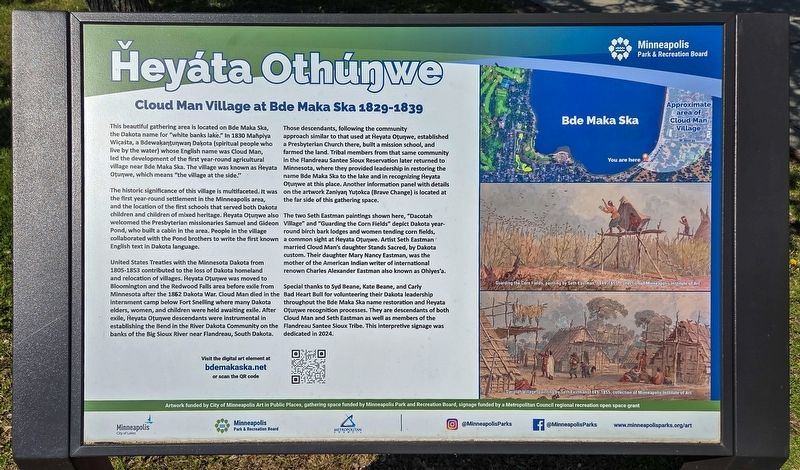
Ȟeyáta Othúŋwe
Cloud Man Village at Bde Maka Ska 1829-1839
Photographed by McGhiever, May 24, 2026
1. Ȟeyáta Othúŋwe Marker
This beautiful gathering area is located on Bde Maka Ska, the Dakota name for "white banks lake." In 1830 Maḣpiya Wic̣aṡta, a Bedwaḳaŋṭuŋwaŋ Daḳota (spiritual people who live by the water) whose English name was Cloud Man, led the development of the first year-round agricultural village near Bde Maka Ska. The village was known as Ḣeyata Oṭuŋwe, which means "the village at the side."
The historic significance of this village is multifaceted. It was the first year-round settlement in the Minneapolis area, and the location of the first schools that served both Dakota children and children of mixed heritage. Ḣeyata Oṭuŋwe also welcomed the Presbyterian missionaries Samuel and Gideon Pond, who built a cabin in the area. People in the village collaborated with the Pond brothers to write the first known English text in Dakota language.
United States Treaties with the Minnesota Dakota from 1805-1853 contributed to the loss of Dakota homeland and relocation of villages. Ḣeyata Oṭuŋwe was moved to Bloomington and the Redwood
this page online
Those descendants, following the community approach similar to that used at Ḣeyata Oṭuŋwe, established a Presbyterian Church there, built a mission school, and farmed the land. Tribal members from that same community in the Flandreau Santee Sioux Reservation later returned to Minnesota, where they provided leadership in restoring the name Bde Maka Ska to the lake and in recognizing Ḣeyata Oṭuŋwe at this place. Another information panel with details on the artwork Zaniyaŋ Yuṭokca (Brave Change) is located at the far side of this gathering space.
The two Seth Eastman paintings shown here, "Dacotah Village" and "Guarding the Corn Fields" depict Dakota year-round birch bark lodges and women tending corn
Photographed by McGhiever, May 24, 2026
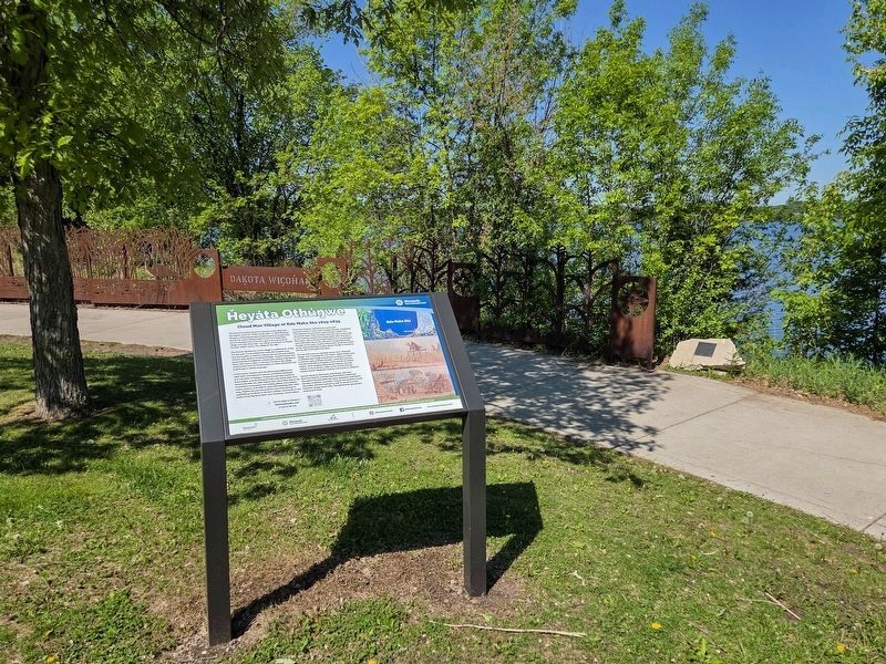
2. Ȟeyáta Othúŋwe Marker on the Grand Rounds
Special thanks to Syd Beane, Kate Beane, and Carly Bad Heart Bull for volunteering their Dakota leadership throughout the Bde Maka Ska name restoration and Ḣeyata Oṭuŋwe recognition processes. They are descendants of both Cloud Man and Seth Eastman as well as members of the Flandreau Santee Sioux Tribe. This interpretive signage was dedicated in 2024.
Approximate area of Cloud Man Village
Guarding the Corn Fields, painting by Seth Eastman, 1849-1855, collection of Minneapolis Institute of Art
Dacotah Village, painting by Seth Eastman, 1849-1855, collection of Minneapolis Institute of Art
Artwork funded by City of Minneapolis Art in Public Places, gathering space funded by Minneapolis Park and Recreation Board, signage funded by a Metropolitan Council regional recreation open space grant
Erected 2024 by Minneapolis Park & Recreation Board.
Topics. This historical marker is listed in these topic lists: Charity & Public Work • Education • Indigenous Peoples and Communities • Waterways & Vessels. A significant historical year for this entry is 1829.
Location. 44° 56.173′ N, 93° 18.32′ W. Marker is in Minneapolis, Minnesota, in Hennepin County. It is in Calhoun Isles. It is on Richfield Road south of W. 36th Street, on the right when traveling south. The marker is between the paved Grand Rounds trails on the southeast shore of Bde Maka Ska. There is a pay parking lot just to the north. Touch for map. Marker is at or near this postal address: 3601 Richfield Road, Minneapolis MN 55419, United States of America. Touch for directions.

Regionally, this marker is in the Twin Cities Metropolitan Area. It is also in the American Midwest, in the Corn Belt, and in the Great River Road Region. Globally, it is in North America, the Western Hemisphere, the Western World, and the Anglosphere. Historically, it finds itself in what was once Rupert’s Land, the territory of the Mississippian Culture, and the Louisiana Purchase.
Other nearby markers. At least 8 other markers are within walking distance of this marker: A different marker also named Ȟeyáta Othúŋwe (about 400 feet away, measured in a direct line); First Dwelling in Minneapolis (approx. ¼ mile away); Harriet Bandshells / Our Park Legacy (approx. 0.6 miles away); First School House (approx. 0.6 miles away); Geology of Minnesota (approx. 0.6 miles away); Como–Harriet Streetcar Line (approx. 0.6 miles away); You Are Here… Lake Calhoun (approx. 0.8 miles away); In Memory of the Boys of Our Navy (approx. 0.9 miles away). Touch for a list and map of all markers in Minneapolis.
Credits. This page was last revised on August 13, 2026. It was originally submitted on July 19, 2026, by McGhiever of Minneapolis, Minnesota. This page has been viewed 15 times since then. Photos: 1, 2. submitted on July 19, 2026, by McGhiever of Minneapolis, Minnesota.
