
Charlestown in Washington County, Rhode Island — The American Northeast (New England)
Ninigret Park History
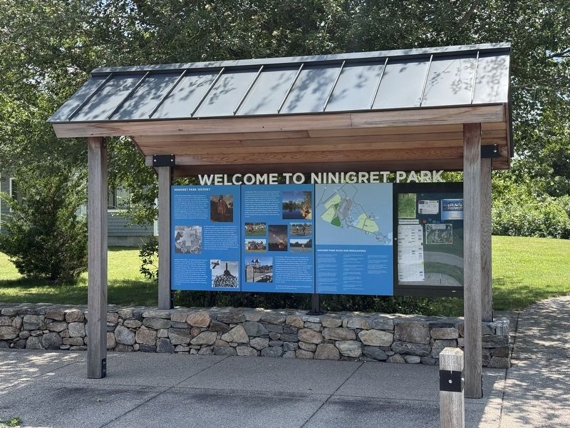
Welcome to Ninigret Park
Photographed by G.W.Bartlett, July 19, 2026
1. Ninigret Park History Marker
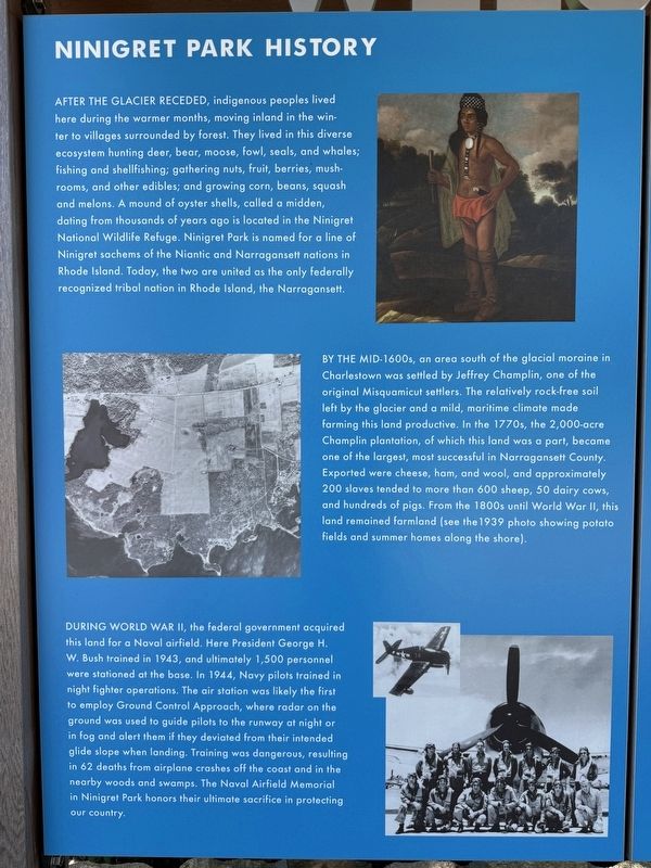
After the glacier receded, indigenous peoples lived here during the warmer months, moving inland in the winter to villages surrounded by forest. They lived in this diverse ecosystem hunting deer, bear, moose, fowl, seals, and whales; fishing and shellfishing; gathering nuts, fruit, berries, mushrooms, and other edibles; and growing corn, beans, squash and melons. A mound of oyster shells, called a midden, dating from thousands of years ago is located in the Ninigret National Wildlife Refuge. Ninigret Park is named for a line of Ninigret sachems of the Niantic and Narragansett nations in Rhode Island. Today, the two are united as the only federally recognized tribal nation in Rhode Island, the Narragansett.
By the mid-1600s, an area south of the glacial moraine in Charlestown was settled by Jeffrey Champlin, one of the original Misquamicut settlers. The relatively rock-free soil left by the glacier and a mild, maritime climate made farming this land productive. In the 1770s, the 2,000-acre Champlin plantation, of which this land was a part, became one of the largest, most successful in Narragansett County. Exported
this page online
During World War II, the federal government acquired this land for a Naval airfield. Here President George H. W. Bush trained in 1943, and ultimately 1,500 personnel were stationed at the base. In 1944, Navy pilots trained in night fighter operations. The air station was likely the first to employ Ground Control Approach, where radar on the ground was used to guide pilots to the runway at night or in fog and alert them if they deviated from their intended glide slope when landing. Training was dangerous, resulting in 62 deaths from airplane crashes off the coast and in the nearby woods and swamps. The Naval Airfield Memorial in Ninigret Park honors their ultimate sacrifice in protecting our country.
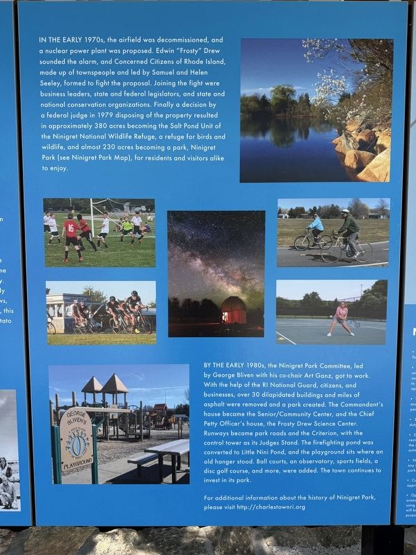
In the early 1970's, the airfield was decommissioned, and a nuclear power plant was proposed. Edwin "Frosty" Drew sounded the alarm, and Concerned Citizen's of Rhode Island,
Photographed by G.W.Bartlett, July 19, 2026
2. Ninigret Park History Marker
(panel 2)
(panel 2)
By the 1980's the Ninigret Park Committee, let by George Bliven, with his co-chair Art Ganz, got to work. With the help of the RI National Guard, citizens and businesses, over 30 dilapidated buildings and miles of asphalt were removed and a park created. The commander's house became the Senior/Community Center, and the Chief Petty Officer's house the Frosty Drew Science Center. Runways became park roads and the Criterion, with the control tower as its Judges Stand. The firefighting pond was converted to Little Nini Pond, and the playground sits where an old hangar stood. Ball courts, an observatory, sports
Photographed by G.W.Bartlett, July 19, 2026
3. Ninigret Park History Marker (wide)
For additional information about the history of Ninigret Park please visit http://charlestownri.org.
Topics and series. This historical marker is listed in these topic lists: Indigenous Peoples and Communities • Settlements & Settlers • War, World II • Wars, US Indian. In addition, it is included in the Former U.S. Presidents: #41 George H.W. Bush series list. A significant historical year for this entry is 1939.
Location. 41° 22.325′ N, 71° 39.889′ W. Marker is in Charlestown, Rhode Island, in Washington County. It can be reached from Park Lane half a mile east of Old Post Road (Rhode Island Road 1A), on the right when traveling east. The kiosk stands inside the entrance of Ninigret Park in front of the administrative buildings. Touch for map. Marker is at or near this postal address: 25 Burlingame State Park Rd, Charlestown RI 02813, United States of America. Touch for directions.

Regionally, this marker is on Narragansett Bay and in South County. It is also in the American Northeast, in New England, and on the Eastern Seaboard.
Photographed by G.W.Bartlett, July 19, 2026
4. Ninigret Park Road Sign
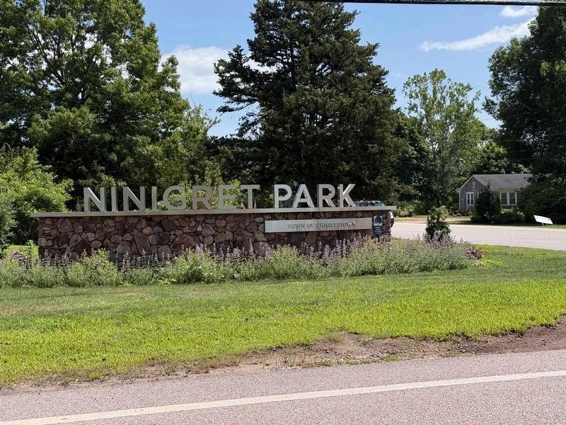
This roadside sign on Old Post Road (Route 1A) marks the turn onto Park Lane to enter Ninigret Park.
Other nearby markers. At least 8 other markers are within 6 miles of this marker, measured as the crow flies: Grumman F6F-5N Hellcat Crash (within shouting distance of this marker); Liberty Tree Memorial (within shouting distance of this marker); Charlestown Naval Auxiliary Landing Field Memorial (within shouting distance of this marker); Ninigret National Wildlife Refuge (approx. half a mile away); Fort Ninigret (approx. 1.1 miles away); Fort Ninigret Marker (approx. 1.3 miles away); General Joseph Stanton Monument (approx. 2.7 miles away); Samuel Ward Birthplace Site (approx. 5.8 miles away). Touch for a list and map of all markers in Charlestown.
Related markers. Click here for a list of markers that are related to this marker. Other parks or memorials to Ninigret, Chief of the Niantics
Credits. This page was last revised on July 23, 2026. It was originally submitted on July 20, 2026, by G.W.Bartlett of Hingham, Massachusetts. This page has been viewed 13 times since then. Photos: 1, 2, 3, 4. submitted on July 20, 2026, by G.W.Bartlett of Hingham, Massachusetts. • Devry Becker Jones was the editor who published this page.
