Charlestown in Washington County, Rhode Island — The American Northeast (New England)
Ninigret National Wildlife Refuge
Photographed by G.W.Bartlett, July 19, 2026
1. Ninigret National Wildlife Refuge Marker
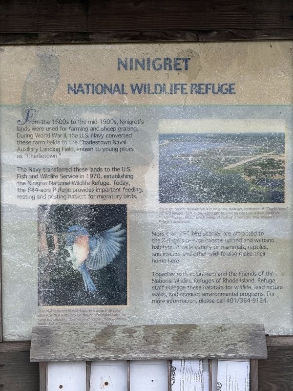
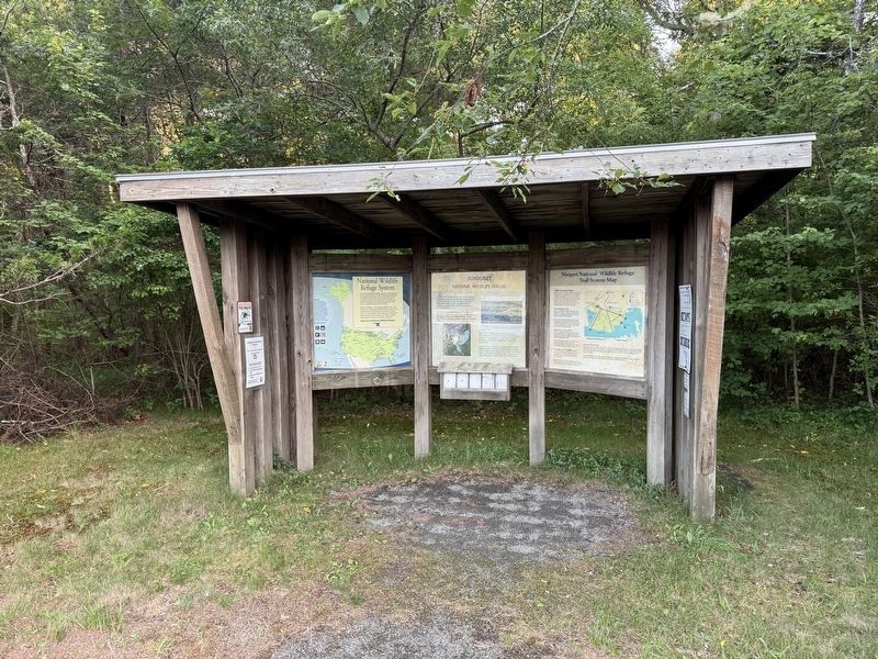
From the 1600s to the mid-1900s, Ninigret's lands were used for farming and sheep grazing. During World War II, the U.S. Navy converted these farm fields to the Charlestown Naval Auxiliary Landing Field, known to young pilots as “Charlietown.”
The Navy transferred these lands to the U.S. Fish and Wildlife Service in 1970, establishing the Ninigret National Wildlife Refuge. Today, the 844-acre Refuge provides important feeding, resting and nesting habitat for migratory birds.
More than 250 bird species are attracted to the Refuge's diverse coastal upland and wetland habitats. A wide variety of mammals, reptiles, and insects and other wildlife also make their home here.
Together with volunteers and the Friends of the National Wildlife Refuges of Rhode Island, Refuge staff manage these habitats for wildlife, lead nature walks, and conduct environmental programs. For more information, please call (401) 364-9124.
[Captions:]
The male eastern bluebird sports a deep blue color above, with a rusty orange throat, chest and sides. His song is a pleasing, down-slurred “cheer cheery-Charley.” Isidor Jeklin/Cornell Laboratory of Ornithology.
Although restoration is in progress, runways, remnants of "Charlietown,” can still be seen in this 1997 photo. Visitors can take a walk along the “Trails Through Time” which interpret historical land uses that shaped the Refuge’s landscape.
Erected by Fish
this page online
Topics. This historical marker is listed in these topic lists: Colonial Era • Environment • War, World II. A significant historical year for this entry is 1970.
Location. 41° 22.081′ N, 71° 40.33′ W. Marker is in Charlestown, Rhode Island, in Washington County. It is on Ninigret Entrance Road 0.2 miles east of Post Road (U.S. 1), on the right when traveling east. Touch for map. Marker is at or near this postal address: 59 Foster Cv Lp Trl, Charlestown RI 02813, United States of America. Touch for directions.

Regionally, this marker is on Narragansett Bay and in South County. It is also in the American Northeast, in New England, and on the Eastern Seaboard. Globally, it is in the North Atlantic Region, North America, the Western Hemisphere, the Western World, and the Anglosphere. Historically, it finds itself in what was once one of the original Thirteen Colonies.
Other nearby markers. At least 8 other markers are within 2 miles of this marker, measured as the crow flies: Ninigret Park History (approx. half a mile away); Liberty Tree Memorial (approx. half a
Photographed by G.W.Bartlett, July 19, 2026
2. Ninigret National Wildlife Refuge Marker
Related markers. Click here for a list of markers that are related to this marker. Other parks or memorials to Ninigret, Chief of the Niantics
Also see . . . Friends of the National Wildlife Refuges of Rhode Island.
A group of concerned citizens established a non-profit association to support the five National Wildlife Refuges in Rhode Island. The Friends are devoted to the conservation and the development of healthy habitat for flora and fauna and a safe, accessible, ecological experience for visitors.(Submitted on July 22, 2026, by G.W.Bartlett of Hingham, Massachusetts.)
We have five beautiful Refuges here in this very small state. We hope you get a chance to visit all of them: Trustom Pond National Wildlife Refuge, Ninigret National Wildlife Refuge, John H. ChafeeNational Wildlife Refuge, Sachuest Point National Wildlife Refuge, Block Island National Wildlife Refuge.Photographed by G.W.Bartlett, July 19, 20263. Ninigret National Wildlife Refuge Marker
Photographed by Devry Becker Jones (CC0), September 17, 2026
4. Adjacent signage
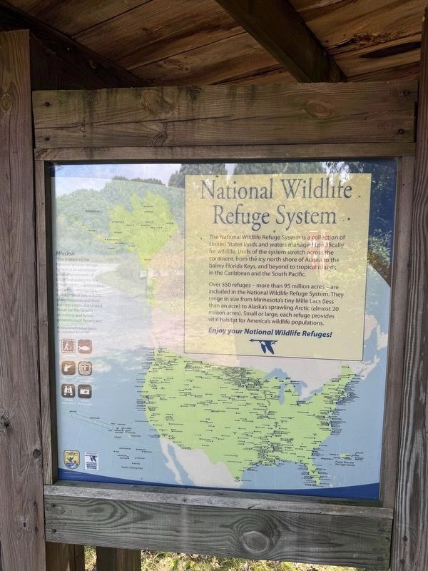
Over 550 refuges - more than 95 million acres - are included in the National Wildlife Refuge System. They range in size from Minnesota's tiny Millie Lacs (less than an acre) to Alaska's sprawling Arctic (almsot 20 million acres.) Small or large, each refuge provides vital habitat for America's wildlife populations.
Enjoy your National Wildlife Refuges!
Mission
"The mission of the National Wildlife Refuge System is to administer a national network of lands and waters for the conservation, management and where appropriate, restoration of fish, wildlife, plant resources and their habitats within the United States for the benefit of present and futures of generations of Americans."
National Wildlife Refuge System Improvement Act of 1997
Photographed by Devry Becker Jones (CC0), September 17, 2026
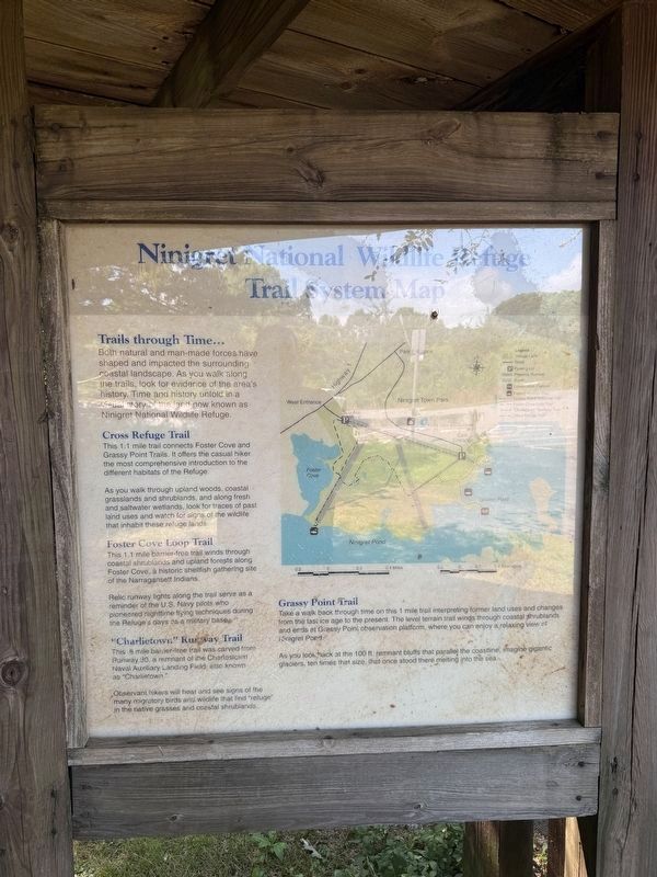
5. Another adjacent sign
Trails through Time...
Both natural and man-made forces have shaped and impacted the surrounding coastal landscape. As you walk along the trails, look for evidence of the area's history. Time and history unfold in a story of the land now known as Ninigret National Wildlife Refuge.
Cross Refuge Trail
This 1.1 mile trail connects Foster Cove and Grassy Point Trails. It offers the casual hiker the most comprehensive introduction to the different habitats of the Refuge.
As you walk through upland woods, coastal grasslands and shrublands, and along fresh and saltwater wetlands, look for traces of past land uses and watch for signs of the wildlife that inhabit these refuge lands.
Foster Cove Loop Trail
This 1.1 mile barrier-free trail winds through coastal shrublands and upland forests along Foster Cove, a historic shellfish gathering site of the Narragansett Indians.
Relic runway lights along the trail serve as a reminder of the U.S. Navy pilots who pioneered nighttime flying techniques during the Refuge's days as a military base.
"Charlietown" Runway Trail
This .8 mile barrier-free trail was carved from Runway 30, a remnant of the Charlestown Naval Auxiliary Landing Field, also known as "Charlietown."
Observant hikers will hear and see signs of the many migratory birds and wildlife that find "refuge" in the native grasses and coastal shrublands.
Grassy Point Trail
Take a walk back through time on this 1 mile trail interpreting former land uses and changes from the last ice age to the present. The level terrain trail winds through coastal shrublands and ends at Grassy Point observation platform, where you can enjoy a relaxing view of Ninigret Pond.
As you look back at the 100 ft. remnant bluffs that parallel the coastline, imagine gigantic glaciers, ten times that size, that once stood there melting into the sea.

Photographed by G.W.Bartlett, July 19, 2026
6. Permitted Activities in Ninigret National Wildlife Refuge

Photographed by G.W.Bartlett, July 19, 2026
7. Ninigret National Wildlife Refuge Entrance on Route 1
Credits. This page was last revised on October 3, 2026. It was originally submitted on July 20, 2026, by G.W.Bartlett of Hingham, Massachusetts. This page has been viewed 26 times since then. Photos: 1, 2, 3. submitted on July 20, 2026, by G.W.Bartlett of Hingham, Massachusetts. 4, 5. submitted on October 3, 2026, by Devry Becker Jones of Washington, District of Columbia. 6, 7. submitted on July 20, 2026, by G.W.Bartlett of Hingham, Massachusetts. • Michael Herrick was the editor who published this page.
