Newcastle in Weston County, Wyoming — The American West (Mountains)
The Hanging of Diamond L Slim Clifton
Wyoming
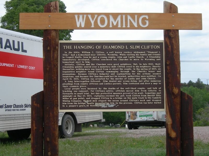
Photographed by Jimmy Emerson, June 5, 2009
1. The Hanging of Diamond L Slim Clifton Marker
Initially, Clifton and the Churches were good neighbors. But, in late 1902, their friendship quickly soured over a monetary debt Clifton owed to his neighbors. Shortly thereafter, nothing more was heard from or about the couple. In the spring of 1903, an inquisitive neighbor found Clifton rummaging through the Church's house and possessions. Because Clifton's behavior and explanations for his actions seemed suspicious, and because the Churches could not be located, authorities were notified. On April 17, 1903, Clifton was arrested for the murder of Luella and John Church. A long interrogation followed. Slim denied any wrong doing, but after numerous pleadings from county officials and Luella's parents, Slim confessed and drew a map to their common grave.
Local people were incensed
this page online
Topics. This historical marker is listed in these topic lists: Law Enforcement • Notable Events. A significant historical date for this entry is May 27, 1903.
Location. Marker has been permanently removed. It was located near 43° 51.261′ N, 104° 12.355′ W. Marker was in Newcastle, Wyoming, in Weston County. It was on West Main Street near Railway Avenue. Touch for map. Marker was at or near this postal address: 222 W Main Street, Newcastle WY 82701, United States of America.
We have been informed that this marker is no longer there and will not be replaced. This page is an archival view of what was.
Regionally, this marker was in the Powder River Basin. It was also in the American Mountain West, in the Black Hills, on the Great Plains, on the Northern Plains, and specifically on the High Plains. Globally, it was in North America, the Western Hemisphere, the Western World, and the Anglosphere. Historically, it found itself in what was once the Louisiana Purchase.

Other nearby markers. At least 8 other markers are within 5 miles of this location, measured as the crow flies: Hanging of Diamond L. Slim Clifton (a few steps from this marker); The Trains Power Newcastle (within shouting distance of this marker); Cambria Powers the Trains (within shouting distance of this marker); Accidental Oil Well (approx. 4 miles away); Cambria (approx. 4½ miles away); Site of Field City (approx. 4.7 miles away); Salt Creek Overlook (approx. 4.8 miles away); The Jenney Stockade (approx. 4.9 miles away). Touch for a list and map of all markers in Newcastle.
More about this marker. Per Google Street View, the marker was still standing in July 2012 but replaced by November 2021.
Credits. This page was last revised on July 21, 2026. It was originally submitted on July 20, 2026, by Jimmy Emerson of Dalton, Georgia. This page has been viewed 25 times since then. Photo 1. submitted on July 20, 2026, by Jimmy Emerson of Dalton, Georgia. • Andrew Ruppenstein was the editor who published this page.
