Near Iaeger in McDowell County, West Virginia — The American South (Appalachia)
Wilmore Dam - Est. 1906

Photographed by Mark Parker, July 11, 2026
1. Wilmore Dam - Est. 1906 Marker
Wilmore Dam is located on Folsom Road in McDowell County, West Virginia. The dam is 3 miles south of Iaeger on South Route 52 and 3 miles north of Roderfield.
Wilmore Dam is one of the most visited historical places by out-of-staters.
The Norfolk & Western Railway started construction on the dam in 1904 & it was first used in 1906. The dam supplied water for the steam engines that hauled coal from Coalwood to up and down the Ohio River.
In 1959, when diesel replaced the steam, the dam was no longer needed. The railroad has since been taken out, but the dam remains. It is amazing to notice the fine details and craftsmanship of the early 1900s within the dam's structure which is nestled between the mountains that offer four-season foliage all throughout the year. There is also lots of wildlife that can be seen in the marshes such as Blue Herons, Geese, endangered Salamanders, Ducks, Otters, Beavers, etc. These waters are stocked by the state with trout 2-3 times a year, which is great news for the fisherman. Also native to the area, you may stumble across Black Bears, Coyotes, Wild Boar, Turkey, Deer, Raccoons,
this page online
Topics. This historical marker is listed in these topic lists: Industry & Commerce • Parks & Recreational Areas • Railroads & Streetcars • Waterways & Vessels. A significant historical year for this entry is 1906.
Location. 37° 26.789′ N, 81° 44.252′ W. Marker is near Iaeger, West Virginia, in McDowell County. It is on Folsom Road 0.2 miles south of Coal Heritage Road (U.S. 52), on the right when traveling south. Touch for map. Marker is at or near this postal address: 121 Folsom Rd, Iaeger WV 24844, United States of America. Touch for directions.

Regionally, this marker is in the Southern Coalfields. It is also in the American South, specifically in the Upper South, in Appalachia, and specifically in Southern Appalachia. Globally, it is in North America, the Western Hemisphere, the Western World, and the Anglosphere. Historically, it finds itself in what was once the territory of the Mississippian Culture.
Other nearby markers. At least 8 other markers are within 9 miles of this marker, measured

Photographed by Mark Parker, July 11, 2026
2. Wilmore Dam - Est. 1906 Marker next to the kiosk above the dam

Photographed by Mark Parker, July 11, 2026
3. Wilmore Dam
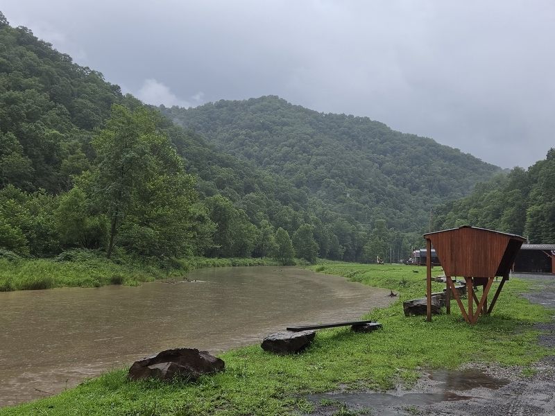
Photographed by Mark Parker, July 11, 2026
4. Wilmore Dam Marker under the kiosk along the Clear Fork River
Credits. This page was last revised on July 22, 2026. It was originally submitted on July 21, 2026, by Mark Parker of Hickory, North Carolina. This page has been viewed 10 times since then. Photos: 1, 2, 3, 4. submitted on July 21, 2026, by Mark Parker of Hickory, North Carolina. • Devry Becker Jones was the editor who published this page.
