Tumacacori in Tumacacori-Carmen in Santa Cruz County, Arizona — The American Mountains (Southwest)
Mission San José de Tumacácori
⎯⎯⎯
Misión San José de Tumacácori
Tumacácori National Historical Park
| — | National Park Service, U.S. Department of the Interior | — |
Photographed by Daniel Barriball, May 24, 2026
1. Mission San José de Tumacácori Marker

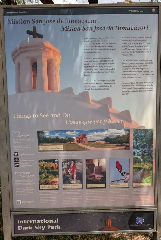
Jesuit missionary Eusebio Francisco Kino first visited Tumacácori in January of 1691. The mission was one of more than twenty established by Kino in the area known by the Spanish as the Pimería Alta.
A mission was much more than a church; it was an entire community designed to teach European ways of life to the people living on lands claimed by Spain. Missions included farmlands as well as workshops and homes.
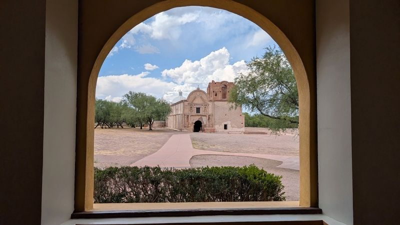
Over time, the landscape and culture transformed. Around 1800, residents of Tumacácori began building the church that stands here today.
Una misión era mucho más que una iglesia; era una comunidad diseñada para enseñar a los indígenas las costumbres de vida Europeas en terrenos reclamados por España. Las misiones incluían tierras de cultivo, así como talleres y hogares.
Con el tiempo, el paisaje y la cultura se trasformaron. Alrededor de 1800, los residentes de Tumacácori comenzaron a construir la iglesia que se encuentra aquí hoy.
this page online
Photographed by Daniel Barriball, May 24, 2026
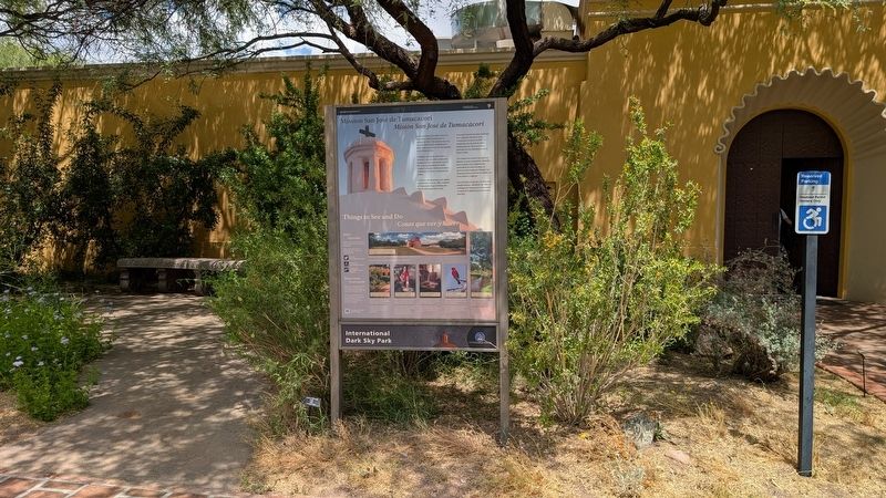
2. Mission San José de Tumacácori / Misión San José de Tumacácori Marker in context
International Dark-Sky Association
Erected by National Park Service, U.S. Department of the Interior.
Topics. This historical marker is listed in these topic lists: Indigenous Peoples and Communities • Parks & Recreational Areas • Religion & Religious Structures • Settlements & Settlers. A significant historical month for this entry is January 1691.
Location. 31° 34.069′ N, 111° 3.075′ W. Marker is in Tumacacori-Carmen, Arizona, in Santa Cruz County. It is in Tumacacori. It is on Interstate 19 Frontage Road near Santa Gertrudis Lane, on the right when traveling north. This marker stands at the entrance to the visitor center of the Tumacácori National Historical Park. Touch for map. Marker is at or near this postal address: 1891 I-19 Frontage
Photographed by Daniel Barriball, May 24, 2026
3. Mission San José de Tumacácori / Misión San José de Tumacácori

Regionally, this marker is in Arizona’s Sky Islands, in the Sonoran Desert, in Southeastern Arizona, in the Phoenix Metropolitan Area, and specifically in the Tucson Metro Metropolitan Area. It is also in the American Borderlands and in the Southwest. Globally, it is in North America, the Western Hemisphere, the Western World, and the Anglosphere. Historically, it finds itself in what was once New Spain and also the Gadsden Purchase.
Other nearby markers. At least 8 other markers are within 3 miles of this marker, measured as the crow flies: Mission San José de Tumacácori (here, next to this marker); Tumacacori Museum (a few steps from this marker); Tubac (approx. 2.8 miles away); Baca Float Number 3 (approx. 3 miles away); Juan Bautista de Anza (approx. 3.1 miles away); Presidio of Tubac (approx. 3.1 miles away); Charles Debrille Poston (approx. 3.1 miles away); Tubac Presidio (approx. 3.1 miles away).
Also see . . . Tumacácori National Historical Park. Official website
Tumacácori sits at a cultural crossroads in the Santa Cruz River valley. Here O'odham, Yaqui, and Apache people met and mingled with European Jesuit and Franciscan missionaries, settlers, and soldiers, sometimes in conflict and sometimes in cooperation. Follow the timeworn paths and discover stories that connect us to enduring relationships, vibrant cultures, and traditions of long ago.(Submitted on July 22, 2026, by Daniel Barriball of Chesterton, Indiana.)
Credits. This page was last revised on July 23, 2026. It was originally submitted on July 22, 2026, by Daniel Barriball of Chesterton, Indiana. This page has been viewed 13 times since then. Photos: 1, 2, 3. submitted on July 22, 2026, by Daniel Barriball of Chesterton, Indiana. • Devry Becker Jones was the editor who published this page.
